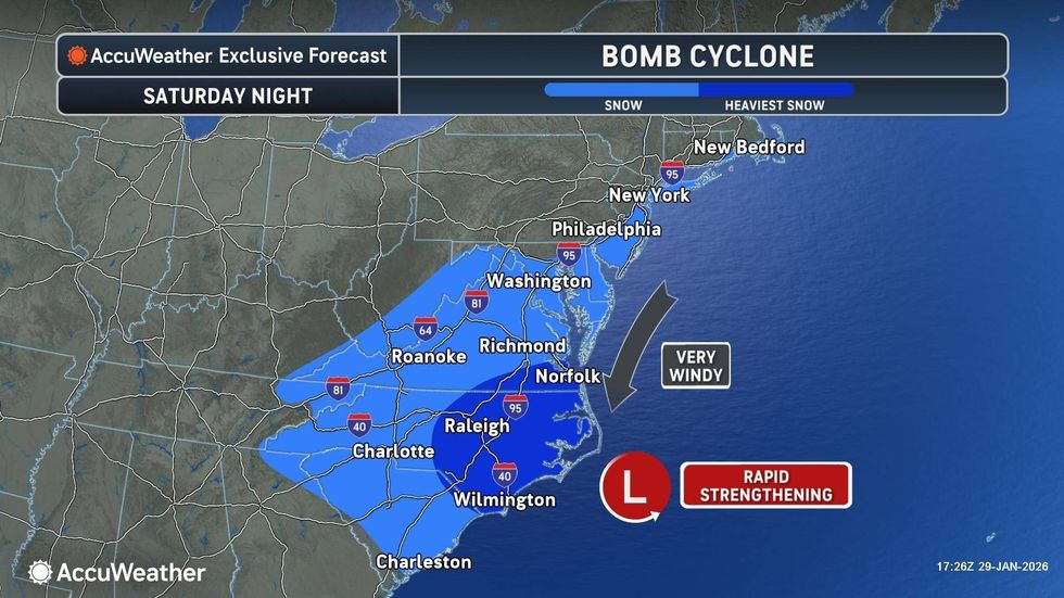
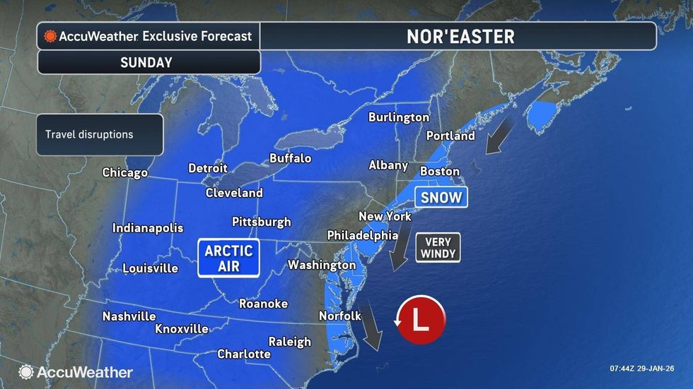
NEW YORK (1010 WINS) — The dangerous cold snap that has held its grip on New York City since last weekend's snowstorm will continue through at least Sunday, according to AccuWeather, with potential for snowfall from a bomb cyclone that is skirting the city.
Thursday afternoon will see sunshine through some clouds, but will remain breezy and quite cold, with a high of 23 but RealFeel temperatures in the single digits.
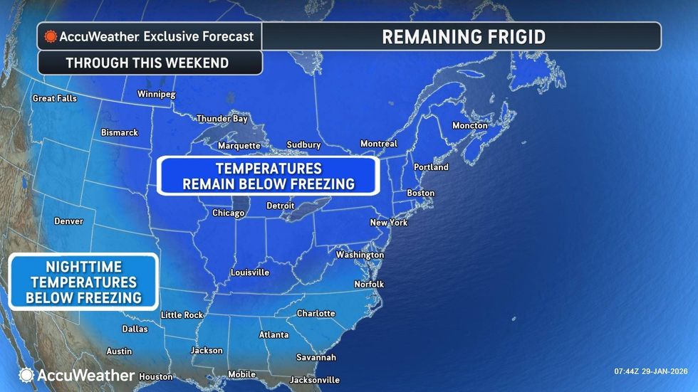
"A frigid air mass remains in place through the weekend," the National Weather Service said. "Wind chills struggle to get out of the single digits [Thursday] afternoon. Dress in layers and cover exposed skin!"
 AccuWeather
It will be clear and exceptionally cold overnight as temperatures dip to the lowest they've been all year, AccuWeather said, with a low of 8 in Midtown and a low near 0 in some outlying suburbs.
The intense freeze prompted officials to issue a Cold Weather Advisory, which is in effect from midnight to 10 a.m. Friday, with wind chills around -5 overnight in the city.
NYC's Department of Homeless Services has issued a Code Blue amid the freezing teperatures, offering shelter to anyone brought in by an outreach team. Warming centers across the five boroughs are also open, at least overnight and sometimes for 24 hours.
 AccuWeather
 AccuWeather
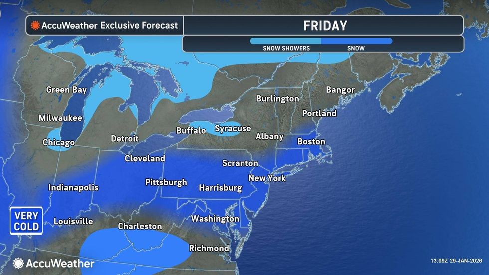
The daytime high will reach 18 on Friday, but AccuWeather said it will be another very cold day with ineffective sunshine. Saturday will feel similar, with more clouds than sun and a one-degree jump from yesterday's high.
The worst of Sunday's bomb cyclone will be felt across southeastern New England and the southeastern U.S., according to AccuWeather, with the effects in NYC being that of a nor'easter.
 AccuWeather
It will be cloudy with snow, wind, beach erosion and coastal flooding as the bomb cyclone passes well offshore. AccuWeather said Sunday will hit a high of 24 and the city could expect up to 1-3 inches of snow.
Nearby suburbs and the Jersey Shore could get as much as 3-6 inches of accumulation, with little to nothing toward the western and northern suburbs.
The sun will peak out on Monday on a slightly less cold day, with highs hitting the low-30s. Temperatures could finally jump above freezing toward midweek, AccuWeather said.