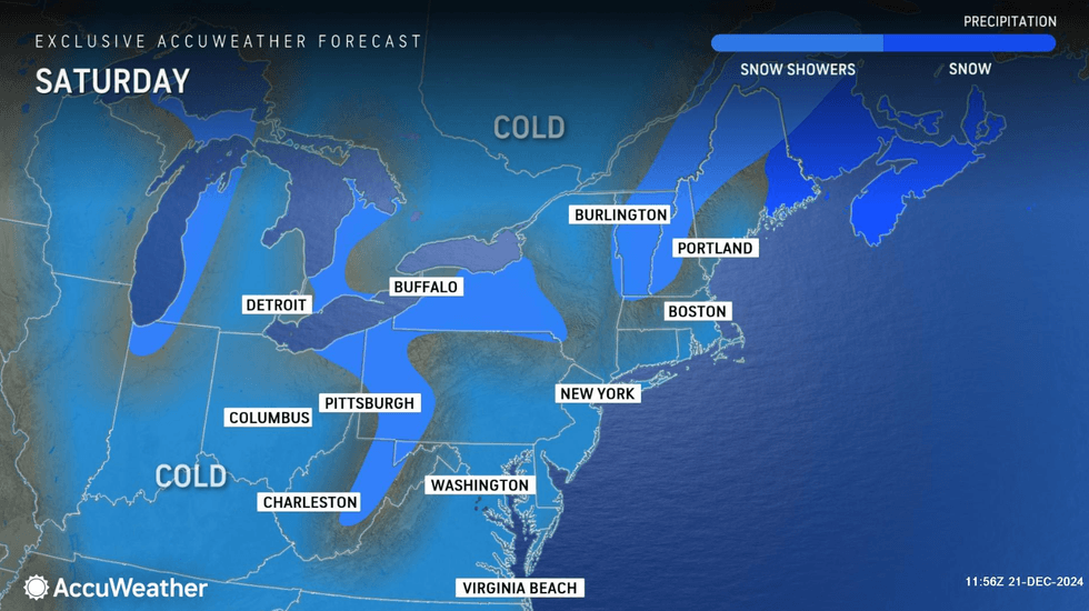
NEW YORK (1010 WINS) — New York City and its surrounding area saw measurable snowfall on Saturday, the official first day of winter, adding precipitation to a bitterly cold weekend in the Tri-State.
According to morning records from the National Weather Service, 1.8 inches of snow fell in Manhattan County. Across the rest of the city—in Queens, Bronx, Kings and Richmond counties—there was 2 to 3 inches.
Over 2 inches of snow graced Nassau and Suffolk counties on Long Island and Westchester, while as much as 4.8 inches of snow accumulated in the Hudson Valley, the NWS reported. Surrounding counties in New Jersey saw anywhere from 2.2 to 4.8 inches of snow, while areas in Connecticut experienced 0.5 to 2.5 inches.
While acknowledging that 2 inches of snow was observed at LaGuardia Airport, NYC Emergency Management warned that winds could peak at 30 to 35 mph during the afternoon, impacting conditions. New Yorkers are encouraged to exercise caution when walking, biking or driving.
"Conditions during this time are expected to lead to blowing snow already on the ground. This can lead to quickly reduced [visibility] on roadways," the agency said. "Any untreated surfaces may remain snow-covered and icy into this evening, leading to hazardous driving conditions."
 AccuWeather
 AccuWeather
 AccuWeather
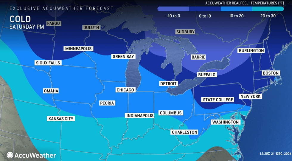
Saturday afternoon is expected to be partly sunny but blustery and cold with a passing flurry, AccuWeather said. While the high will hit 34, RealFeel temperatures will remain in the teens due to the strong wind gusts hitting the area.
The night will be brisk and bitterly cold with a mostly clear sky. The low will dip to 19, and RealFeel temperatures will be in the low single digits, according to AccuWeather.
 AccuWeather
 AccuWeather
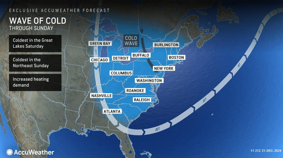
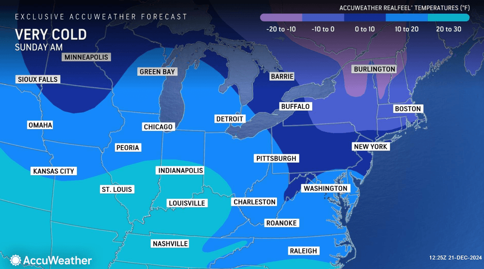
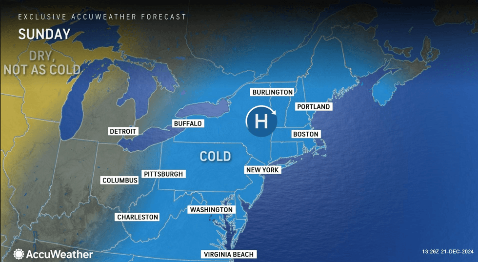
Snow accumulation ushered "the coldest air mass in nearly 2 years" into the region, the NWS said, and the cold temperatures will continue Sunday. While there will be plenty of sunshine, AccuWeather forecasts it will be brisk and very cold, with a high of 27 and RealFeels in the teens.
Sunshine will remain and Monday will be cold, but not quite as harsh, with a high of 31.
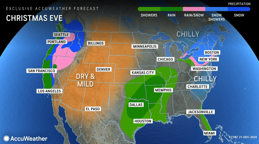
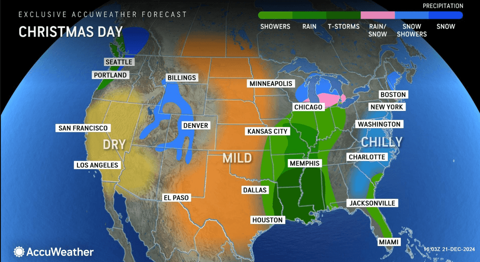
Christmas Eve will heat up even more with a high of 38, and it will be mostly cloudy with a very spotty rain or snow shower. Christmas Day, also the first day of Hanukkah, will be drier as the high nears 40, AccuWeather said.
 AccuWeather
 AccuWeather