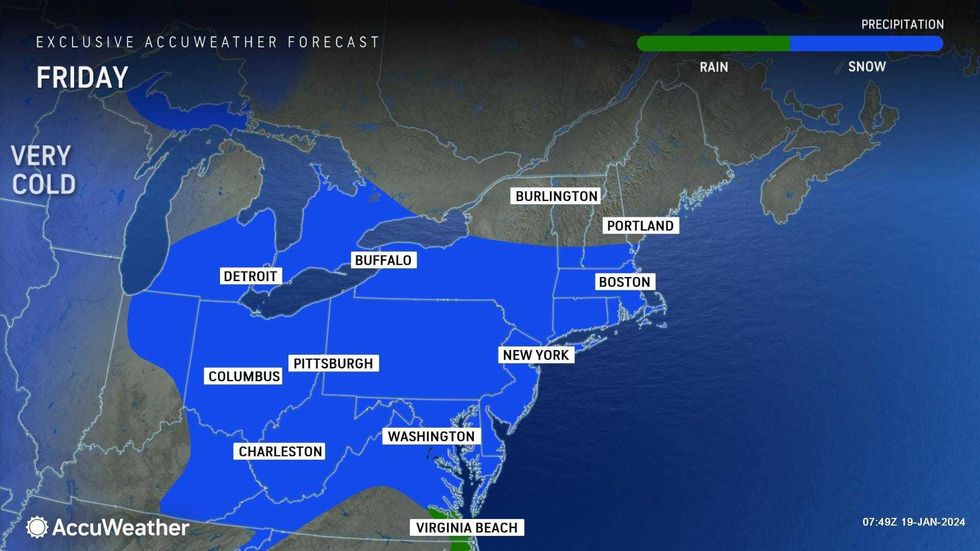
NEW YORK (1010 WINS/WCBS 880) – The second winter storm of the week is set to dump up to several inches of snow on the New York area Friday, just days after the pervious storm ended the city's record 701-day snow drought.
After a relatively quiet start to the season, winter arrived with a vengeance this week, with brutally cold temps and multiple rounds of snow and ice. While New York City is only expected to see 1 to 3 inches of snow Friday, a dramatic drop in temperatures—RealFeels will reach 0 degrees overnight—will create dangerous, icy conditions going into the weekend.
Most of the area, including all five boroughs, is under a Winter Weather Advisory until Friday night. New York City Emergency Management issued a travel advisory, while the Department of Sanitation issued a Snow Alert and suspended Alternate Side Parking on Friday.
 AccuWeather
 AccuWeather
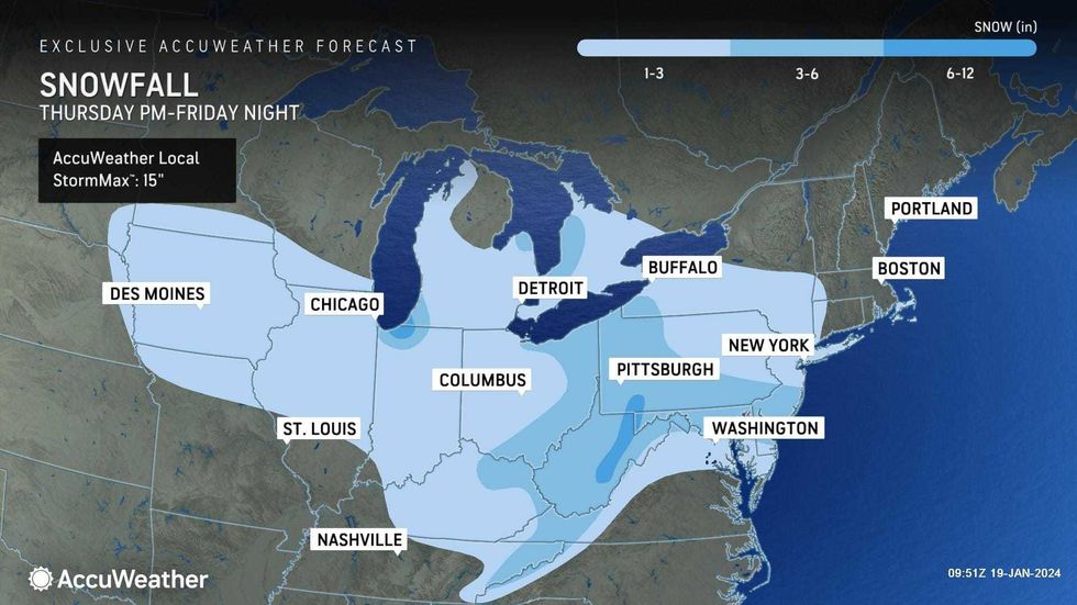
Steady snow arrived Friday morning and continued into the afternoon, creating slippery spots on sidewalks and roadways as highs stick to the upper 20s, below freezing.
There wasn't much snow accumulation in the city by 5:30 p.m.—about 0.4 inches in Central Park and a 1.3 inches at LaGuardia Airport—suggesting the total snowfall will be closer to an inch in the boroughs.
However, areas further south in New Jersey saw more by 1 p.m., including Edison at 2.3 inches and North Brunswick at 2.8 inches.
A State of Emergency is in effect for New Jersey through the weekend, Gov. Phil Murphy said, and a commercial vehicle ban went into effect at 3 a.m. Friday for several major interstates.
Snow will fall throughout the day before moving out early Friday night. Unlike Tuesday's storm, this will be an all-snow event for the city; there won't be any mixing with sleet and rain, AccuWeather said.
 AccuWeather
A general 1 to 3 inches of snow is expected for the metro area, including in the city. Areas south of I-195 in New Jersey may see more than 3 inches, while areas to the north in the Hudson Valley will see a coating to an inch.
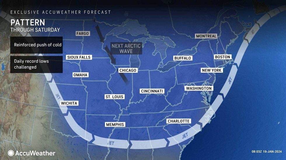
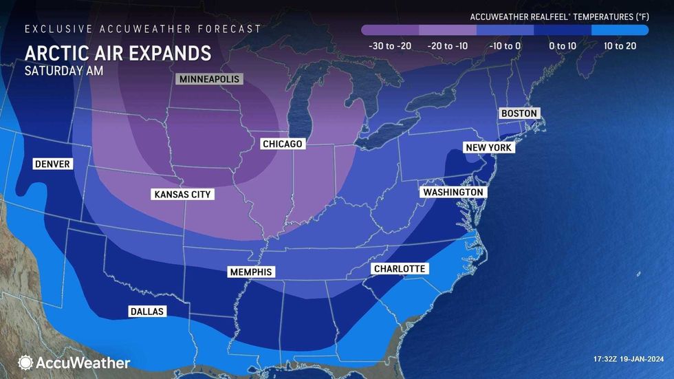
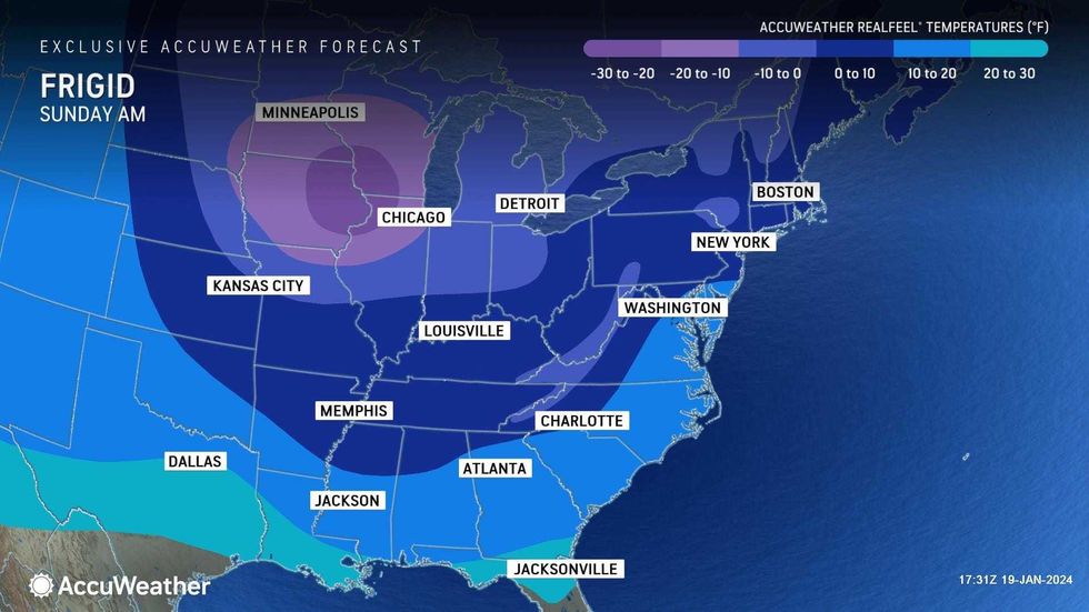
The snow will precede another blast of bitter Arctic air this weekend.
 AccuWeather
 AccuWeather
Conditions will grow windier and colder Friday night as the snow tapers off. Untreated roads and sidewalks may be especially icy during this time. The low overnight will be just 17 degrees, while RealFeels will be around 0.
Saturday will be windy and very cold with clouds and sun. The high will be 24 with RealFeels mainly in the single digits. Drivers should also watch for areas of blowing or drifting snow.
The vicious cold will continue on a blustery and sunny Sunday, with a high of 31.
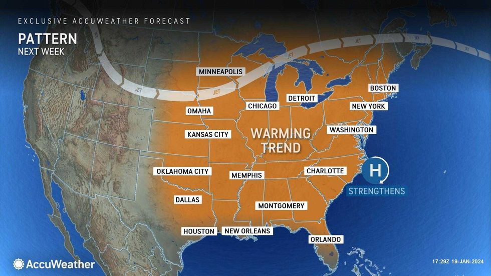
However, a major warmup is in store for next week. Highs will be in the upper 30s Monday, the mid-40s Tuesday and Wednesday, and the low 50s by Thursday and Friday. The milder temps will come with a catch—it's expected to rain, at least periodically, every day from Tuesday to Saturday.
 AccuWeather