


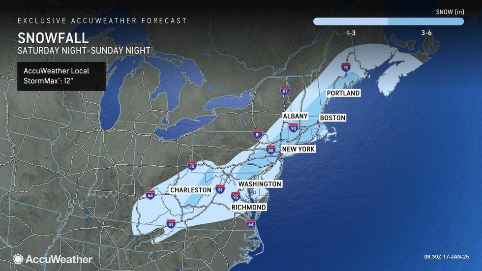
NEW YORK (1010 WINS) – A winter storm will drop up to 4 inches of snow on the New York City area Sunday before extreme cold takes over the region next week.
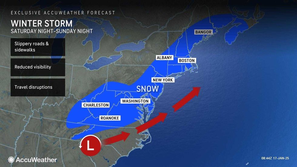
The snowstorm is one of two storms that will hit the city this weekend. A storm on Saturday will bring rain and breezy conditions in the afternoon and evening.
Friday's relatively mild temperatures—the high is 40 degrees in Manhattan—will carry over to Saturday, when highs will hit 45. So don't expect any snow in or around the city during the first storm.
 AccuWeather
 AccuWeather
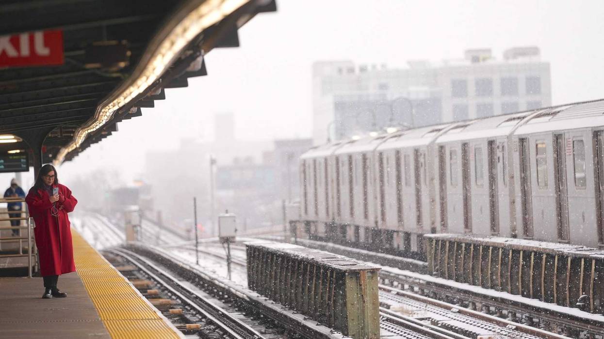
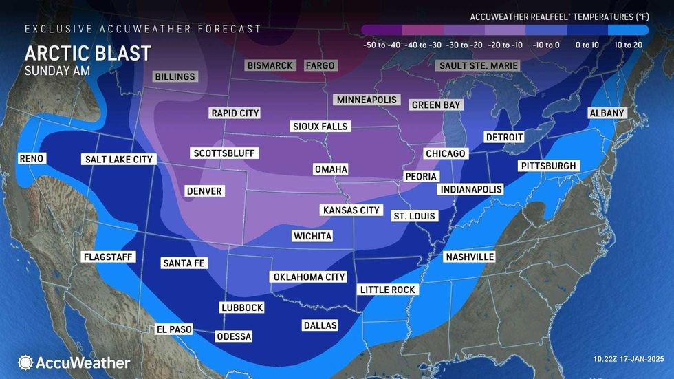
However, Sunday's snowstorm will move through just as temps are beginning to plunge with the arrival of the polar vortex, leading to a general 2 to 4 inches of snow in the city and surrounding suburbs.
The storm will arrive Sunday afternoon, either as rain and snow or all snow, then continue to spray the city with snowflakes into Sunday evening, according to AccuWeather.
The temperatures will drop precipitously Sunday night, leading to the potential for dangerously slippery roads and sidewalks.
 AccuWeather
 AccuWeather
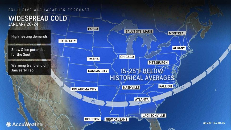
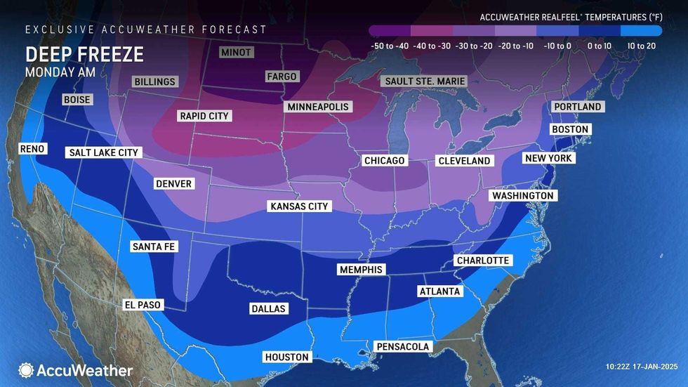
It turns much colder and blustery to start the week on Monday as the polar vortex arrives. The blast of cold has even forced President-elect Donald Trump's inauguration indoors in Washington, D.C.
The high will only be 27 degrees on Monday in Manhattan, and wind chills will fall towards 0 degrees by Monday night.
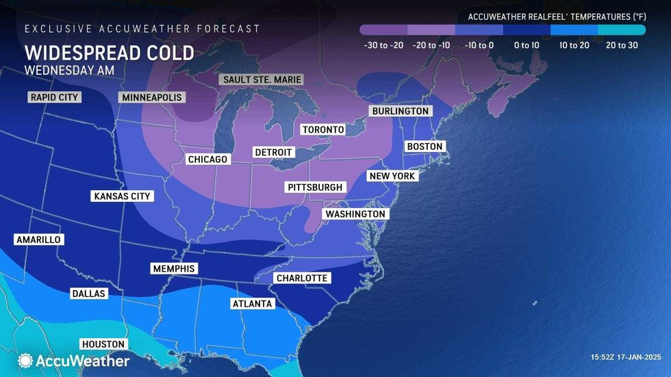
It'll be even colder on Tuesday and Wednesday, with biting winds and highs in the teens. Wind chills will be dangerously cold.
 AccuWeather
 AccuWeather
According to the National Weather Service, the Arctic blast "will deliver the coldest air-mass of the season to-date for much of the Lower 48."
The polar vortex is a low-pressure area of swirling cold air at the North Pole that expands in winter.
When the vortex is disturbed by other systems, parts of it can break away and drift south, causing cold spells like this one.


