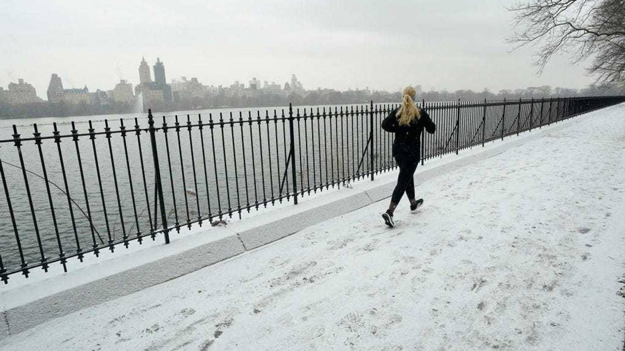
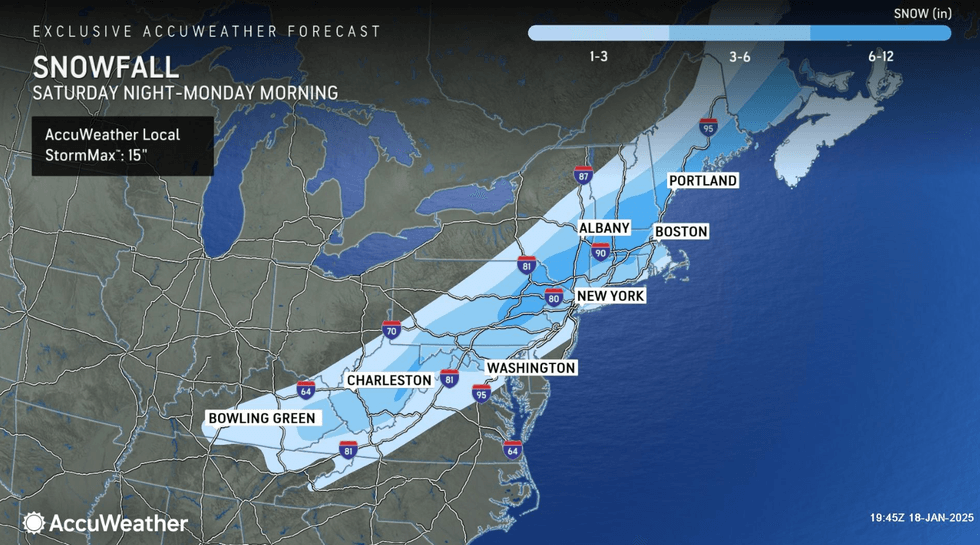
NEW YORK (1010 WINS) — A snowstorm is expected to coat New York City and its surrounding area with 2-4 inches of snow on Sunday before temperatures drop to extreme lows during the week, prompting city officials to issue a winter weather alert through Monday.
"We're expecting snow Sunday and a cold snap hitting the city tomorrow night through Wednesday," Mayor Eric Adams said in a statement. "To keep streets safe and clean, city agencies will be implementing snow clearing protocol and reaching out to connect unsheltered New Yorkers to shelters."
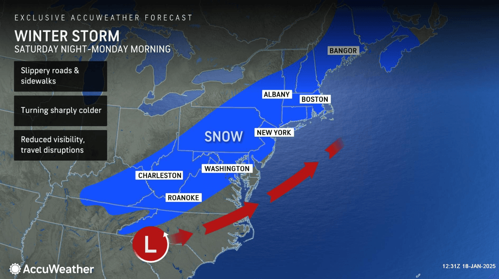
Snow falling through the day will taper off Sunday night, AccuWeather said, accumulating 2-4 inches in NYC, nearby suburbs and on Long Island. Totals will be higher north and west of I-287, reaching 4-8 inches.
The nighttime low is 18, and commuters are told to expect slippery travel as the cold is ushered in.
The National Weather Service said that the majority of the snow accumulation for the NYC metro area and places further east and north would take place by early to late evening, and called the storm a "quick mover" that will be gone by midnight.
 AccuWeather
 AccuWeather
"If you made a bet that it doesn't snow in New York anymore, you're about to lose big time," Acting NYC Sanitation Commissioner Javier Lojan said at a press conference on Saturday. "And if you're going to double-or-nothing that the city of New York has forgotten how to fight a powerful storm, let's just say you shouldn't quit your day job."
A snow alert was issued for the city by NYC Sanitation, beginning at 7 a.m. on Sunday and running through 2 a.m. on Monday.
NYC Sanitation is fully prepared with a fleet of more than 700 salt spreaders to help travel conditions. Plows are ready to roll once 2 inches of snow has fallen.
 AccuWeather
"If you must travel, use mass transit if possible, and allow for extra time. Exercise caution on roads and sidewalks as they may be slippery," NYC Emergency Management Commissioner Zach Iscol said. "The salt on the sidewalks can be a concern for pets, so make sure you're putting those booties on your dogs when you're walking them and cleaning their feet when you come inside."
New Jersey is expecting snow accumulation as great as 8 to 12 inches across the state, Gov. Phil Murphy said, prompting him to declare a state of emergency in preparation for the storm and extreme cold. The state of emergency went into effect for all 21 New Jersey counties at 7 a.m. on Sunday.
"Beginning tomorrow morning, we are expecting a winter storm to bring heavy snow, followed by dangerously low temperatures expected on Monday and continuing through Wednesday," Murphy said. "As always, I urge all New Jerseyans to use caution, follow all safety protocols, and remain off the roads unless absolutely necessary."
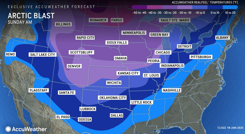
The National Weather Service warned that the beginning of the week will be brisk in NYC, stating that "Arctic air with sub zero windchills arrives after the storm departs for the first half of next week."
 AccuWeather
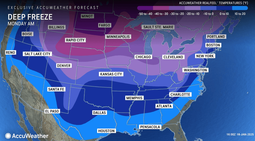
Monday will be blustery and more brisk with a mix of clouds and sun, AccuWeather said. Despite a high of 25, RealFeel temperatures will remain in the single digits much of the time. By nighttime, it will be clear, brisk and frigid, with a low of 10 and with RealFeel temperatures near 0.
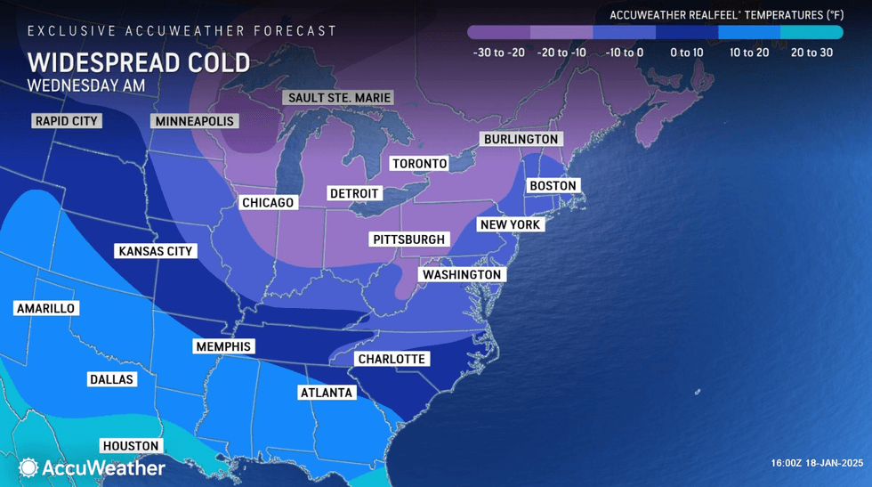
Tuesday will be even colder, with a high of 18 and RealFeel temperatures again near 0. This trend will continue Wednesday, with highs in the upper teens.
It will be not quite as cold come Thursday, with highs in the mid-20s.
 AccuWeather
 AccuWeather
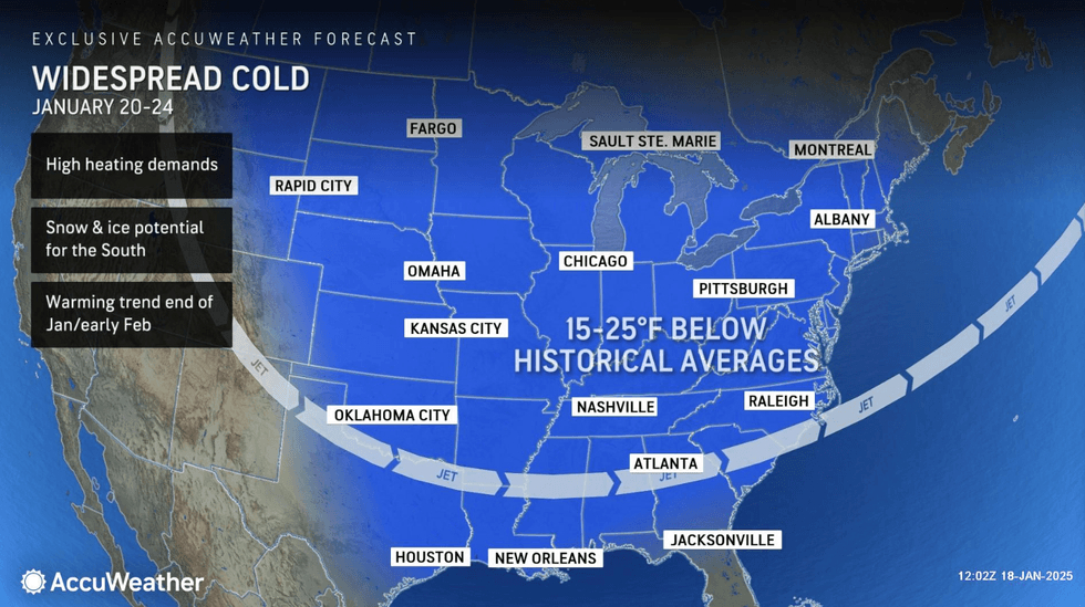
According to the National Weather Service, the Arctic blast "will deliver the coldest air-mass of the season to-date for much of the Lower 48."
The polar vortex is a low-pressure area of swirling cold air at the North Pole that expands in winter.
When the vortex is disturbed by other systems, parts of it can break away and drift south, causing cold spells like this one.