


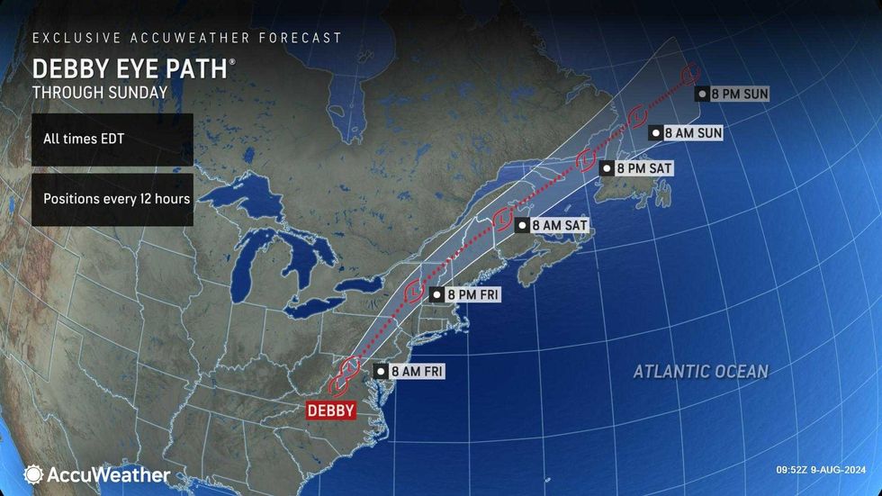
NEW YORK (1010 WINS/WCBS 880) -- Debby, now a tropical depression, moved into the Tri-State on Friday, bringing the threat of flooding rain, heavy winds and even isolated tornadoes.
"There will be multiple threats in Debby's final chapter, and it's a dangerous one," said Jon Porter, AccuWeather's chief meteorologist.
 AccuWeather
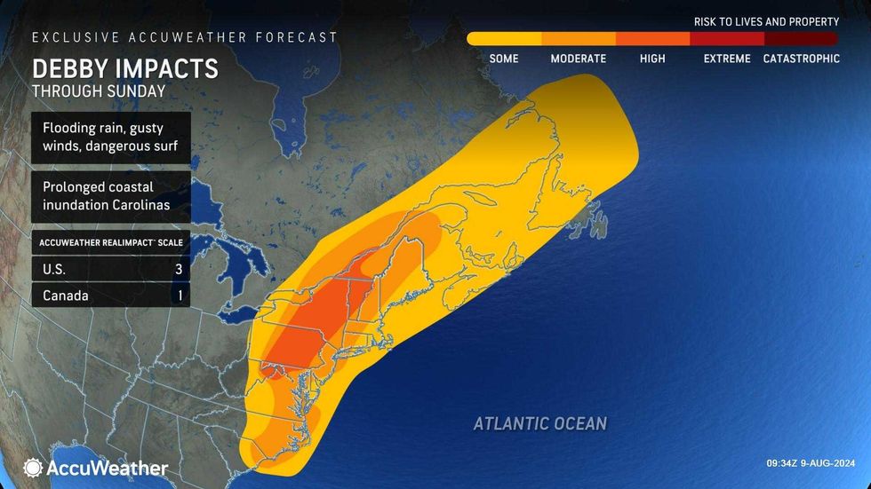
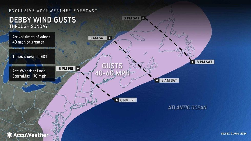
While the worst of the storm is expected upstate, the New York City area is still under the threat of major downpours, 40-50 mph wind gusts and pop-up tornadoes. The severe weather may lead to power outages, flash flooding and travel issues. The heaviest storms are forecasted for the late afternoon and evening. It will otherwise he very humid with a high of 81.
 AccuWeather
 AccuWeather
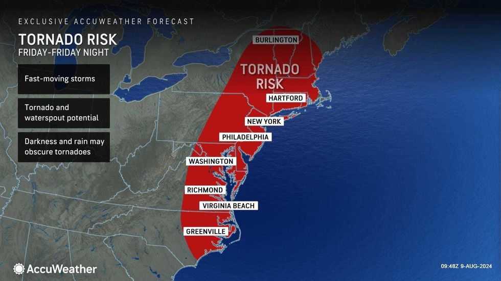
A Tornado Watch was expanded to include most of North Jersey through the Hudson Valley until 10 p.m. Friday. The alert encompasses 26 counties in New York—including Dutchess, Orange, Putnam, Rockland, Sullivan, Ulster and Westchester. Also included in the alert are 11 New Jersey counties, among them Bergen, Essex, Hunterdon, Mercer, Middlesex, Morris, Passaic, Somerset, Sussex, Union and Warren. Hartford County in Connecticut is also under the alert.
Other alerts included a Wind Advisory for most of the area, including all of NYC, until 6 a.m. Saturday and a High Surf Advisory for the South Shore of Long Island until Saturday afternoon.
Delays and cancelations were piling up at JFK, Newark and LaGuardia airports, with more than 1,000 delays and about 450 cancellations before 2 p.m., according to FlightAware.
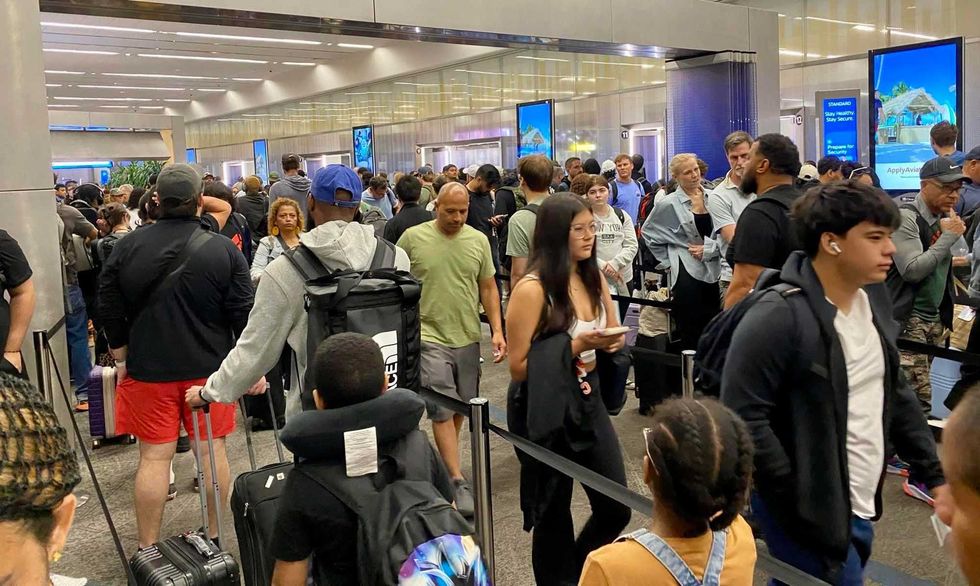 LaGuardia Airpot was packed with travelers on Friday morning.Jeanne Scott
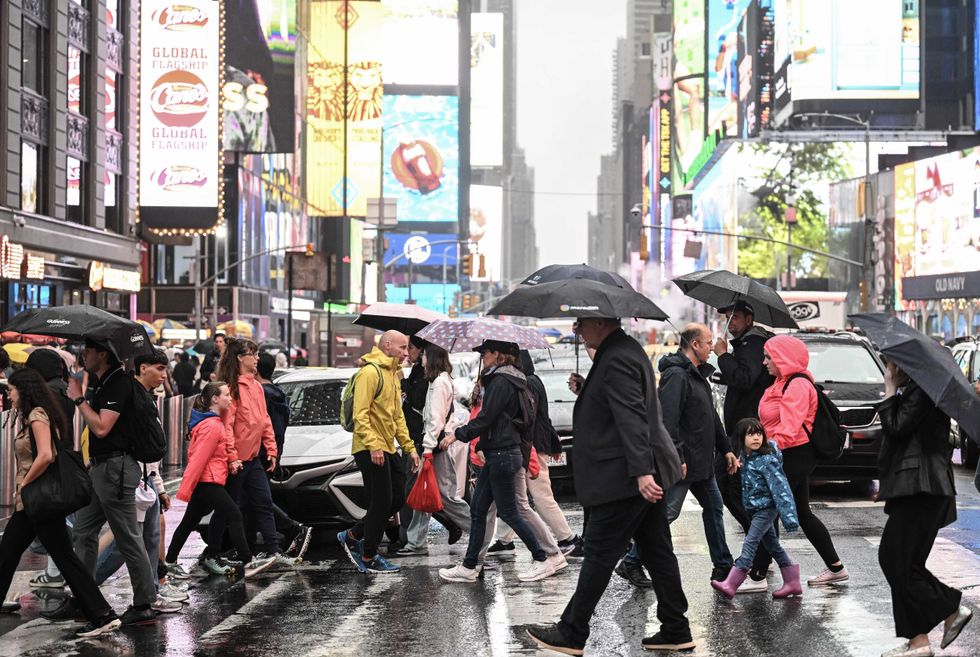 People across a street near Times Square on Aug. 8, 2024.Fatih Aktas/Anadolu via Getty Images
With Debby's eye on a collision course with Upstate New York, Gov. Kathy Hochul declared a statewide state of emergency as the remnants of Debby began to cause severe flooding in communities throughout New York and deployed swift water rescue teams to impacted areas to support local rescue operations and the state stands ready to support impacted localities with any and all resources.
"With the remnants of Debby making its way across New York, I am declaring a statewide State of Emergency, and my administration stands ready to support impacted communities," Hochul said in a statement on Friday. "State agencies have activated swift water rescue teams for impacted regions that require assistance, and it is important for New Yorkers to remain vigilant and stay off the roads."
MTA chair Janno Lieber told WCBS 880 on Friday morning that "we're ready to go" and that he doesn't anticipate any shutdowns in the transit system. The agency is prepositioning personnel to respond to flooding and downed trees. It also issued a ban on empty tractor-trailers and tandem trucks on its bridges from 3 p.m. Friday to 7 a.m. Saturday.
 AccuWeather
 AccuWeather
Debby made landfall in Florida on Monday and then moved up the East Coast throughout the week, sparking flash flooding and tornadoes from Georgia to Virginia. At least eight people have been killed.
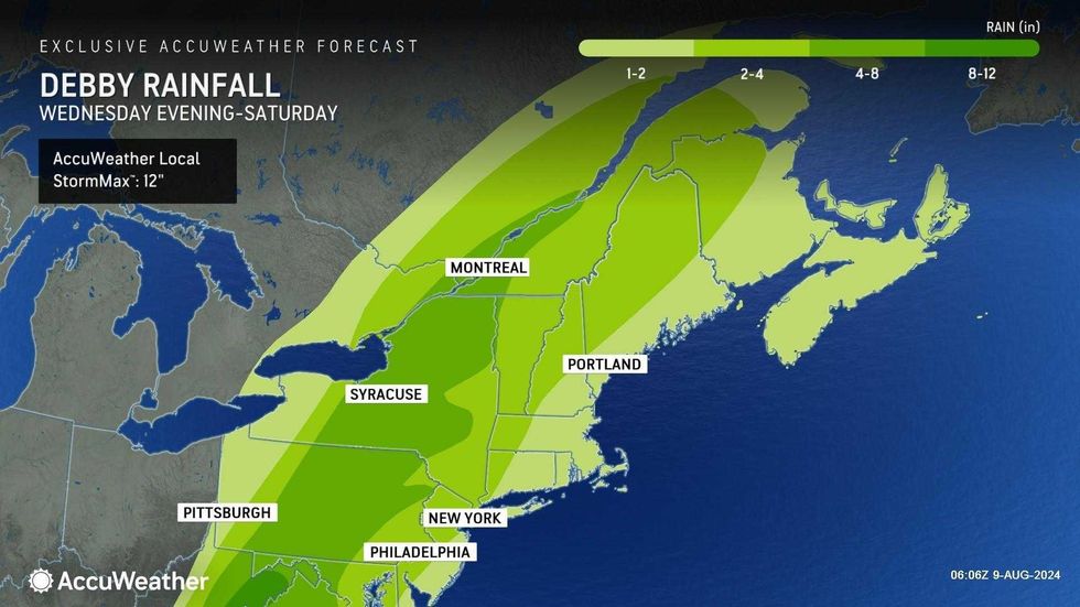
According to Hochul, Debby is expected to merge with another storm system midday Friday, with the heaviest rain totals forecasted for the southern Adirondacks, eastern Catskills and Central New York. Some areas could see up to 6 inches of rain at rates of 2 inches per hour, an amount Hochul called "fairly cataclysmic."
After Debby passes through the Tri-State, Saturday and Sunday will be mostly sunny and breezy with low humidity. Highs will be in the low-to-mid 80s.
The dry and comfortable conditions are expected to continue into next week.


