NEW YORK (1010 WINS/WCBS 880) – Two storms packing heavy winds and rain will batter the New York City area in the days ahead, including a monster system moving through Tuesday and Wednesday that may pack several inches of rain and up to 60 mph wind gusts.
The one-two punch will follow the weekend nor'easter that dropped rain on the city and slushy snow on nearby suburbs—compounding the risk of major flooding on saturated ground.
The "highly impactful" storm has already dropped as much as a foot of snow in Middle America, where communities were under blizzard and winter storm warnings.
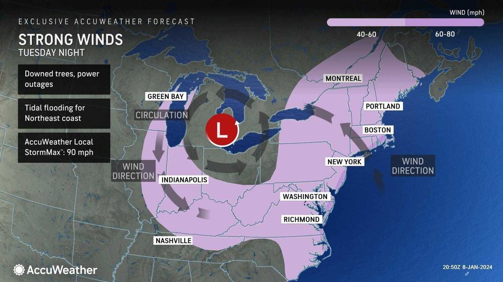
A High Wind Warning was issued for Brooklyn, Queens, Staten Island, all of Long Island, the Jersey Shore, much of central and southern New Jersey, and coastal Connecticut from 6 p.m. Tuesday to 6 a.m. Wednesday. A Wind Advisory is in effect for the rest of the NYC metro.
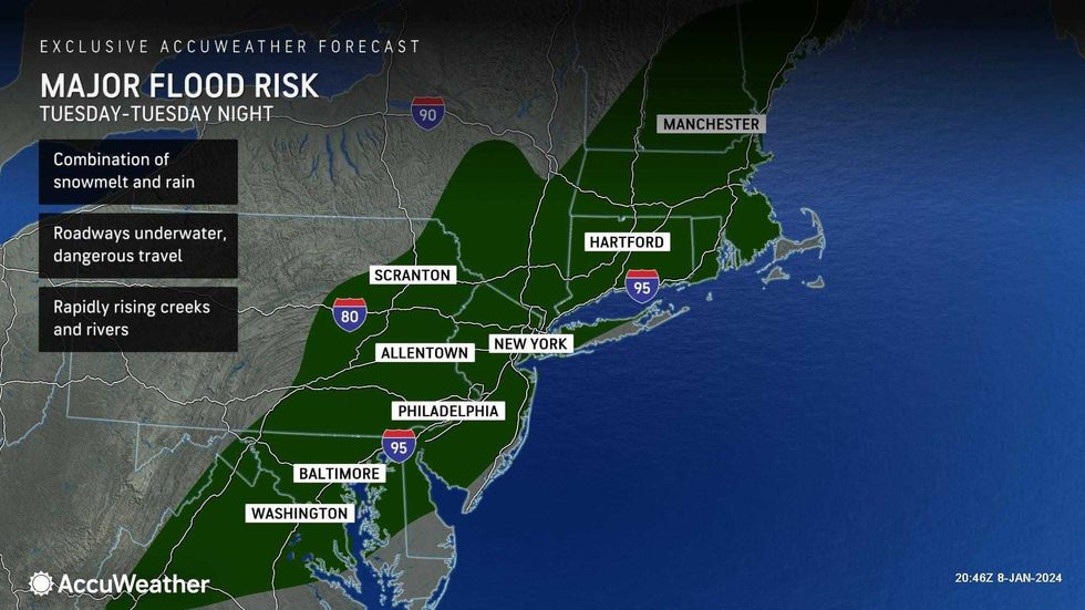
A Flood Watch is also in effect for the entire area from Tuesday evening through Wednesday morning, the National Weather Service said.
"Damaging winds could blow down trees and power lines," the National Weather Service warned. "Widespread power outages are possible. Travel could be difficult, especially for high profile vehicles."
 AccuWeather
 AccuWeather
Gov. Phil Murphy declared a state of emergency for New Jersey starting at 5 p.m. Tuesday, saying, "This is one I would strongly, strongly, strongly encourage folks not to underestimate."
"During past storms we have seen the devastation, including the loss of life, that flooding can cause," Murphy said at a news conference. "So use extreme caution, particularly if you're in and around the Passaic or Raritan rivers."
Gov. Kathy Hochul alerted New York State agencies to prepare for the impacts of Tuesday's storm, which will drop snow further upstate and likely disrupt travel statewide. Flash flooding and power outages are also a major concern.
"After the weekend weather brought snow across our state, a new storm threatens to cause substantial flooding and gale force winds – posing a risk of power outages and creating unsafe travel conditions," Hochul said.
NYC Emergency Management issued a travel advisory from Tuesday evening until Wednesday morning.
The MTA said its employees "will be poised to respond to any weather-related issues," including downed trees on tracks or subway flooding. MTA Bridges and Tunnels will implement a ban on empty tractor-trailers and tandem trucks from 6 p.m. Tuesday to 6 p.m. Wednesday.
 AccuWeather
New Yorkers waiting to break the city's nearly 700-day streak without an inch or more of snow will be disappointed yet again—there's no snow on tap for the five boroughs with these systems.
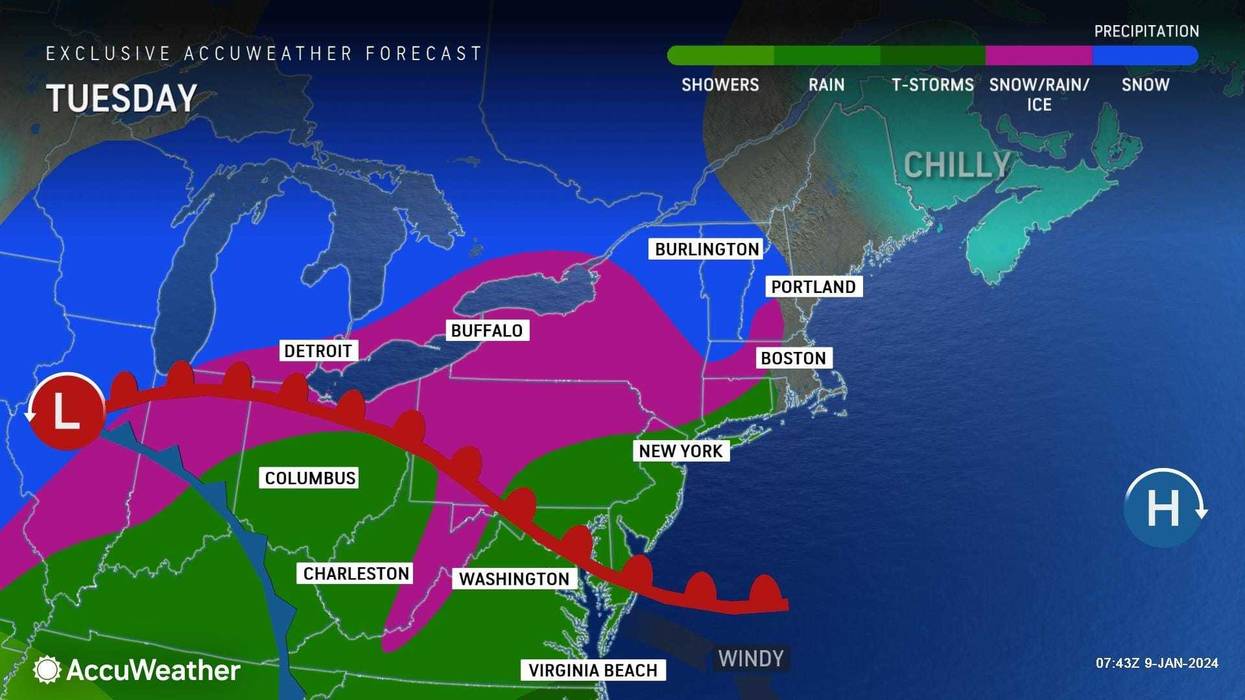
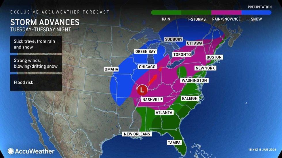
According to AccuWeather, rain will overspread the New York area southwest to northeast on Tuesday afternoon. Winds will pick up going into the evening.
The heaviest rainfall is expected Tuesday night. A general 2 to 4 inches of rain could be seen across the area, which is already soaked from the weekend rain and ongoing snow melt. Flooding issues could easily persist into Wednesday morning's commute.
 AccuWeather
Wind gusts may top 50 mph in the city and 60 mph across the island on Tuesday night—winds that are expected to linger into Wednesday.
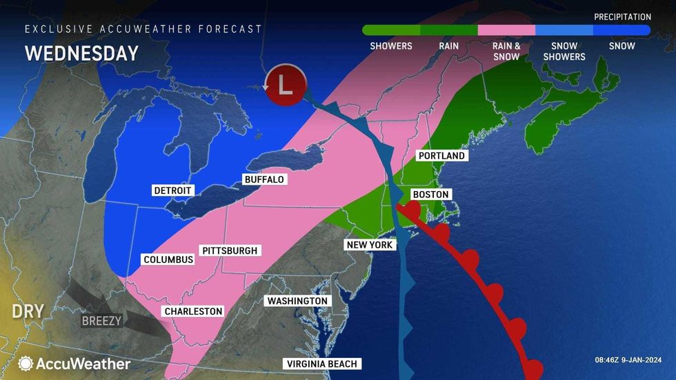
Wednesday will start off stormy, but the sun should be out later in the day. Temps will be in the mid-50s early on before falling into the 40s.
 AccuWeather
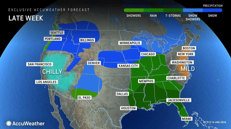
Thursday looks mostly sunny and breezy, with a high of 48 degrees.
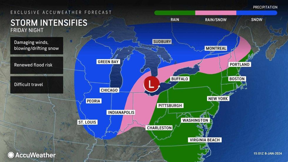
A significant wind and rain storm is then brewing for Friday night into Saturday, AccuWeather said. Heavy rain could lead to even more flooding, while damaging winds could knock out power again.
Sunday and Monday will be clear but cold. Highs will only be in the mid-30s both days.
Looking ahead to next week, there's possible snow in the forecast for Tuesday and Wednesday morning.
 AccuWeather