NEW YORK (1010 WINS) -- A powerful, late-winter storm unleashed heavy rain, slushy snow, strong wind gusts and even a thunderstorm on the New York City area on Saturday.
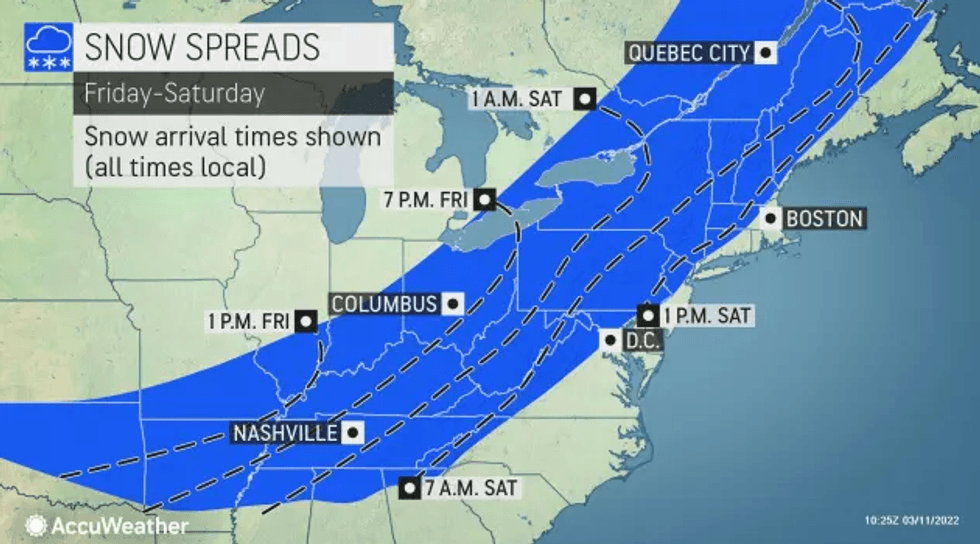
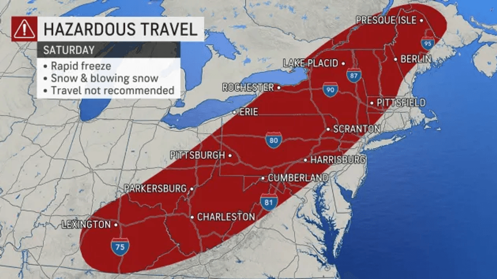
The storm began as rainfall and will gradually switch over to snow making for dangerous, slippery road conditions as a layer of ice forms underneath slush.
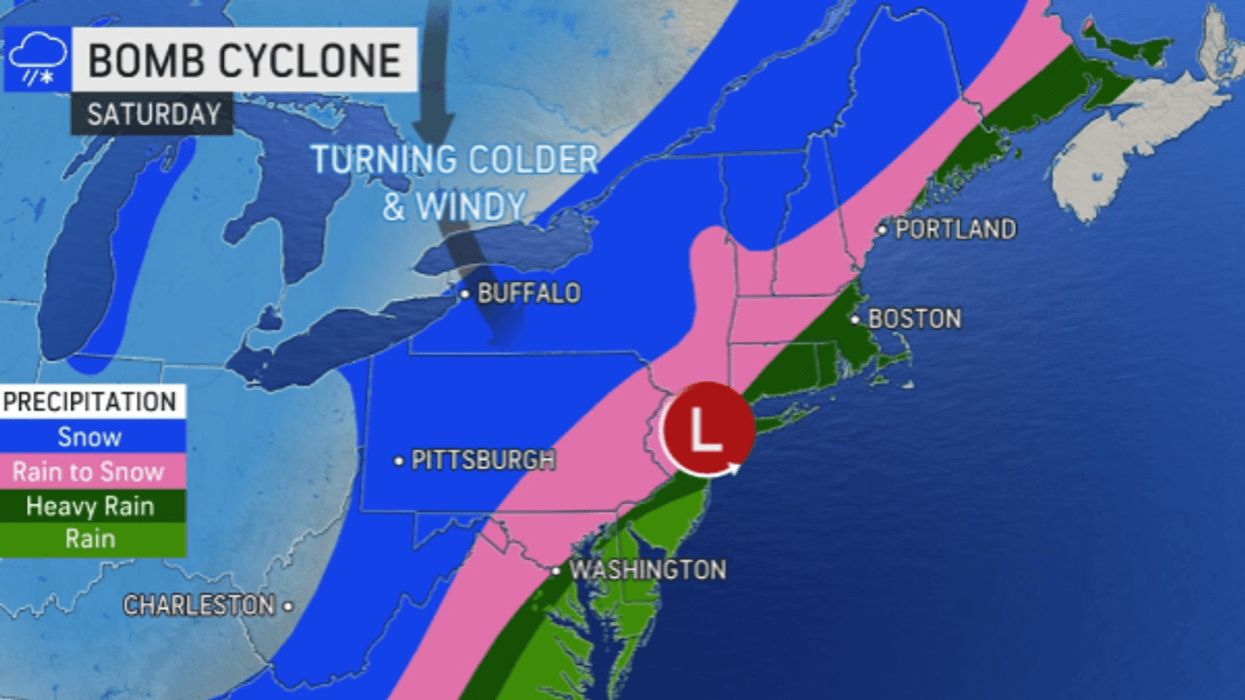
The rapidly strengthening storm, which forecasters predict will reach "bomb cyclone" status, is impacting a swath of the U.S. stretching from Alabama all the way up to Maine. Bomb cyclones intensify quickly as pressure drops; they usually carry multiple associated weather patterns, from blizzards to thunderstorms and more.
 AccuWeather
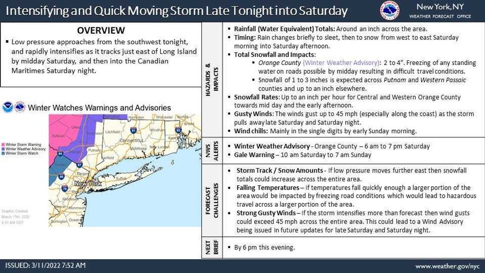
Heavy snowfall should only be a concern for Upstate New York, where some areas could see up to 18 inches, according to AccuWeather.
New York City and coastal communities can expect to get a slushy coating to an inch of snow, while 1 to 3 inches is possible for the nearby suburbs in New Jersey and the Hudson Valley. Up to 6 inches is possible further to the northwest; a Winter Storm Watch has been issued for parts of northwestern New Jersey from Saturday morning to evening.
 AccuWeather
 AccuWeather
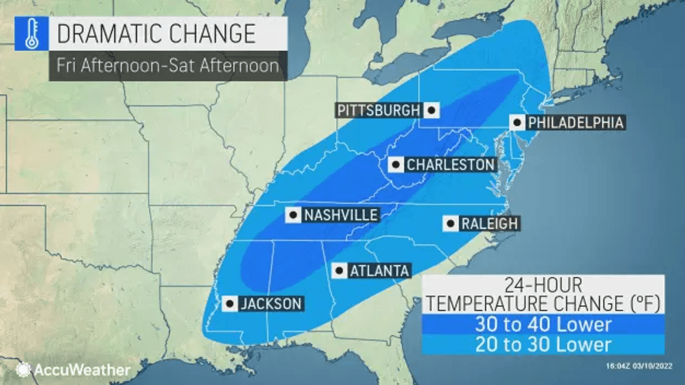
While Friday was sunny and nice, with highs in the upper 50s, clouds increased overnight ahead of the storm.
Colder air and gusty winds sweep into the region throughout the day Saturday. Wind gusts could top 50 mph as temps fall from the 40s into the 30s in the city by late afternoon.
 AccuWeather
 AccuWeather
The powerful winds could down trees and power lines, and travel may be hazardous at times.
A changeover from rain to wet snow will happen from west to east before the precipitation tapers off by evening.
 National Weather Service
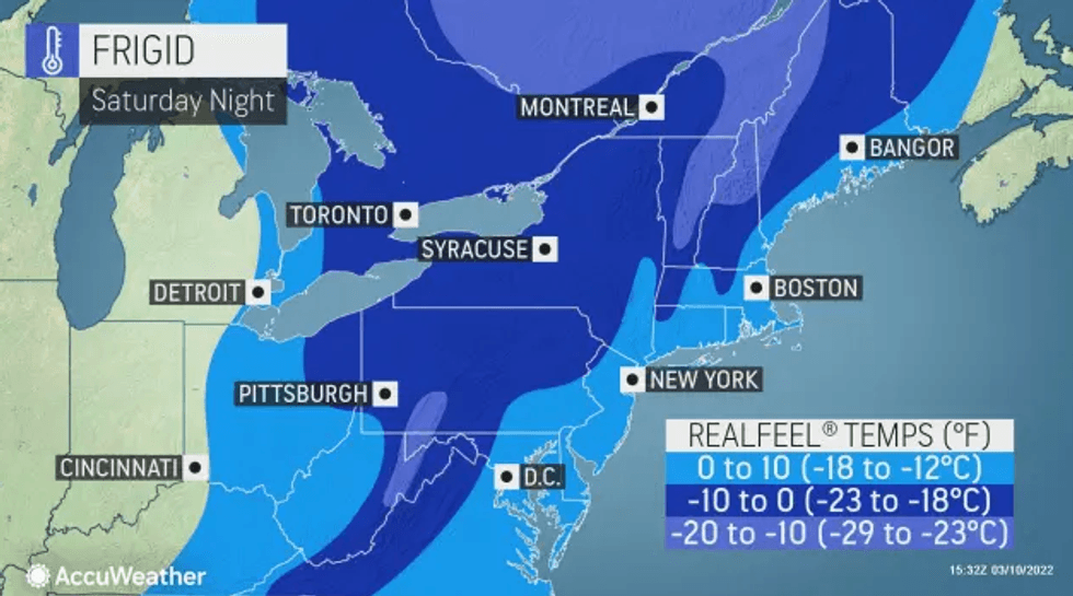
As temps fall to a low of 22 overnight Saturday, untreated streets and sidewalks will get icy. RealFeel temps will drop into the single digits.
It's windy and cold Sunday with a high of 38. It will feel more like spring on Monday as temps return to the mid 50s, and highs could even reach 60 on Tuesday.
 AccuWeather
 AccuWeather