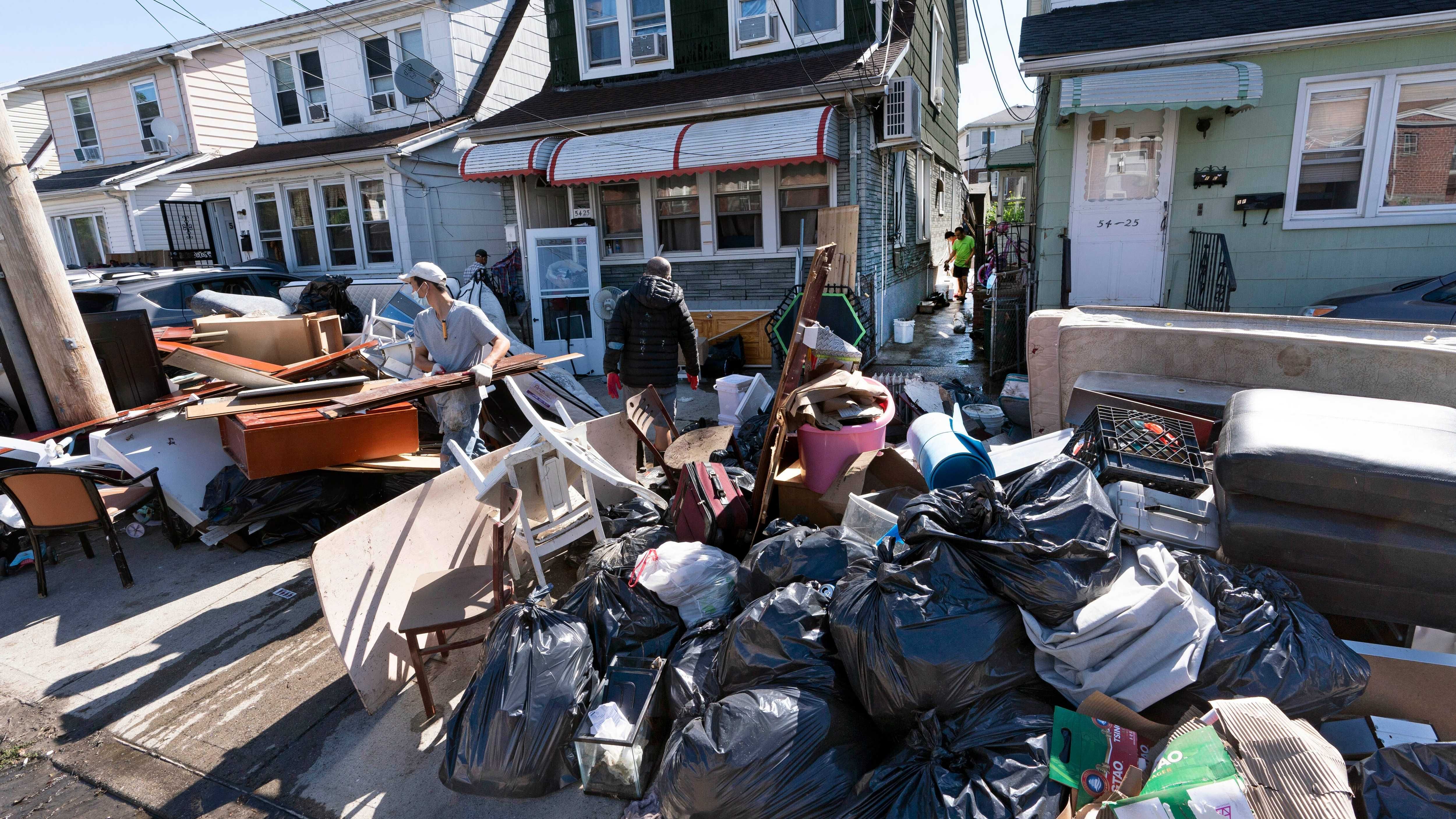
NEW YORK (1010 WINS) — The New York City area is facing drenching rain, severe storms and damaging wind gusts into Friday, just weeks after Ida and other tropical systems flooded the region.
A Flash Flood Watch has been issued for New York City until 8 a.m. Friday. The watch also covers Nassau County, northern New Jersey, the Lower Hudson Valley and western Connecticut.
NYC Emergency Management issued a travel advisory through Friday and has activated the city's Flash Flood Emergency Plan.
"The city is still working to recover Ida, and we want to ensure that New Yorkers are ready," the agency said as it urged residents to prepare for hours of rainfall.
 Tayfun Coskun/Anadolu Agency via Getty Images
Gov. Kathy Hochul directed state agencies to prepare emergency response assets. Her office said the MTA is "taking all necessary precautions to protect its transportation network and deliver safe service."
New York State Police were prepared to deploy swift-water rescue teams in impacted areas, while the Department of Transportation has 1,329 large dump trucks at the ready.
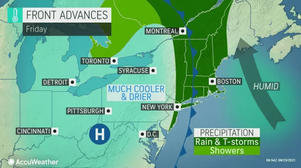
The city and coastal suburbs may see 1 to 2 inches of rain, while inland areas of New Jersey and the Lower Hudson Valley could get up to 4 inches.
Along with a risk of flooding for basements, streams, creeks and rivers, there's also the threat of damaging wind gusts or an isolated tornado, especially west of the city.
Gusts could hit 60 mph in the city and surrounding areas, potentially downing trees and power lines and causing scattered power outages, the National Weather Service said.
The rain tapers off to showers Friday morning before conditions dry throughout the day. It will be a bit cooler with a high of 71.
The weekend is mostly sunny and pleasant. Highs will be in the low-to-mid 70s on Saturday and Sunday.
 AccuWeather