NEW YORK (1010 WINS) – New York City could see its first snowflakes of the season this Wednesday into Thursday, as meteorologists track another system that has the potential to become a powerful nor'easter next week.
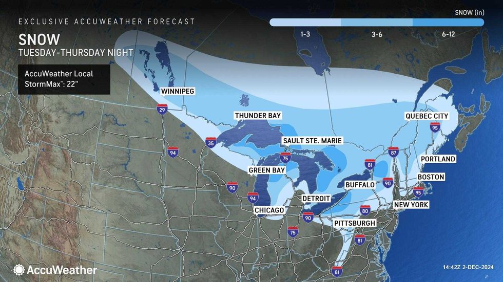
Wednesday night's wintry storm will be nothing like the massive snowfall seen upstate over the weekend, when a storm dumped nearly 2 feet of snow on Buffalo and almost 4 feet on the community of Barnes Corners in Lewis County.
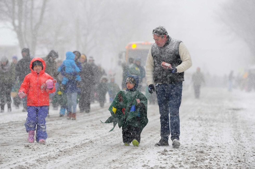 Ella, Cooper, and Colin Reilly march through lake effect snow during the annual Hamburg Holiday Parade on November 30, 2024 in Hamburg, New York.John Normile/Getty Images
Still, it would be the first snow of the season for NYC, which saw almost no snow during the 2023-2024 winter season and has experienced an extremely dry fall season.
 AccuWeather
It will be quiet start to the work week before the "Alberta clipper" sweeps down from Canada midweek. Expect mostly sunny skies Monday, Tuesday and early Wednesday, then cloudier conditions going into the storm.
 AccuWeather
The New York area will be on the "warmer side" of the storm, though it may be chilly enough in parts to allow pockets of snow to develop, according to AccuWeather. However, it's likely the city will experience mostly rain or a wintry mix, as temps will warm to the 40s Wednesday night.
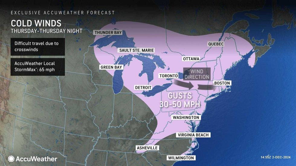
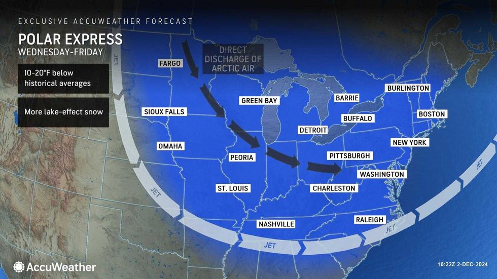
It will otherwise be windy and very cold much of the week in the city, with highs in the low 40s every day and lows down into the 20s at night, as an "Arctic plunge" engulfs the region. Wind chills will send RealFeel temps plunging to the teens at times.
 AccuWeather
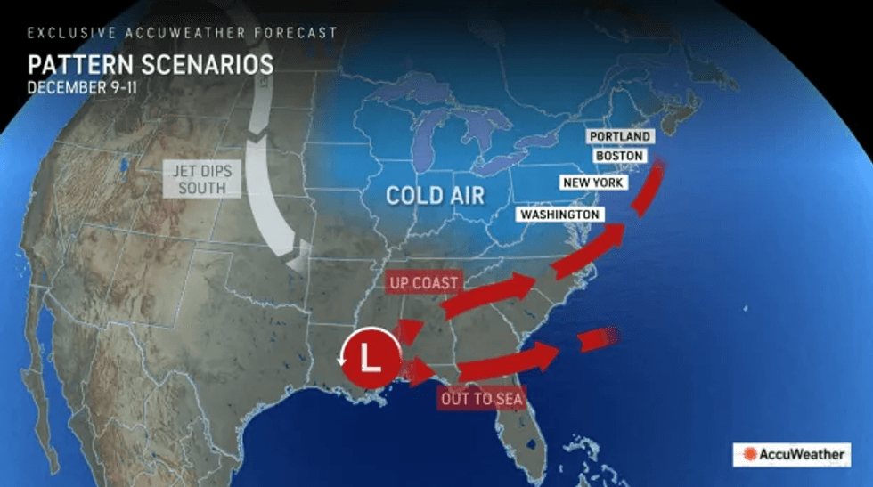
Meanwhile, meteorologists are keeping an eye on a system in the South that could soak up moisture from the Gulf of Mexico and move up the coast as a nor'easter between Dec. 9 and Dec. 11, according to AccuWeather.
It's still too soon to say what path the storm will take, but it has the potential to cause major disruptions if it climbs up the East Coast instead of moving out to the Atlantic.
 AccuWeather