NEW YORK (1010 WINS/WCBS 880) -- After weeks of stifling heat and humidity, New York City will see a return to 70-degree temps this week, as well as an increased chance of rain and severe storms.
NYC had its fourth heat wave of the summer last week—highs reached the 90s in Central Park on Thursday, Friday and Saturday. That followed two heat waves in early-mid July and one in late June.
Indeed, the last day the high was below 80 degrees in Central Park was on June 29, when it was 79 degrees, according to the National Weather Service.
 AccuWeather
 AccuWeather
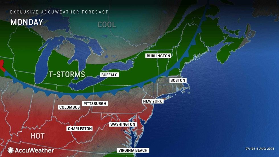
The sweltering stretch is set to end this week, as storms usher in much cooler temps.
While Monday's high is forecasted to reach 91 in Midtown, with a heat index of 100, conditions will begin to cool Tuesday.
Tuesday's high will be 84, while Wednesday's will be just 72, according to AccuWeather. Highs are expected to stick to the 70s through the weekend.
 AccuWeather
 AccuWeather
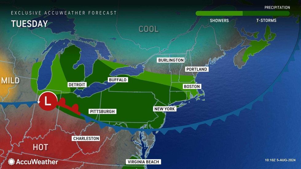
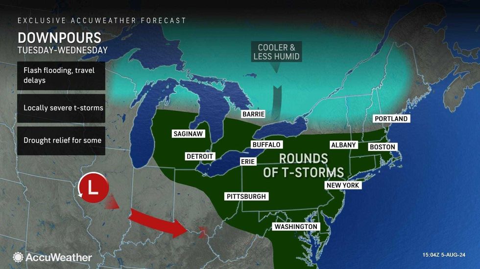
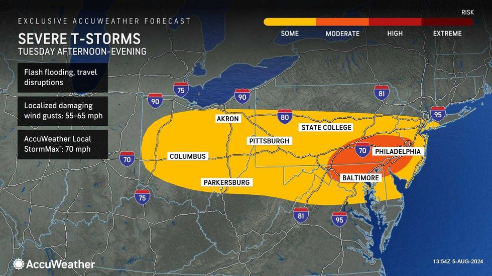
The cooler temps will come with a tradeoff—an increased chance of storms starting Tuesday.
Showers and heavy thunderstorms may bring damaging gusts and flooding downpours on Tuesday and Tuesday night. More rain may pop up Wednesday.
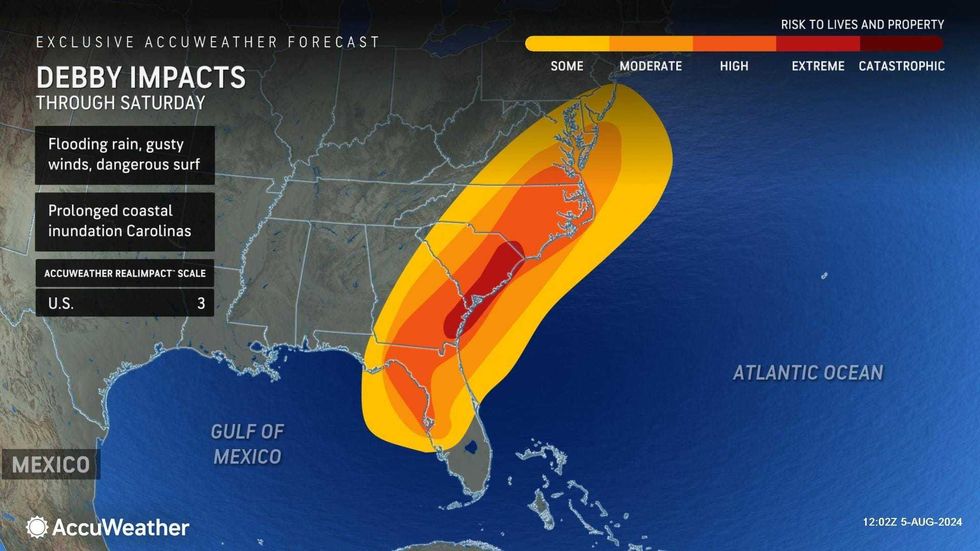
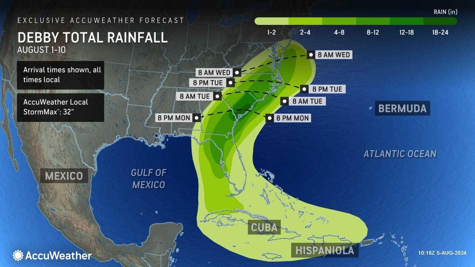
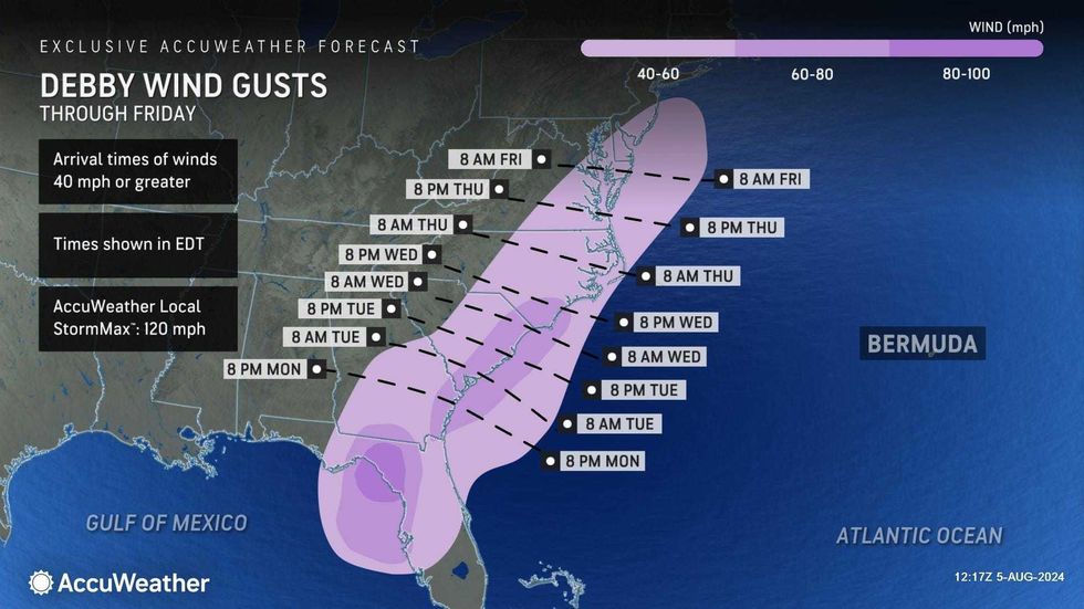
Thursday should be dry, but the remnants of Hurricane Debby will pass by the New York area late Friday and Saturday. The approaching system could bring heavy rain Friday, and the impacts of Debby could last into the weekend.
Debby made landfall in Florida on Monday as a Category 1 hurricane, killing several people and knocking out power to more than 200,000 customers.
Emergency managers in New York and New England have been monitoring the path of the storm. Parts of New York and Vermont are still coping with flooding and saturated ground after heavy storms in recent weeks.
 AccuWeather
 AccuWeather
 AccuWeather
The Associated Press contributed to this report.