NEW YORK (1010 WINS/WCBS 880) – Heavy rain and gusty winds hammered the New York City area overnight and continued to pop up Monday, though the weather was expected to clear throughout the day and usher in chillier and drier conditions for the holiday travel week.
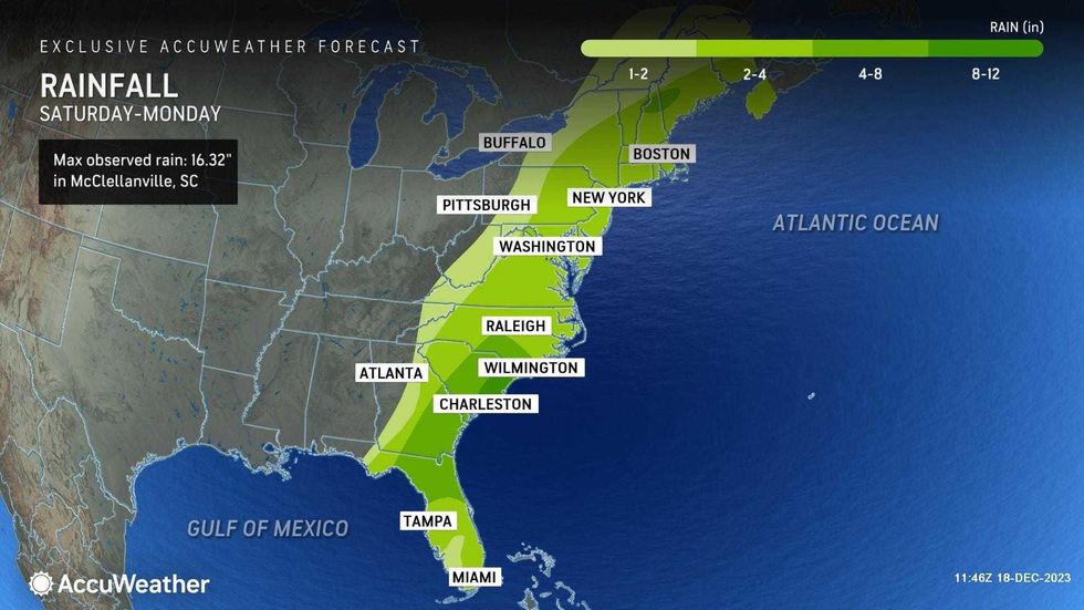
Sunday night's wild weather came from a major coastal storm that churned up the East Coast from the South. Some 60 million people were under flood alerts, just as holiday travel begins. About 500,000 customers were without power along the East Coast, including tens of thousands in the NYC area.
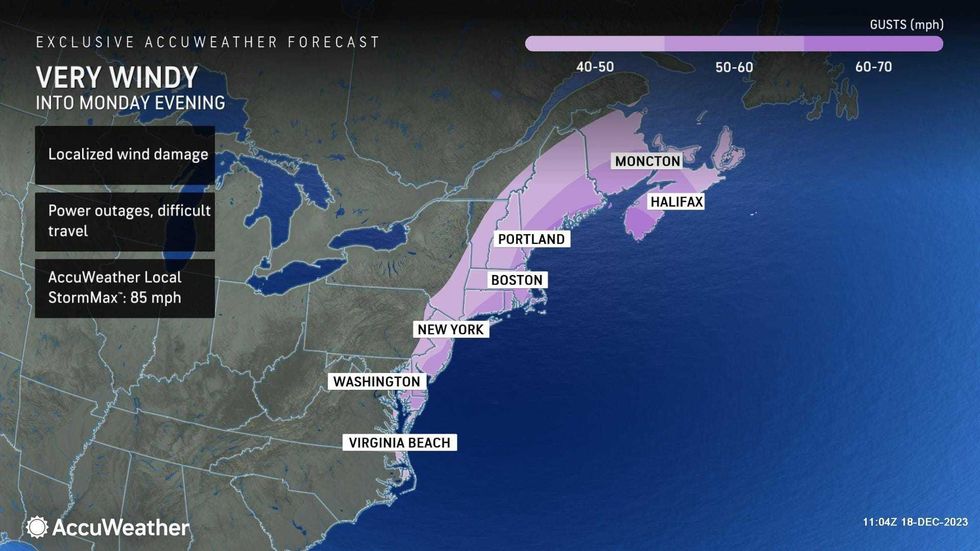
Some areas of North Jersey saw 3 to 4 inches of rain, while wind gusts on Long Island reached upwards of 50 mph, toppling trees and power lines.
 AccuWeather
Flood and wind advisories that were posted Sunday were set to last into the day Monday, including a flood watch up until 5 p.m.
A travel advisory was put in place in New York City, as was a ban on empty tractor-trailers and tandem trucks at the bridges. Flooding was impacting roadways throughout the city, including 90-minute delays at the GWB in the morning. Alternate Side Parking was also suspended Monday due to the severe weather.
Downed wires were causing major issues on commuter rail lines, including NJ Transit, LIRR and Metro-North. There were 45-minute delays into and out of Penn Station at one point, and some subway lines were snarled due to debris on the tracks. Meanwhile, nearly 50 flights were canceled and dozens more delayed at the airports serving New York.
 AccuWeather
 AccuWeather
As of noon, nearly 50,000 customers were without power across local utilities in the five boroughs, Long Island, New Jersey and Westchester, including over 30,000 Jersey Central Power & Light customers and some 10,000 Con Edison customers in the city.
NYC Emergency Management Commissioner Zach Iscol told 1010 WINS that crews were working to restore power in the boroughs. He also dispelled reports that the shelter housing thousands of migrants at Floyd Bennett Field in Brooklyn had flooded. Listen to the full interview here:
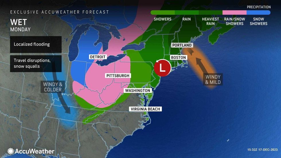
The worst of the rain moved out in the morning, but lighter downpours continued in the afternoon before conditions were set to clear. Winds may continue to gust up to 50 mph throughout the day as the storm pushes away.
 AccuWeather
 AccuWeather
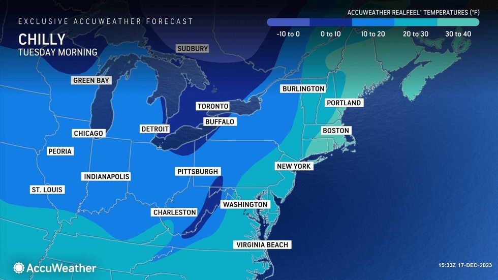
Temps were in the low 60s to start the day Monday, but they'll fall to 38 in the city overnight after the storm moves out.
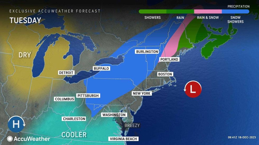
Tuesday will be blustery and chillier with clouds and some sun. A rain or snow shower is possible during the day. The high will be 43.
 AccuWeather
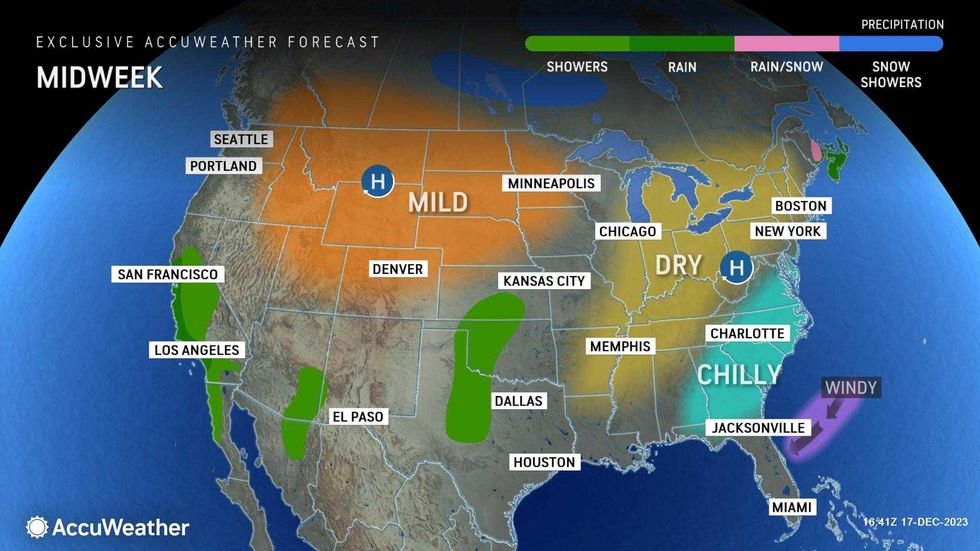
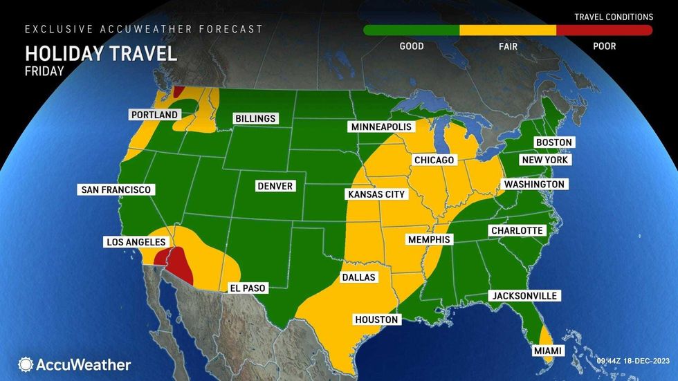
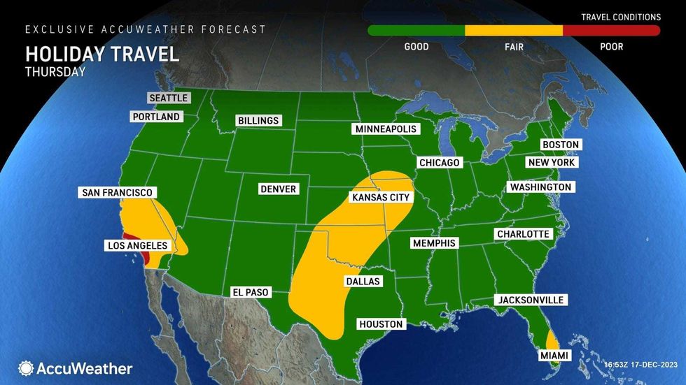
Highs will stick to the low or mid 40s on Wednesday, Thursday and Friday. It will otherwise be dry and mostly sunny through the workweek, including Thursday and Friday, when holiday air travel reaches its height.
Hoping for a white Christmas next Monday? Unfortunately, that's looking unlikely for those in the New York area. Temps were expected to be in the high 30s or low 40s under partly sunny skies, with no snow in the forecast.
 AccuWeather
 AccuWeather