


Much of the Upper Midwest on Saturday was dealing with swaths of unhealthy air because of drifting smoke from Canadian wildfires, covering the northern region of the U.S. at a time when people want to be enjoying lakes, trails and the great outdoors. There are more alerts on Tuesday - and potentially more on Wednesday - in northern Minnesota.
Most of Minnesota and parts of Montana, North Dakota and Wisconsin were ranked “unhealthy” for air quality on a U.S. Environmental Protection Agency map. Part of North Dakota that is home to Theodore Roosevelt National Park and other tourist attractions was ranked “very unhealthy,” some of the worst air quality in the nation.
These fires across Canada aren't that unusual, but in recent years have seemingly grown and spread more frequently, causing heavy amounts of smoke to drift south, depending on wind conditions.
"Canada is very large and there are a lot of forests, and so, this time of year, wildfire season, you get a lot of wildfires that start and spread," says Meteorologist Ryan Lueck from the Minnesota Pollution Control Agency. "As soon as you have those hot, dry conditions, they can just kind of take off and sometimes those fires are really remote."
Lueck, who adds Minnesota and the Dakotas have been getting the worst of the Canadian wildfire smoke, adds that predicting when air quality will deteriorate is a difficult thing to do.
"The first problem that we have to answer is, will the wildfires be active? And if so, when? And when I say active, they're always kind of like smoldering and burning, but sometimes you get weather conditions that really like fuel the flames, like really kind of promote that fire growth," says Lueck. "So we look for those days across the regions of the wildfires, first and foremost. That's weather related, so weather models go out to about seven days with some level of accuracy."
He says complicating those forecasts are trying to also predict what direction and how far the wind will carry that smoke, also an approximately 7-day lead for forecasters.
"After that it drops off quite a bit," he says. "So in that respect, we can kind of have a decent feel for what the wildfires will be like through about 7 days."
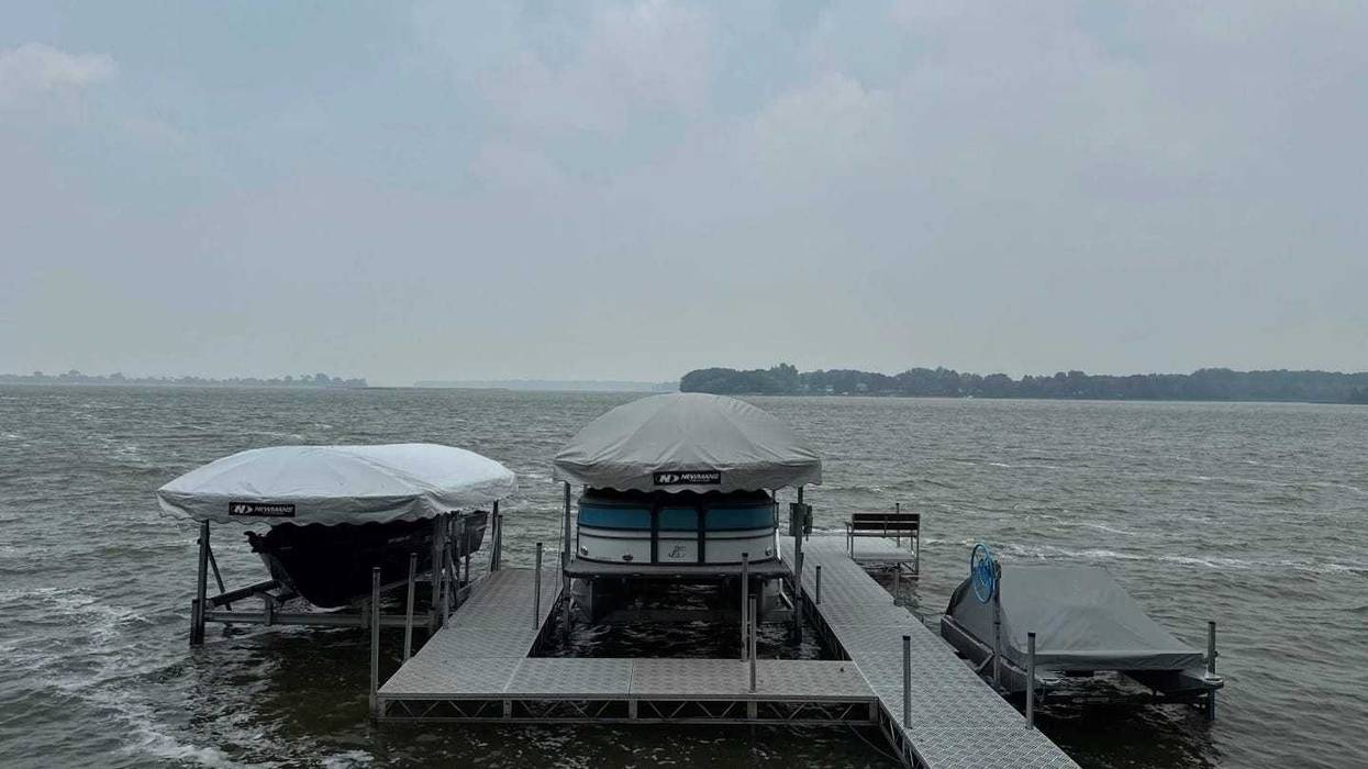
In Minnesota, “If you have a nice pork loin you can hang from a tree, it'll turn into ham,” quipped Al Chirpich, owner of the Hideaway Resort near Detroit Lakes, where people come to enjoy tree-lined Island Lake for fishing and other water activities.
Normally there would be boats and jet skis all over, but on Saturday he couldn't see a boat on the lake, where the smoke impaired visibility and curtailed his camper business. None of his 18 RV sites was occupied. His seven rental cabins drew a handful of customers.
“I suspect when the weather clears, we'll be swamped again. Fourth of July, I had probably 20 boats here lined up at my docks, and today my boat is the only one,” Chirpich said.
The conditions started Friday, dragging smoke from the Canadian wildfires down to the surface, said National Weather Service Meteorologist Jennifer Ritterling, in Grand Forks. Periods of bad air quality are expected to last through the weekend in the region, she said.
Limiting time outdoors, keeping windows closed and running air purifiers are good ideas for people with lung conditions such as asthma and chronic obstructive pulmonary disease, and even healthy people, Ritterling said.
“Our summers up here are fairly short and so everyone wants to get out and enjoy them, and it’s a little frustrating when there’s this smoke in the air,” she said.
Fires in Canada prompt state of emergency for some
All of Manitoba is under a state of emergency because of the wildfires, which have led to 12,600 people evacuating their homes in the province. The fires in the central Canadian province have burned over 3,861 square miles (10,000 square kilometers), the most land burned in 30 years of electronic record-keeping.
Under 1,000 people have evacuated their homes in Saskatchewan, where wildfires also continue to burn.
North Rim in Grand Canyon still closed
In Arizona, the North Rim in Grand Canyon National Park is still closed because of a 2.3 square-mile (6.1 square-kilometer) wildfire and another fire nearby on Bureau of Land Management land that has burned nearly 17 square miles (44 square kilometers).
More than 200 firefighters and support personnel worked to halt the uncontained fire Saturday as it burned across a high-altitude plateau between the communities of Lonesome, White Sage and Jacob Lake.
In Colorado, Black Canyon of the Gunnison National Park remains closed because of a 4.4-square-mile (11.3-square-kilometer) wildfire burning on the South Rim of the park, known for its dramatic, steep cliffs. A few miles from the fire, an evacuation was ordered for the community of Bostwick Park, and a nearby highway also was shut.
The fires in and near both national parks led to evacuations of hundreds of people.
Chirpich, the Minnesota resort owner, said he has plans to go to Black Canyon of the Gunnison National Park on Thursday and is “a bit pensive about how that's going to be there.”
“I'm going to leave one smokehouse for another, I guess,” he said.


