


AccuWeather says recent severe weather outbreaks have sent preliminary tornado reports skyrocketing to levels that are nearly double the historical average for early April.
Meteorologist Joe Lundberg of Accuweather says, "I think the tornado reports were 526 for the year to date. The average would be 307, so that's almost double what we would normally see for the year to date. If you look back at the last 16 years, only 2023, 2022 and 2017 had more by now."
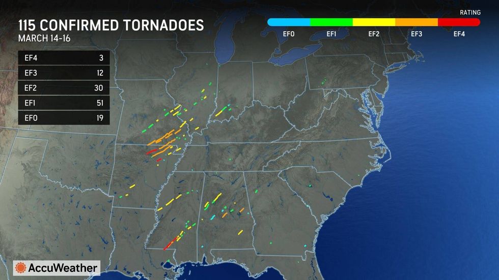
According to Accuweather, Missouri had 57 tornadoes and Illinois had 55 so far this year.
Lundberg says, "And if you look at that map, it's weighted more toward the eastern part of the Plain States and really more toward the Mississippi Valley and points east. Not so much in what you would call your typical tornado alley, which would be parts of Texas, Kansas and Oklahoma."
Lundberg points out, "If you look at the pattern that we've had, there's been a lot of dry air across the Southwest. There's a big drought in southwest Texas and across Arizona and New Mexico. And as that dry air has come out, it's limited the development of thunderstorms until farther east, basically east of the I-35 corridor and even points farther east. But then you've picked up some of that moisture from the Gulf of America as these storms have come out. That's when they've exploded. And we've seen the tornado development. And I think that's one of the reasons why we're seeing such high numbers for Missouri and Illinois so far this year."
During Total Information A.M., Megan Lynch asked about other atmospheric triggers for recent tornadoes?
"There's been these systems coming through the west. They produce some rain and mountain snow across portions of California and Nevada. As they come out into the eastern Rockies and western plains, they start to sense that Gulf moisture. There's also been a lot of warm air trying to come off of Mexico and work its way into these systems. So that's just that kind of volatile mix. At the same time, as these systems have come out, they've brought a lot of cold air out of Canada down through the plains into their circulation. These unusually strong storms track across the heart of the plains and work their way toward the Great Lakes. And that's, I think, been one of the bigger contributors to, you know, some of the big events back in the middle of March and more recently over the last couple of weeks."
 Accuweather
Lundberg says the trend will continue over the next month or two. "It does look like the pattern is going to remain fairly active. And these storm systems still come out of the eastern Rockies. I think we're going to be in the crosshairs of severe weather for late April and into the month of May. We've been in a lull over the past several days, but it looks like that activity is probably going to change when we go into the weekend."
@2025 Audacy St. Louis (KMOX). All rights reserved.


