


ST. LOUIS (KMOX) -- You'll want to keep an ear to the weather tomorrow.
 AccuWeather
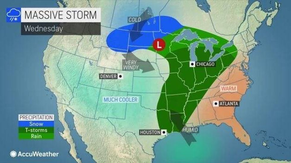
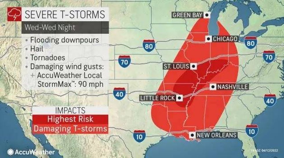
Severe storms are forecast to strike the heart of the St. Louis metro area between noon and 4 p.m. Metro East counties could see the severe threat persist though 7 p.m.
The Weather Service says tornadoes, 80 mile-per-hour winds, and hail are all possible. The risk of major flooding is forecast to be low.
 AccuWeather
Here's KMOX meteorologist Dave Murray's forecast as of Tuesday night:
Limited action Tuesday overnight into Wednesday early morning…big big thunderstorms…strong to severe Wednesday afternoon and early evening..all gone late Wednesday night.
TUESDAY NIGHT:
Mostly cloudy, windy, a few spot showers/storms, lots of dry time, warmer
LOW: 65 degrees
WEDNESDAY:
Mostly cloudy, windy with periods of rain and storms, some strong to severe. Still shaping up to be an active storm day. The focus for severe weather will be the afternoon and early evening.
HIGH: 72 degrees, but dropping into the 50s during the afternoon
WEDNESDAY NIGHT:
Rain and storms, some strong to severe, ending in the early evening. Clearing sky, still windy, cold.
LOW: 38 degrees
THURSDAY:
Sunny, windy, and cool. All is dry.
HIGH: 62 degrees


