As deadly flash floods swept through Central Texas over the Fourth of July weekend, questions have emerged about the timing and effectiveness of official weather warnings.
The National Weather Service issued multiple alerts leading up to the disaster - but many residents, including those at summer camps, say they were caught off guard. Here's a timeline of the flood watches and warnings issued by the NWS before and during the catastrophe.
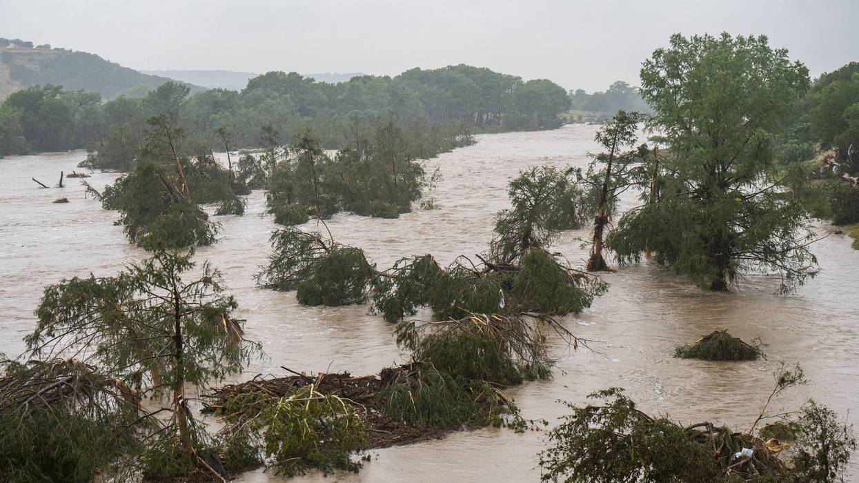
⛈️ NWS Flood Watches & Warnings Timeline
🔹 July 3, 1:18 PM CDT – An official Flood Watch was issued by NWS Austin/San Antonio for Kerr and surrounding counties, warning of 1–3 inches - potentially up to 5–7 inches - of rain and "scattered to widespread showers and storms" through early Friday.
🔹 July 3, late evening - Mesoscale Precipitation Discussions flagged excessive rainfall, followed by flash flood warnings for Bandera and Kerr counties first issued at 11:41 PM CDT .
🔹 July 4, 1:14 AM CDT - A Flash Flood Warning was upgraded with Impact-Based criteria - tagged "considerable" or higher - triggering Wireless Emergency Alerts (WEAs) and NOAA Weather Radio broadcasts .
🔹 July 4, 4:03 AM CDT - The situation escalated to a Flash Flood Emergency for South-central Kerr County (including Hunt), warning of life-threatening "wall of water" flooding and urging immediate evacuation .
🔹 July 4–5 - NWS issued a total of six Flash Flood Emergencies on July 4 (including areas like Kerrville and Mason) and two more on July 5 covering Burnet, Travis, Williamson counties, and the Lake Travis area .
Lead Time & Effectiveness
Forecasters delivered several hours of advance warning - NWS reports a lead time of more than three hours after the initial watches and warnings.
Yet, many residents and camp staff were asleep when the flash flood emergency dropped around 4 AM - leaving little time to heed warnings or evacuate effectively.
Summary
The National Weather Service provided a clear progression of alerts: starting with a Flood Watch Thursday afternoon, followed by flash flood warnings Thursday night, and culminating in multiple Flash Flood Emergencies early Friday. Technically, the alerts were timely and carried federal triggers like Wireless Emergency Alerts - but the fact they arrived during predawn hours meant many were issued too late to ensure full public response.
LISTEN on the Audacy App
Tell your Smart Speaker to "PLAY 1080 KRLD"
Sign Up to receive our KRLD Insider Newsletter for more news
Follow us on Facebook | Twitter | Instagram | YouTube