


UPDATE 4:0O PM: Rapid storm development in West Texas is occurring right now. This will most likely turn into a line of storms and blow through north Texas after midnight. High winds and some small hail are the threats. I don't think it'll be anything like what we saw this morning, but I've got plenty of time to watch the radar trends as this line approaches this evening.
I will soon know how strong the wind will be and if there will be any hail embedded in the line. Tornado threat is never zero along a line of storms, but they're usually weak and short-lived if any do spin up.
Most of North Texas is experiencing clean-up and awaiting power restorations after Tuesday's storms. Dallas County Judge Clay Lewis Jenkins says in 14 years on the job he hasn't seen a widespread thunderstorm develop and do as much damage as this.
Jenkins has already signed a disaster declaration for Dallas County. Trees are down, power is out across the area and Jenkins says it will take time to fix everything. As for the power outages, ONCOR's Grant Cruz agrees it's going to take days to get electricity restored for some.
As of 7:35 a.m. Tuesday, nearly 600,000 people in the Dallas-Fort Worth area were without power, including 355,841 in Dallas County, 84,382 in Collin County, 52,359 in Denton County, 51,519 in Tarrant County, 24,954 in Rockwall County, 8,132 in Ellis County, 14,552 in Kaufman County, and 1,974 in Wise County.
At North Texas airports, there were 70 delays and 44 cancellations at Love Field as of 7:15 a.m. and 176 delays and 123 cancellations at DFW International Airport.
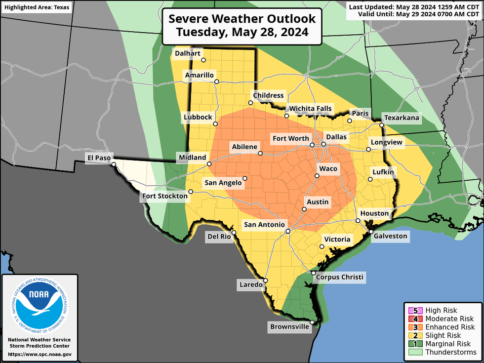
According to the National Weather Service, showers and thunderstorms will continue to roll through the Interstate 20 corridor Tuesday morning. More storms will enter from the west Tuesday evening, some of which may be severe with large hail and damaging winds. Flooding is also a risk due to the amount of rain North Texas has experienced this spring.
 NWS
NWS
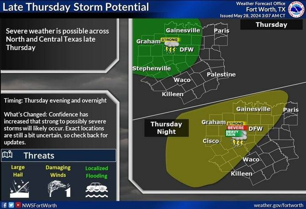
More severe weather is possible Thursday. Large hail, damaging winds, and heavy rain will be possible, especially west of the Interstate 35 corridor.
 NWS
NWS
7-Day Headlines:
* DFW Airport reached 96 yesterday. 0.28" of rain.
* Severe Thunderstorm Watch until11 a.m.
* A stormy week ahead.
* Severe threat today, late Thursday and late Saturday.
* Threats: Large hail, damaging wind and flooding.
* A ton of humidity.
* Drying out next Monday.
_____________________________________________________
*Yest Rain: 0.28"; Yest High: 96; Low: 74
*Today's Averages: High: 87; Low: 68
*Record high: 107 (1927) Record low: 51 (1907)
_________________________________________________________
*May Rain: 4.05"; Deficit: 0.13"
*2024 Rain: 21.32"; Surplus: 5.33"
*Sunrise: 6:22am; Sunset: 8:30pm _________________________________________________________
Today: **Severe Thunderstorm Watch until 11am** Morning severe storms, a break in the afternoon, then more severe storms move in from the west this evening.. Threats: Large hail, damaging wind, an isolated tornado. High: Low to mid 80s. Wind: ESE 15-25 mph.
Tonight: Strong to severe storms. Threats: Large hail, damaging wind, an isolated tornado. Low: Near 70. Wind: ESE 10-15 mph.
Tomorrow: Morning rain, afternoon sun, warm and humid. Isolated late day storms. High: Mid 80s. Wind: SE 5-10 mph.
Thursday: Partly cloudy, warm and humid. Severe storm threat ramps up by late evening into early Friday morning. Highs: Mid 80s.
Friday: Morning storms, some afternoon sun. Warm and humid. High: Mid 80s.
Saturday: Partly cloudy, warm and humid. More storms possible late. High: Mid to upper 80s.
Sunday: Morning storms, some afternoon sun. Warm and humid. High: Upper 80s.
Monday: More storms by evening. Warm and humid. High: Near 90.
LISTEN on the Audacy App
Tell your Smart Speaker to "PLAY 1080 KRLD"
Sign Up to receive our KRLD Insider Newsletter for more news
Follow us on Facebook | Twitter | Instagram | YouTube


