


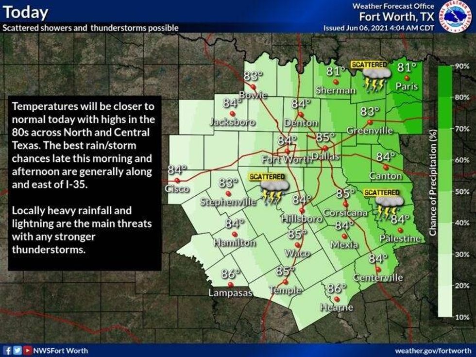
Dallas (1080 KRLD) - Saturday evening saw parts of Northern Dallas and most of Collin County suffer up to 6" of rain. And while things are quiet on the radar right now, this is set to change.
We are expecting some shower and thunderstorm activity to form once again along and North of Interstate 30, especially across the two-county rows just south of the Red River Valley. These will be slow-moving non-severe storms and will produce more flooding in areas that have already seen a lot of rain.
 National Weather Service
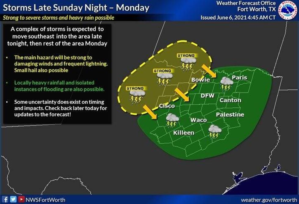
Things will quiet down in these areas by late this evening, but another cluster of storms will be impacting our area by tomorrow morning. These storms will form to our northwest and head southeast containing wind, heavy rain, and lightning.
 National Weather Service
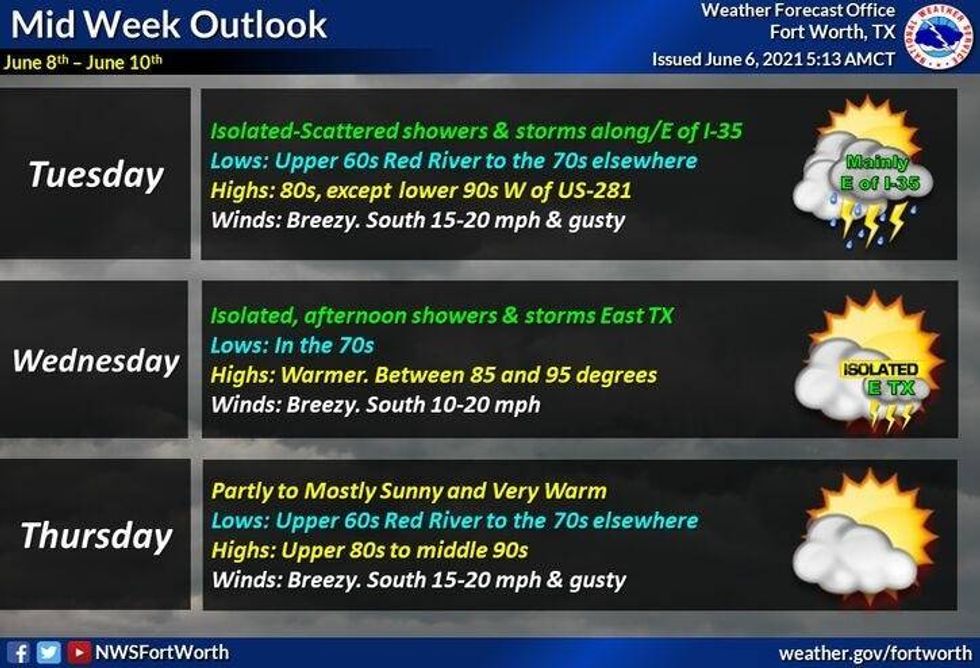
One more area of storms may impact us early Tuesday morning.
After that, we'll start to dry out and hear up by the end of the week and into the upcoming weekend. Temperatures may exceed 90゚ by then. Factor at the oppressive humidity and the heat index values will be well up into the 90s.
 National Weather Service
LISTEN on the Audacy App
Sign Up and Follow NewsRadio 1080 KRLD


