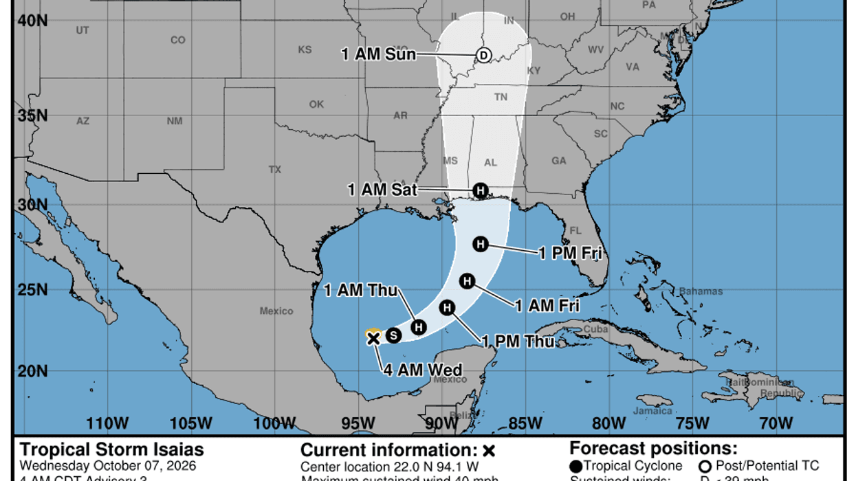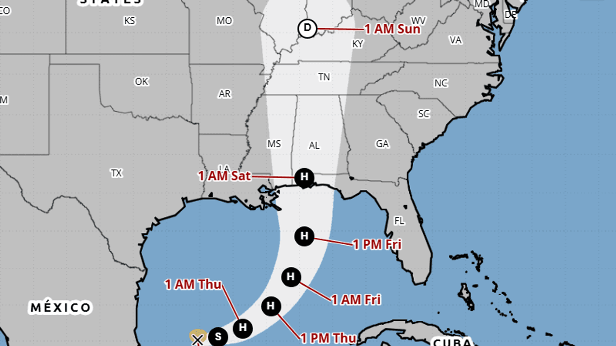

The Gulf system is now Tropical Storm Isaias, and forecasters say it is likely to become the Atlantic season’s first hurricane before it reaches the northern Gulf Coast on Friday.
The National Hurricane Center upgraded the storm at 4 a.m. Central time Wednesday. At that advisory, Isaias was about 580 miles southwest of the mouth of the Mississippi River, and about 285 miles west of Progreso, Mexico, with maximum sustained winds near 40 mph. It was moving east-northeast at 8 mph. Tropical-storm-force winds extended outward up to 45 miles from the center. The minimum central pressure was 1004 millibars.
No coastal watches or warnings were in effect at 4 a.m. The center said interests on the Yucatan Peninsula and the U.S. northern Gulf Coast should monitor the storm. Hurricane and storm-surge watches will likely be required for part of that coast later today.
4 AM CDT Wed Oct 7 (Advisory 3) Key Messages for Tropical Storm #Isaias. Latest info: https://t.co/GrztW6mQJV 4 AM CDT miércoles 7 de octubre (Aviso 3) Mensajes clave sobre la tormenta tropical #Isaias. Más información: https://t.co/GrztW6mQJV https://t.co/KtZXk4I1OV
— National Hurricane Center (@NHC_Atlantic) October 7, 2026
Rapid strengthening is forecast. Isaias is expected to become a hurricane by Thursday and reach a peak near 110 mph while it is over the central Gulf. On the forecast track, it should pass north of the Yucatan on Thursday and approach the coast Friday somewhere from Louisiana toward the Florida Panhandle. The exact landfall point is not set. Forecasters said wind and rain impacts could extend well east of the center, and that the storm could still be a significant hurricane when it reaches the coast.
The main threats are dangerous wind, storm surge, and heavy rain. The center said Isaias will bring heavy rainfall to the central Gulf Coast and much of the Southeast from Friday into the weekend, with flash flooding, urban flooding, and isolated river flooding possible. Air Force Reserve and NOAA Hurricane Hunter flights are scheduled to sample the storm later today.
North Texas is not in the landfall path. The closer concern is the northern Gulf Coast, where residents were told to have a hurricane plan ready.
LISTEN on the Audacy App
Tell your Smart Speaker to "PLAY 1080 KRLD"
Sign Up to receive our KRLD Insider Newsletter for more news
Follow us on Facebook | Twitter | Instagram | YouTube