


Another cool day today, but a warming trend is on the way through the rest of the week. By the weekend, a strong cold front will arrive, but not nearly as strong as the last one we experienced. Plenty of sunshine will we'll shine down on everyone this week!
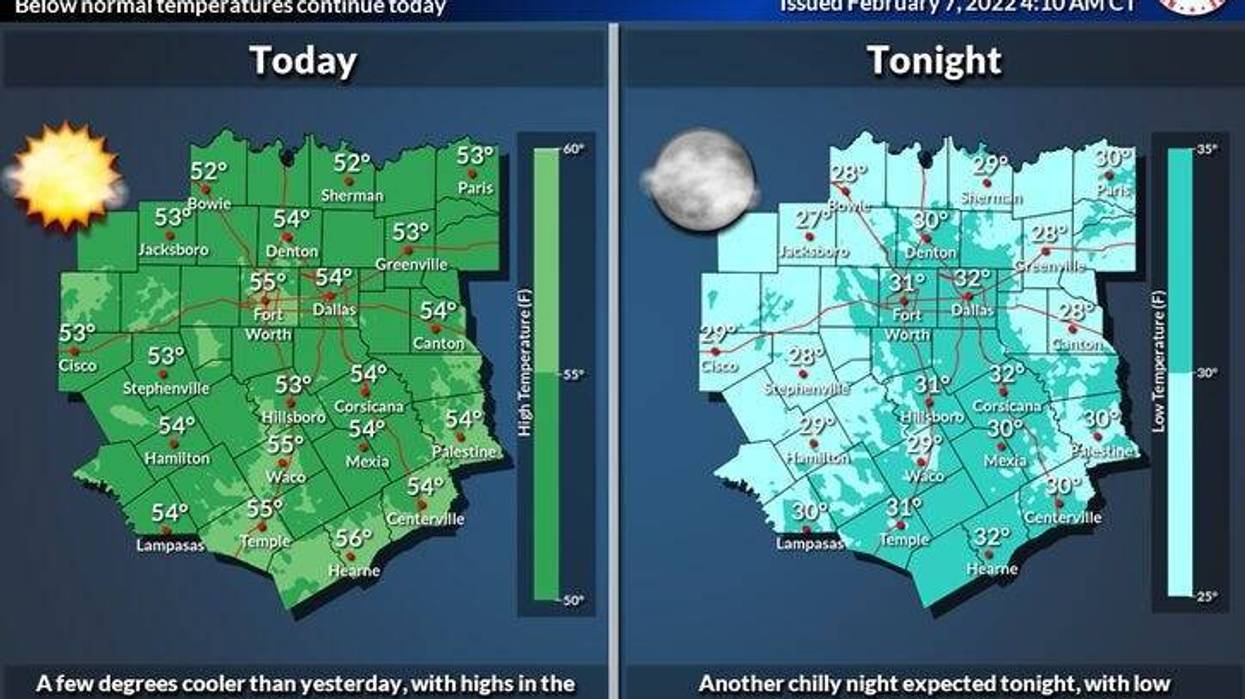
It's a chilly start this morning with temperatures near freezing. Ample sunshine today with highs in the mid fifties.
A warming trend is on the way Tuesday through Friday. Morning lows will be in the thirties to low forties, afternoon highs will be in the mid sixties Tuesday through Thursday, warming into the low seventies by Friday!
Our next decent front arrives sometime the 1st half of Saturday. It'll turn windy and colder during the day, as temperatures drop to below freezing by Sunday morning. Sunny, windy and chilly temperatures will prevail on Sunday, with highs struggling to hit 50゚. Unfortunately, no rain is in the forecast with our stronger front this weekend.
*Yest Rain: 0.00"; *Yest High: 56; Low: 27
*Today's Averages: High: 59; Low: 38
*Record high: 88 (1932); Record low: 7 (1933)
*February rain: 1.39"; February surplus: +0.92"
*2022 Rain: 1.47"; 2022 deficit: 1.53"
*Sunrise: 7:18am; Sunset: 6:07pm
Today: Sunny and cool. High: Mid 50s. NNW 10-20. Wind: North 10-15, G20 mph.
Tonight: Clear and cold. Low: Low to mid 30s. Wind: Lt. Var.
Tomorrow: Sunny and warmer. High: Mid 60s. Wind: SSW 10-20 mph.
Wednesday and Thursday: Sunny and pleasant. High: Mid 60s.
Friday: High clouds and a bit warmer. High: Low 70s.
Saturday: Increasing clouds. Strong cold front arrives. High: Near 60.
Sunday: Sunny, windy and colder. High: Upper 40s.

LISTEN on the Audacy App
Sign Up and Follow NewsRadio 1080 KRLD


