A warming trend is on the way, scattered strong storms late Saturday, a decent Sunday, increasing clouds for the eclipse on Monday, and increasing rain chances late Monday through early Thursday of next week. A weather pattern is shaping up late Monday - Thursday, with some severe weather possible late Monday through Wednesday evening.
It's a dewy morning as temperatures have fallen into the 40s across much of the area. The skies are clear and the wind is virtually calm. It will be sunny and beautiful today with highs ranging from 75° to 82°. The coolest weather will be east of the Dallas/Fort Worth area.
Clear and not as cool tonight with morning lows Friday in the low to mid-50s. A south wind returns tomorrow with highs back in the low to mid-80s.
 National Weather Service - Fort Worth
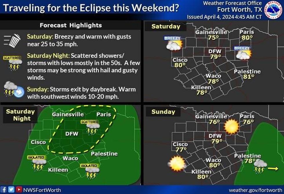
Hold on to your hats this weekend it'll be very windy, especially on Saturday. There is a small threat for some strong storms Saturday evening as a fast-moving system cruises across the area. Afternoon highs on Saturday will be near 80°. Brief clearing on Sunday, Breezy and warm again with highs near 80 degrees.
 National Weather Service - Fort Worth
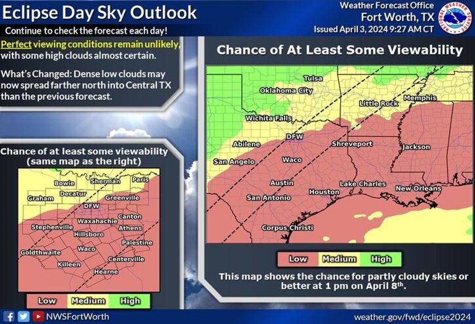
High clouds will rapidly increase Monday morning through the afternoon for the eclipse. It's still too early to tell how thick these clouds will be. We're still 4 days out. Stay tuned for an updated eclipse forecast. The eclipse in Dallas starts at 1:40 47 and ends at 1:44:38. Totality will be almost 4 minutes long. Longer east and SE, lower west and NW.
See the National Weather Service Interactive Eclipse Map.
 National Weather Service - Fort Worth
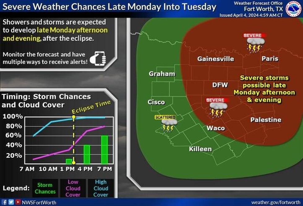
Showers and thunderstorms will sneak in from the south by Monday evening. A few storms could become severe. Our active weather pattern will continue Tuesday through Thursday with numerous showers and storms. Still a severe weather threat on Tuesday, but less of a threat on Wednesday due to the cooler temperatures. Highs will be in the 70s on Monday and Tuesday, and 60s on Wednesday. Flooding may also be a concern by Wednesday into early Thursday. Stay tuned.
We will continue to update the cloud cover forecast for Monday as we get closer and closer. Still 4 days out.
*Yest Rain: 0.00"; Yest High: 74; Low: 50
*Today's Averages: High: 74; Low: 52
*Record high: 94 (1940); Record low: 31 (1920)
*March Rain: 0.50"; Surplus: 0.20"
*2024 Rain: 11.30"; Surplus: 2.41"
*Sunrise: 7:11am; Sunset: 7:51pm
LISTEN on the Audacy App
Tell your Smart Speaker to "PLAY 1080 KRLD"
Sign Up to receive our KRLD Insider Newsletter for more news
Follow us on Facebook | Twitter | Instagram | YouTube