
UPDATE 2:00 P.M.: A few scattered showers and storms will form over the next few hours, as the cold front moves into the area. Some shower activity will continue behind the front through this evening, mainly along and north of Interstate 20. Temperatures will quickly drop into the 40s this evening. Wind chills will be in the 30s after 9:00 p.m..
We saw record rainfall yesterday at DFW airport where we measured 2.67 inches of rain, and we have more rain on the way for the first part of your Friday. After that, a shock to the body is on the way as sharply colder air arrives later this afternoon. It's still Winter after all.
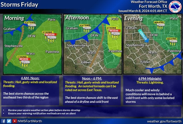
Another big batch of showers and thunderstorms will work its way through the southeastern half of North Texas through noon. An additional one to two inches of rain is possible in some areas. Virtually no rain will fall northwest of a Sherman to Mineral Wells line this morning.
We're starting off with temperatures near 60° under a cloudy and rainy sky. The severity will be low with this area of showers and storms as it continues to slowly press off to the east by late morning. I can't rule out one or two warnings, especially east of Dallas as we work our way through this afternoon. Temperatures will warm into the low 70s, as a few breaks in the clouds are possible after the noon hour. However, don't let your guard down, a strong cold front now moving through the Panhandle will arrive here later this afternoon. Some showers and isolated storms will accompany the front, and then it will turn windy and sharply colder this evening.
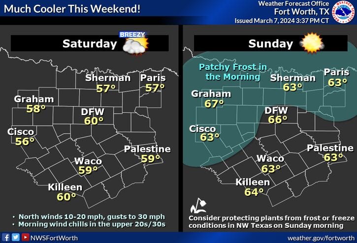
Temperatures will tumble down into the 35° to 40° range by early Saturday morning. Wind chills will be in the upper 20s in some areas. Morning clouds, afternoon sun tomorrow with highs only in the mid to upper 50s. A north wind will gust as high as 30 mph.
Cover your tender vegetation before you go to bed on Saturday because morning lows will dip into the upper 20s to mid 30s by Sunday morning. There will be some frost, especially north and west of DFW. Sunny with highs and the low to mid-60s by afternoon.
A rapid warm-up will occur next week. Plenty of sunshine Monday through Wednesday. Low 70s on Monday, near 80 on Tuesday, low to mid 80s on Wednesday.
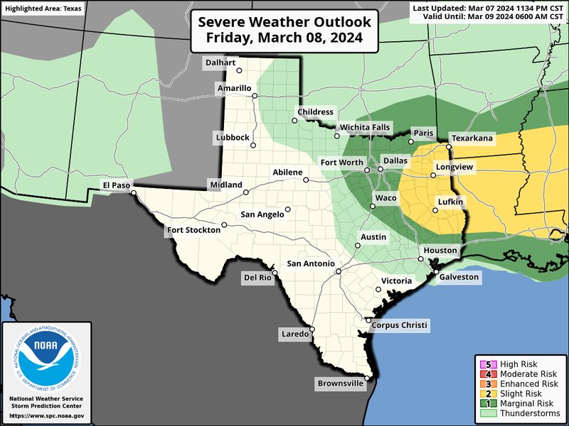
As of now, our next weather system arrives late Thursday, with a decent shot of showers and storms lingering into Friday. Some of these storms may become severe. I'll have more information as we get closer to this possible event.
*Yest Rain: 2.67" (Record); Yest High: 68; Low: 58
*Today’s Averages: High: 66; Low: 46
*Record high: 94 (1911); Record low: 22 (1996)
*March Rain: 2.68"; Surplus: 1.90"
*2024 Rain: 7.82"; Deficit: 1.75"
*Sunrise: 6:47am; Sunset: 6:31pm
LISTEN on the Audacy App
Tell your Smart Speaker to "PLAY 1080 KRLD"
Sign Up to receive our KRLD Insider Newsletter for more news
Follow us on Facebook | Twitter | Instagram | YouTube