


We're waking up the temperatures and the forties and fifties this morning with a light south wind under a clear sky. Another perfect day today with highs reaching the upper 70s. Wind will be light from the south.
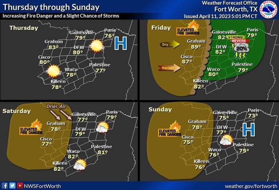
Not as cool tonight with morning lows in the mid to upper 50s. Thursday, a lot of areas will touch the 80 degree mark with plenty of sunshine.
There'll be more clouds around on Friday with a slight chance for an early evening shower or storm along the dryline. COverage will only be 20%. I think the "CAP" will hold strong. Afternoon highs will top out in the low eighties. A south wind will gust to 30 mph.
 National Weather Service - Fort Worth
Our next cold front arrives as you're pouring that 1st cup on Saturday morning. The wind will shift to the NW and gust to 25 mph. Plenty of sunshine will dominate your day with highs in the mid 70s.
Upper forties to low 50s will greet you Sunday morning as sunshine returns. Afternoon highs once again will be in the mid seventies. We warm back into the low eighties on Monday and Tuesday.
*Yest Rain: 0.00"; Yest High: 77 Low: 53
*Today's Averages: High: 76; Low: 54
*Record high: 95 (1972); Record low: 31 (1950, 1957)
*April Rain: 0.60"; Deficit: 0.47"
*2023 Rain: 8.71"; Deficit: 0.85"
*Sunrise: 7:02am; Sunset: 7:56pm
Today: Mostly sunny and beautiful! High: Upper 70s. Wind: ESE 5-10 mph.
Tonight: Partly cloudy and mild. Low: Mid to upper 50s. Wind: ESE 5-10 mph.
Thursday: Mostly sunny and nice again. High: Near 80. Wind: ESE 5-10.
Friday: Morning clouds, some afternoon sunshine. A very slight chance of a late day shower or storm. High: Low 80s.
Saturday: Morning cold front. Sunny, windy and cooler. Lower humidity. High: Mid 70s.
Sunday: Sunny and perfect. Low humidity. High: Mid 70s.
Monday and Tuesday: Mostly sunny, windy and warmer. High: Low 80s.

LISTEN on the Audacy App
Tell your Smart Speaker to "PLAY 1080 KRLD"
Sign Up and Follow NewsRadio 1080 KRLD


