


UPDATE 1:30 pm - Storms are already breaking out to the west of DFW. These will be sliding NNE at a rapid clip. Gusty winds and small hail will be the threats this afternoon across North Texas.
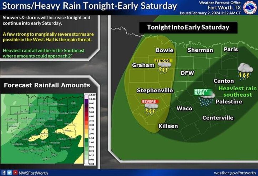
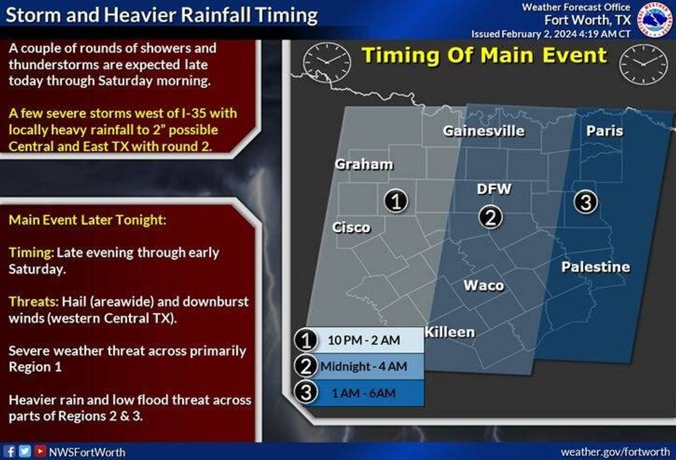
Another wave of thunder, heavy rain and some damaging wind will appear overnight between midnight and 6:00 a.m. Severity will be low, but not out of the question.
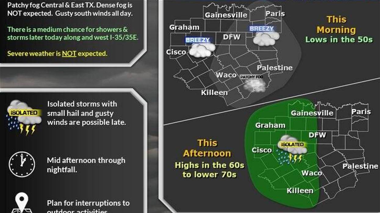
We've got a significant weather change unfolding later today through the overnight hours. A few storms could be strong. Please do not be overly concerned by a severe weather outbreak this evening. It's not going to happen. It may be a different story out west of Highway 281 where quarter to half-dollar size hail may fall from the sky.
We've been enjoying some nice weather this week. Yesterday we topped out at 73°. This is the fourth 70-plus-degree day we've experienced. And some of you might kiss that 70° mark this afternoon, depending on if these clouds mix out for us.
 National Weather Service - Fort Worth
A very strong storm system is heading in from the west. It will spark the first round of showers and storms out west of Highway 281 this afternoon; these will press toward the East before dinner time. Small hail and gusty wind will be the threats as they come through the area into the early evening hours.
 National Weather Service - Fort Worth
The main wave of showers and storms will arrive after midnight tonight through daybreak tomorrow. It'll be a noisy night while you're sleeping with bouts of heavy rain, small hail, and 40 mph wind gusts in areas. Before all is said and done, just about everybody should see at least an inch of rain with isolated higher totals possible in areas, especially east of Dallas and McKinney. Morning lows will dip into the mid-50s.
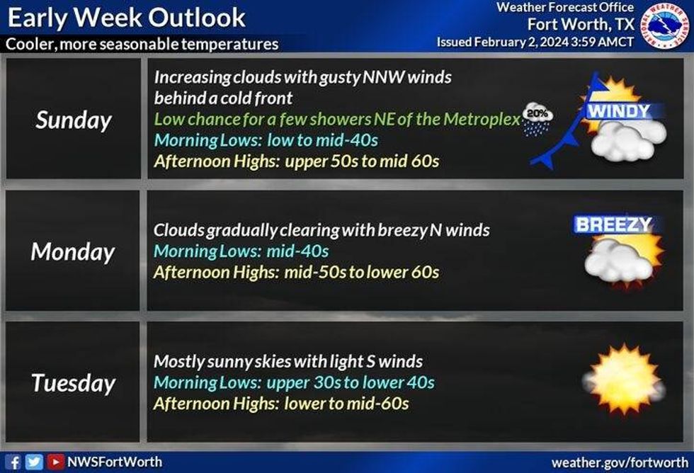
Sunshine will return by tomorrow afternoon as afternoon highs top out in the mid 60s.
Looks like the clouds will roll back in through most of tomorrow as afternoon highs struggle to hit 60°. Wind will pick up from the north with gusts to 30 mph. There's a very slight chance of a few sprinkles, but most will stay dry.
 National Weather Service - Fort Worth
This past week was very warm, next week will be beautiful as well, but temperatures will be in the 60s. 60° on Monday, 62° on Tuesday, 65° on Wednesday, and 72° on Thursday. Morning lows will be in the upper 30s to mid-40s with very dry air in place.
*Yest Rain: 0.00"; Yest High: 73 Low: 47
*Today's Averages: High: 59; Low: 38
*Record high: 83 (1995); Record low: 7 (1985)
*February Rain: 0.00"; Deficit: 0.08"
*2024 Rain: 3.20"; Surplus: 0.50"
*Sunrise: 7:23am; Sunset: 6:01pm
LISTEN on the Audacy App
Tell your Smart Speaker to "PLAY 1080 KRLD"
Sign Up to receive our KRLD Insider Newsletter for more news
Follow us on Facebook | Twitter | Instagram | YouTube


