A total solar eclipse, a severe weather risk for the next 60 hours, and better weather as we head into the weekend.
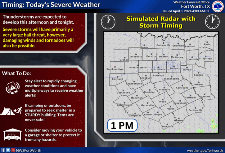
We have a severe weather threat that is moving in from the South late afternoon through the evening hours. All modes of severe weather are possible. The highest threat for severe weather will be along and east of I-35W and especially east of Dallas. Afternoon highs will reach the low 80s.
 National Weather Service - Fort Worth
A second wave of severe weather will be breaking out to our northwest late this afternoon and will be heading our direction after midnight. Again, all modes of severe weather are possible before sunrise. Large hail, damaging wind, and isolated tornadoes. Morning lows will dip into the mid 60s as a cold front slides through the area.
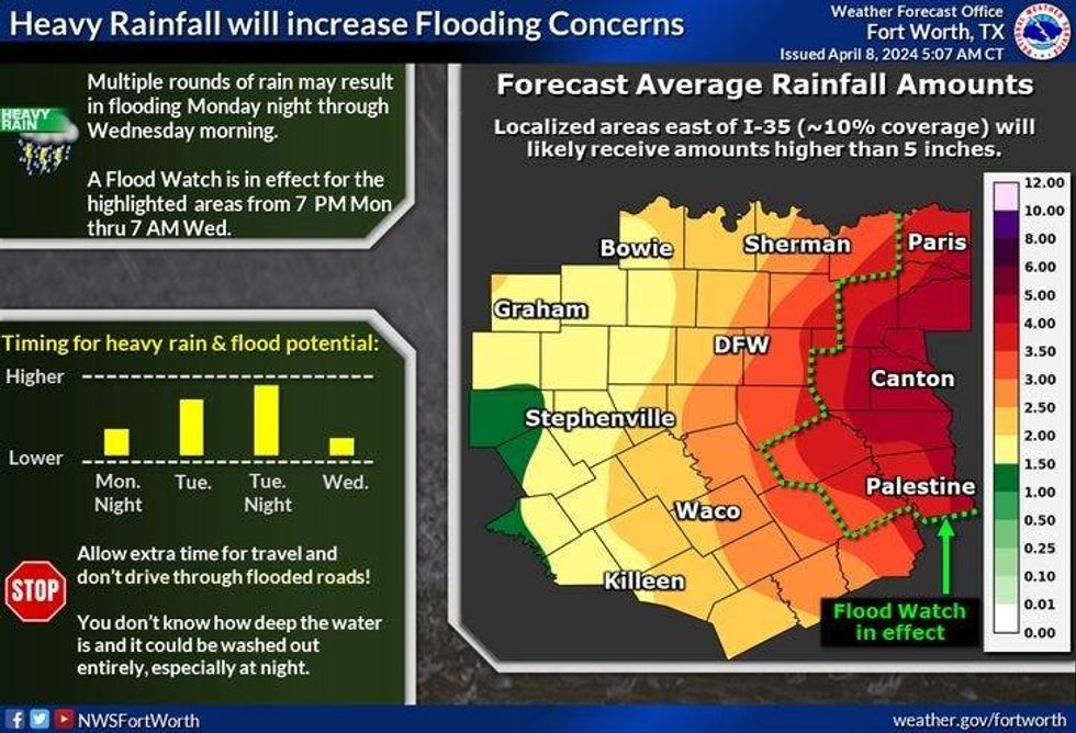
Another area of very heavy rain, non-severe for us, will move across the area tomorrow mid-morning through mid to late afternoon. Up to two inches of rain are possible in areas. The severe weather threat is low for us, greater threat south of I-20. It will be cooler and windy with afternoon highs in the mid 60s.
 National Weather Service - Fort Worth
One last wave of scattered showers and non severe storms will arrive during the day Wednesday as a whole system swings through. There may be some pea-sized hail and a stronger storm but that's it. Afternoon highs will once again reach the mid 60s.
Thursday through Sunday looks down-right gorgeous. Low 70s for Thursday, near 80 on Friday, mid to upper 80s this weekend with a ton of wind.
*Yest Rain: 0.02"; Yest High: 80 Low: 59
*Today's Averages: High: 75; Low: 53
*Record high: 97 (2020): Record low: 32 (1938)
*April Rain: 0.52"; Deficit: 0.17"
*2024 Rain: 11.32"; Surplus: 2.04"
*Sunrise: 7:05am; Sunset: 7.54pm
LISTEN on the Audacy App
Tell your Smart Speaker to "PLAY 1080 KRLD"
Sign Up to receive our KRLD Insider Newsletter for more news
Follow us on Facebook | Twitter | Instagram | YouTube