Monday morning began with a bit of fog, but temperatures weren't too cold. However, a windy Tuesday is in store, before warming temperatures toward the end of the week. There won't be a lot of measurable rain in the forecast over the next week.
A Dense Fog Advisory was in place until 10 a.m. Monday for areas along and north of Highway 380. Areas of sunshine will return as afternoon highs warming into the upper 60s.
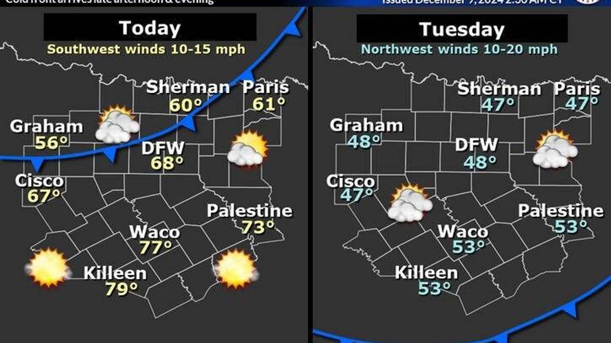
Unfortunately, the mild weather doesn't stick around long. A strong cold front will arrive Monday evening. It looks to bring no measurable rain to the area. It'll turn windy and colder overnight with morning lows dropping into the low to mid 40s. Tuesday will start cloudy, with peaks of sunshine by late afternoon. A north wind will gust to 30 mph as temperatures struggle to hit 50 degrees.
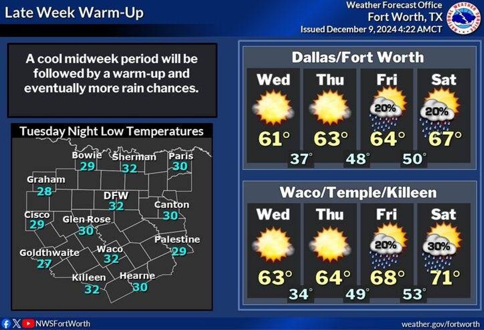
After a morning freeze on Wednesday, temperatures will warm to near seasonal levels. Highs will reach the upper 50s. Another morning freeze is expected on Thursday with highs warming into the low 60s with plenty of sunshine.
Friday will be delightful with plenty of sunshine, as high as warm into the Low 70s. By Friday evening, the next cold front arrives bringing a slight chance of showers, especially east of the Dallas-Fort Worth area.
Saturday will be sunny windy and cooler with highs near 60 degrees. More of the same on Sunday with a slight chance of rain returning late Sunday night.
 North Texas forecastNational Weather Service
7-Day Headlines
* DFW Airport reached 58 on Sunday. Weekend rain: 0.83".
* Areas of fog Monday morning, then a beautiful day.
* Late-day cold front comes through dry.
* A windy and cold Tuesday. Cloud bank most of the day.
* Morning freeze on Wednesday and Thursday.
* Warming Thursday and Friday.
* Weekend cold front.
_____________________________________________________
*Sunday Rain: 0.08"; Sunday High: 58; Low: 45
*Monday's Averages: High: 59; Low: 40
*Record high: 81 (2021); Record low: 15 (2005)
________________________________________________________
*December Rain: 0.98"; Surplus: 0.28"
*2024 Rain: 36.73"; Surplus: 1.86"
*Sunrise: 7:20am; Sunset: 5:22pm
________________________________________________________
Monday: **Dense Fog Advisory until 10 a.m.** north of DFW... Morning clouds/fog, afternoon sunshine. High: Mid to upper 60s. Wind: South 5 mph.
Monday night: Increasing clouds, windy and colder. Dry, but windy cold front arrives. Low: 40-48. Wind: North 10-20 mph.
Tuesday: Mostly to partly cloudy, windy, and chilly. High: Upper 40s. North 15-25, G30 mph.
Wednesday: Morning freeze, then sunny, breezy and cool. High: Mid to upper 50s.
Thursday: Partly cloudy and cool. High: Low 60s.
Friday: Mostly sunny, then increasing clouds late. A slight chance of showers east of DFW along our next cold front. High: Low 70s.
Saturday: Morning showers east, the decreasing clouds, windy and cooler. High: Near 60.
Sunday: Passing high clouds and cool. High: Near 60.
LISTEN on the Audacy App
Tell your Smart Speaker to "PLAY 1080 KRLD"
Sign Up to receive our KRLD Insider Newsletter for more news
Follow us on Facebook | Twitter | Instagram | YouTube