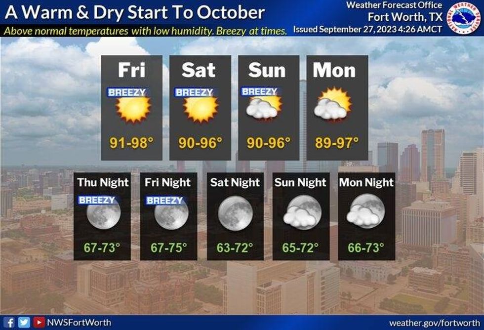
Unseasonably warm temperatures and the lack of rainfall will continue to be our weather story through the rest of the week, into the weekend, and for most of next week as an upper level ridge of high pressure continues to dominate our area.
Yesterday we hit 96° and I'm forecasting the middle 90s again today, tomorrow, Friday, through the weekend and into the middle of next week. Morning lows will be comfortable with readings of the upper 60s to low 70s. Light winds today and tomorrow will continue to cause poor air quality across North Texas.
Friday through the weekend, south winds will pick up so our air quality will improve somewhat.
 National Weather Service - Fort Worth
If you're heading to the opening weekend of the State Fair of Texas, make sure you stay hydrated, wear light-colored loose-fitted clothing, and don't forget the sunscreen and a hat.
*Yest Rain: 0.00"; Yest High: 96; Low: 72
*Today's Averages: High: 85; Low: 65
*Record high: 103 (1953): Record low: 40 (1942)
*September Rain: 0.83"; Deficit: 1.57"
*2023 Rain: 15.66"; Deficit: 11.29"
*Sunrise: 7:19am; Sunset: 7:18pm
Today: *Air Quality Alert* Mostly sunny and warm. High: Mid 90s. Wind: SE 5 mph.
Tonight: Clear and comfortable. Low: 65-72. Wind: SE 5-10 mph.
Thursday: Mostly sunny and warm. High: Mid 90s. Wind: SE 5-10 mph.
Friday - Sunday: Mostly sunny, breezy and warm. High: Mid 90s.
Monday and Tuesday: Mostly sunny, continued warm. High: Low to mid 90s.
LISTEN on the Audacy App
Tell your Smart Speaker to "PLAY 1080 KRLD"
Sign Up to receive our KRLD Insider Newsletter for more news
Follow us on Facebook | Twitter | Instagram | YouTube