


Here are your weather stories over the next seven days... Strong storms continue to exit North Texas, a cold front is sweeping through lowering our temperatures through Friday, a few showers return late Thursday into Friday, a decent Easter weekend ahead, and very warm and a rain-free and humid weather pattern shaping up for most of NEXT week.
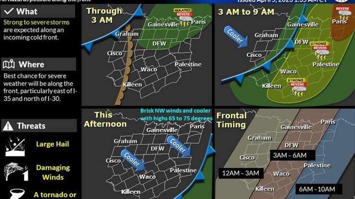
Again, strong thunderstorms continue to press east of the Dallas/Fort worth area. Now we get to enjoy a cold front that's ushering in cooler/drier air through the day today, knocking temperatures down into the sixties for highs through Friday! Heck yeah!
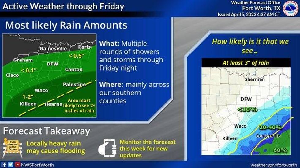
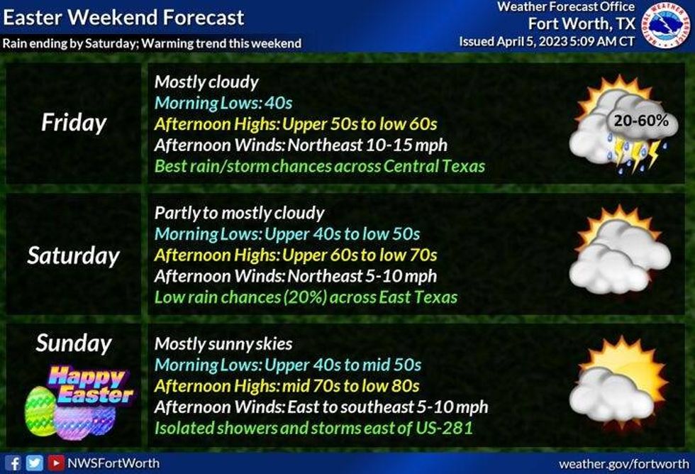
Cooler temperatures will continue to dominate our weather Thursday and Friday, with high temperatures struggling to get above 60゚! There's also rain back in the forecast late Thursday and Friday, as a slow moving disturbance crosses through south Texas. Due to the drier in place across north Texas, the rain will have a hard time creeping north, but areas along and south of US 380 will see some light to moderate rain on Friday.
Skies will slowly clear on Saturday as temperatures warm into the low seventies. Easter Sunday looks perfect! Partly cloudy with highs approaching eighty degrees!
As of now, most of next week looks very warm, windy and humid, with morning low clouds and afternoon sunshine. Afternoon highs will reach the low to mid eighties -- maybe even warmer than after Wednesday!
Glad the storms weren't severe this morning, enjoy the cooler temperatures and the weather when you can, it's the only weather you've got!
 National Weather Service - Fort Worth
7-Day Headlines:
* DFW reached 82 degrees yesterday.
* Severe Storm Watch south and east of DFW this morning.
* Cold front cools us off through Friday.
* A chilly rain late Thursday into Friday, heaviest south of I-20.
* A decent Easter weekend, with warming temperatures.
* Next week is quiet, windy and warm!
*Yest Rain: 0.00"; Yest High: 82 Low: *72 (Record high minimum)
*Today's Averages: High: 74; Low: 53
*Record high: 95 (2022); Record low: 32 (1920)
*April Rain: 0.60"; Surplus: 0.21"
*2023 Rain: 8.71"; Deficit:
*Sunrise: 711am; Sunset: 7:51pm
**Tornado Watch until noon Wednesday for Delta, Fannin, Hopkins Hunt, Lamar counties**
 National Weather Service - Fort Worth
Looking Ahead:
Today: Morning storms, afternoon sun. Windy and MUCH cooler. Lower humidity. High: 70s early, falling into the 60s late morning. Wind: NW 15-25, G30 mph.
Tonight: Clear and cool. Low: 43-50. Wind: North 10-15 mph.
Tomorrow: Increasing clouds and cool. Chance of showers by evening, mainly south of US 380. High: Low 60s. Wind: NE 10-20 mph.
Friday: Cloudy and cool. Scattered showers, heaviest well to the south of DFW. High: Upper 50s.
Saturday. Morning showers, then decreasing clouds and a tad warmer. High: Low 70s.
Easter Sunday: Mostly sunny and warmer. High: Near 80.
Monday and Tuesday: Partly cloudy, windy, warm and humid. High: Low to mid 80s.

LISTEN on the Audacy App
Tell your Smart Speaker to "PLAY 1080 KRLD"
Sign Up to receive our KRLD Insider Newsletter for more news


