We're waking up to cloud cover and temperatures in the low to mid 40s this morning. There's also some light precipitation rapidly moving in from the west. Most of this is not reaching the ground because the air is so dry at the surface. However, there will be some cool clouds around today. Afternoon highs will struggle to get out of the mid to upper 50s.
Some clearing will take place overnight tonight allowing temperatures to fall back into the upper 30s to low 40s. More clouds will rapidly move in tomorrow morning with a chance for a few showers and even an isolated chilly thunderstorm. More than half of you will stay dry though.
A south wind returns tomorrow and Thursday, warming temperatures back to above seasonal averages. Afternoon highs on Wednesday will reach near 70゚ with a lot of wind, Low to mid seventies on Thursday.
 National Weather Service - Fort Worth
By Thursday afternoon, widespread showers and strong thunderstorm activity will break out. There could be a few severe storms as well. I will continue to monitor and keep you posted through the week.
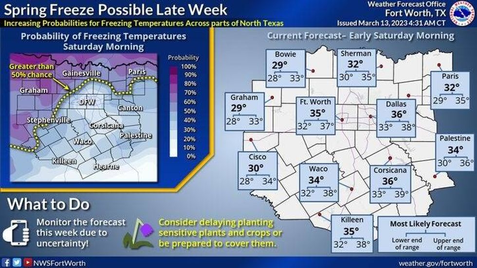
A strong cold front will blow through here before you wake up Friday morning. A very chilly Saint Patrick's day weekend is ahead. There may even be a light freeze in some areas on Saturday morning. Afternoon highs on Friday will be in the low fifties with a lot of wind. Mid fifties for Saturday, cooling into the upper forties for highs with increasing clouds.
 National Weather Service - Fort Worth
On Sunday, a strong storm system will approach by late evening, and slowly creeps across the area into early next week. Some data is suggesting some snow off to the west of us. This will all depend on the track and speed of the system as well as how cold the air will be. It could get pretty crazy across parts of the state into early next week.
 National Weather Service - Fort Worth
*Yest Rain: 0.00"; Yest High: 66; Low: 54
*Today's Averages: High: 68; Low: 46
*Record high: 92 (1953); Record low: 23 (1932, 1950)
*March Rain: 1.35"; Surplus: 0.04"
*2023 Rain: 6.70"; Surplus: 0.10"
*Sunrise: 7:41am; Sunset: 7:34pm
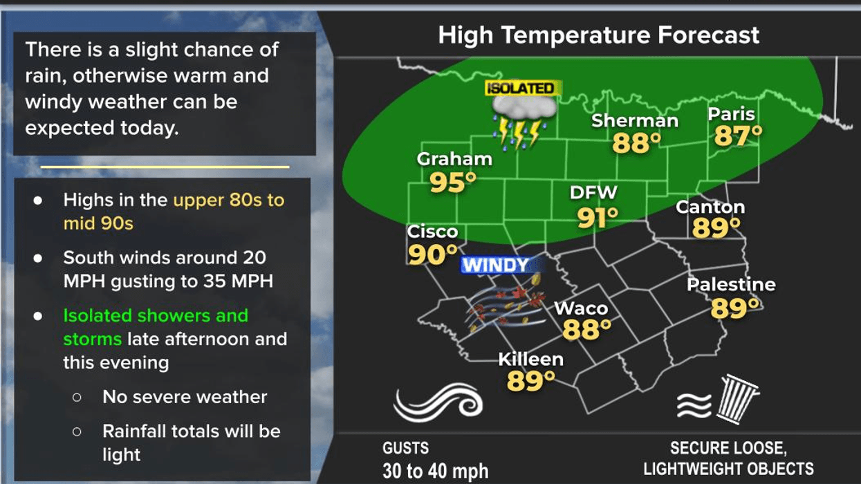
Today: Mostly cloudy and cool. A few sprinkles. High: Mid 60s. Wind: NW 5-15 mph.
Tonight: Partly cloudy and chilly. Low: 38-44. Wind: NE 10 mph.
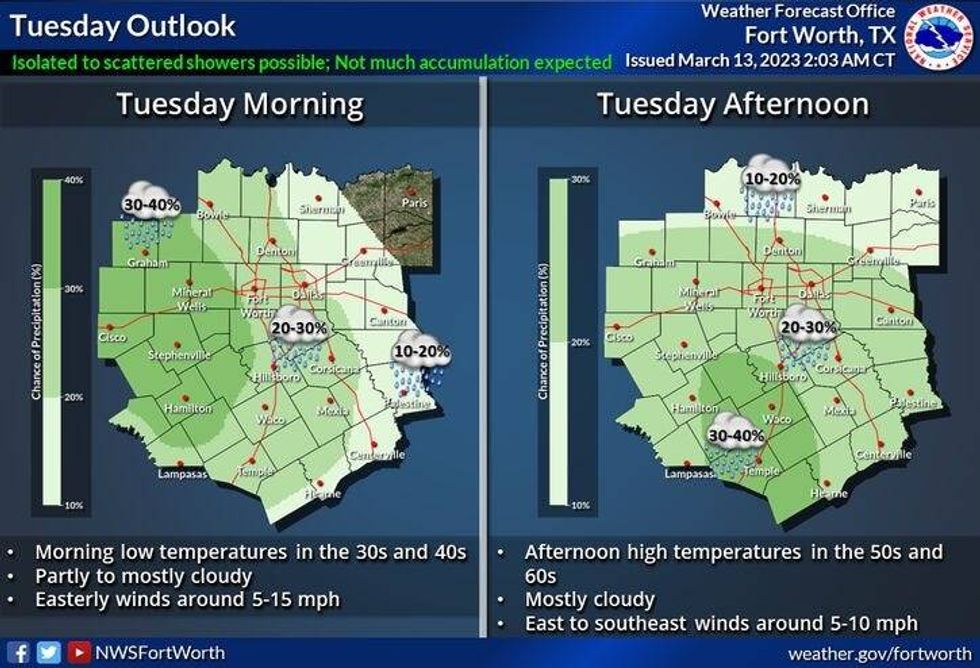
Tomorrow: Mostly cloudy, continued cool. A few showers and isolated storms. Wind: East 5-10 mph.
Wednesday: Morning clouds, peaks of afternoon sunshine. Windy and warmer. High: Near 70.
Thursday: Mostly cloudy, windy and mild. Scattered showers and storms. Some severe. Stay tuned! High: Mid 70s.
St. Patrick's Day: Mostly sunny, windy and MUCH cooler. High: Low 50s.
Saturday: Morning freeze away from DFW. Partly cloudy and cool. High: Mid 50s.
Sunday: Increasing clouds, continued chilly. Chance of a chilly rain late. High: Upper 40s.

LISTEN on the Audacy App
Tell your Smart Speaker to "PLAY 1080 KRLD"
Sign Up to receive our KRLD Insider Newsletter for more news