Well, they say it takes a flood to break a drought… and that’s exactly what may be happening across North Texas!
Good morning, everyone, and welcome to Tuesday!
We’re starting the day under mostly cloudy skies with temperatures falling into the 70s. It’s a comfortable morning, but temperatures will climb quickly today with highs in the lower to middle 90s. The heat index will approach 100 degrees, and no rain is expected today.
But things change dramatically beginning tomorrow.
A FLOOD WATCH goes into effect at 4 PM Wednesday and continues through at least 1 PM Thursday.
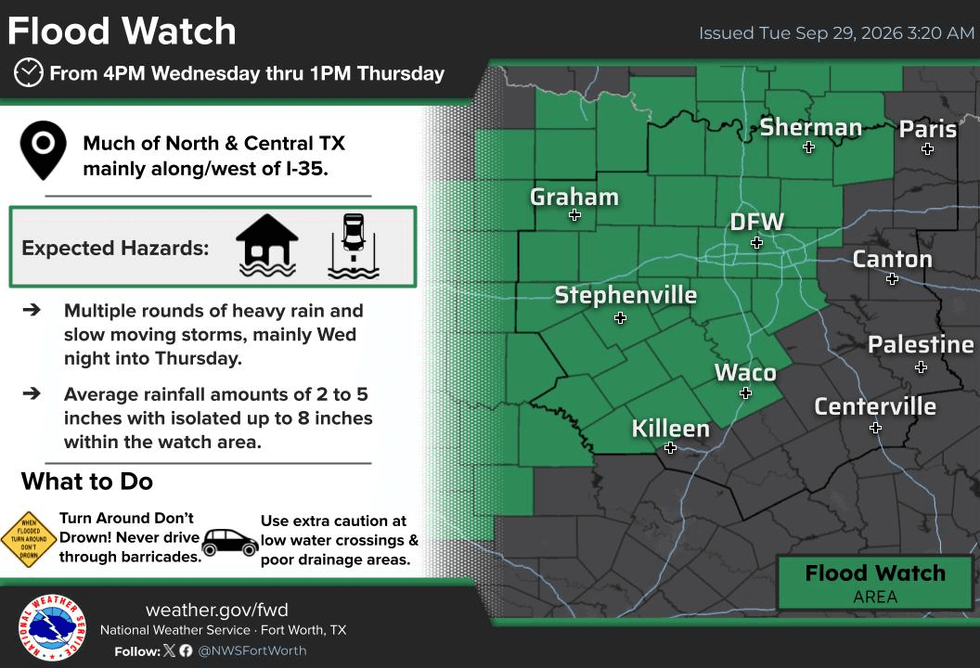
Waves of heavy rain and some strong storms will move in from the west late Wednesday evening and continue through at least Thursday morning.
The first wave could produce 2–4 inches of rain, with a few isolated severe storms possible early Thursday morning. However, the biggest concern is flooding.
We should get a break in the rain Thursday evening, but don’t put the umbrella away just yet.
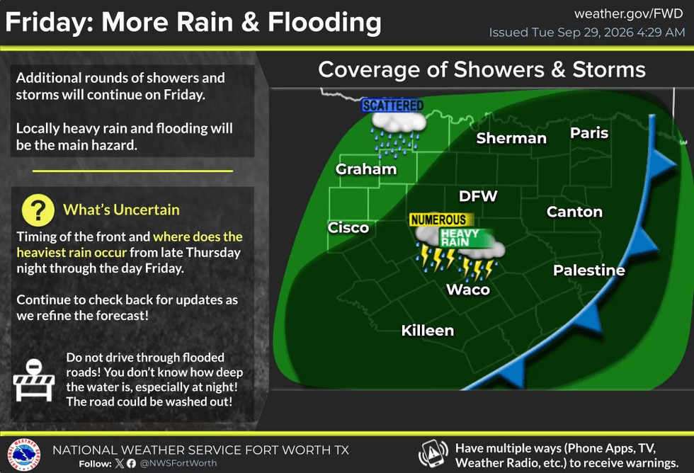
Another round of heavy rain is expected to move in from the south on Friday as an upper-level disturbance affects North Texas into the weekend.
Rain chances:
Wednesday night–Thursday: 100%
Friday: 80%
Saturday: 50%
Sunday: 40%
Right now, rainfall totals from Wednesday evening through Sunday are averaging around 3–5 inches across much of the area, with some locations potentially picking up 6–8 inches or MORE.
Please take the flooding threat seriously. If you encounter water covering a roadway and you don’t know how deep it is, TURN AROUND, DON’T DROWN!
I’ll be watching the radar and forecast trends closely and will keep you posted as we work our way through the next several days.
And remember… enjoy the weather when you can. It’s the only weather you’ve got!
7-Day Headlines:
- DFW Airport hit 93 degrees on Monday
- Two more hot days ahead (90s)
- Flood Watch starts: 4pm Wednesday; Ends: 1pm Thursday
- Heavy rain threat late Wednesday into Thursday
- Rain chances continue Friday into the weekend
- Average rainfall totals: 3”-5”...isolated 6”-8”
- Cooler temperatures
- Download our AUDACY app! Listen to KRLD LIVE at home or at work
Almanac:
- Yest Rain: 0.00”; Yest High: 93; Low: 78
- Today’s Averages: High: 85; Low: 64
- Record high: 101 (2011); Record low 46 (1967)
- September rain: 0.01”; Deficit: <2.55”>
- 2026 Rain: 22.62”; Snow: 2.4”; Deficit: <4.49”>
- Sunrise: 7:22am; Sunset: 7:14pm
Forecast:
Tuesday: Partly cloudy, breezy, warm and humid. High: Low to mid 90s. Wind: South 15-25 mph.
Tuesday night: Partly cloudy, breezy and mild. Low: Mid to upper 70s.
Wednesday: Increasing clouds, breezy and warm. **Flood Watch begins at 4pm**. Heavy rain moves in from the west by mid evening and continues overnight. Isolated severe (west of DFW). High: Low 90s.
Thursday: **Flood Watch until 1pm** Cloudy, breezy and cooler. Numerous showers and isolated storms. Heavy rain and flooding threat. High: Upper 70s.
Friday: Cloudy and mild. Decent chance of showers and isolated storms. Flooding possible. High: Upper 70s.
Saturday: Mostly cloudy and mild. Scattered showers. High: Upper 70s.
Sunday: Partly cloudy, continued mild. A few leftover showers. High: Near 80.
Monday: Partly cloudy and nice! Drier air FINALLY arrives. High: Near 80.
LISTEN on the Audacy App
Tell your Smart Speaker to "PLAY 1080 KRLD"
Sign Up to receive our KRLD Insider Newsletter for more news
Follow us on Facebook | Twitter | Instagram | YouTube