I hope you protected your plants overnight, because temps have fallen into the 30s and 40s again. This may be the last time you'll have to bring them indoors until next November.
In case you're interested, the latest freeze ever recorded in DFW was on April 13th. Also,
March ended, 4゚ above average. A far cry from what February was… right, precip was 0.46" below avg.
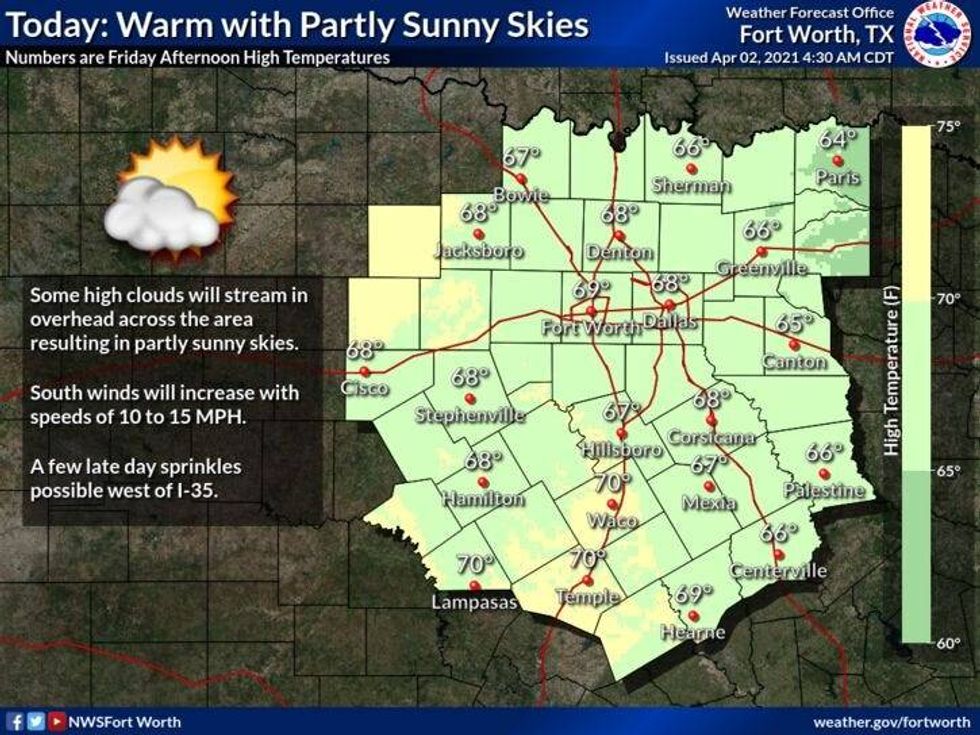
I think you'll like this forecast! Temps will once again climb to around 70゚ today, just like yesterday. The wind will pick up from the south today and continue through at least the middle of next week. If you're new to the area, a south wind is a warming wind. It also brings moisture in from the Gulf of Mexico. This moisture will be slow to return at the surface, but there may be enough around late Saturday into early Sunday to see a few light showers on radar across the DFW. However, most of this will not reach the ground. A different story south of a Comanche, to Hillsboro, to Corsicana line, where less that than 0.10"may fall.
 NWS
NWS
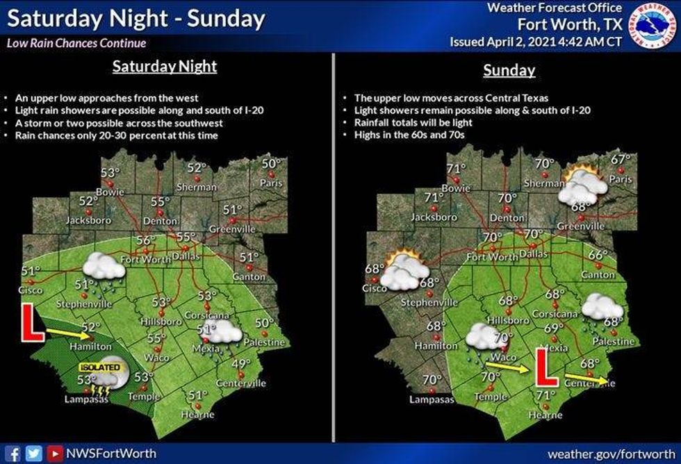
With the clouds around tomorrow and the 1st half of Easter, this will hold temps down a little bit. Readings made not get out of the lower 60s on Saturday and possibly reach 70゚ on Easter Sunday. Either way, I wouldn't cancel your outdoor plans for Easter unless you live about 40 miles South of DFW. You may want a monitor the radar trends during this time frame.
 NWS
NWS
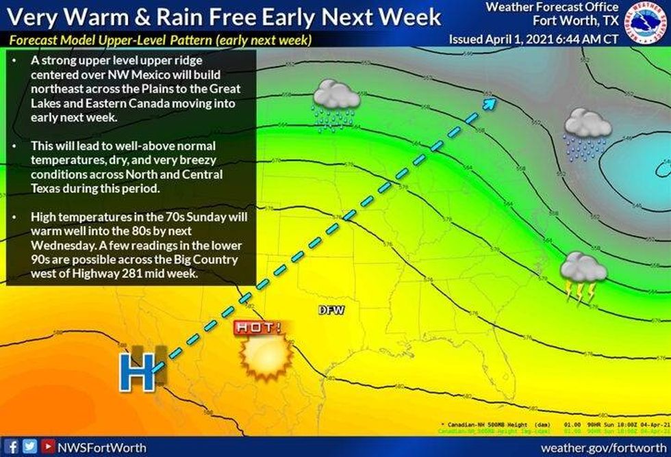
By next week, an upper level ridge of high pressure will build across the Lone Star State. This will cause temps to warm to 80゚ and above Tuesday through Thursday. Some data is hinting that temps may get close to 90゚ on Wednesday. We'll see!
 NWS
NWS
So overall, little rain and warming temps will be our weather story over the next 7 days. There are signs of a cold front arriving Thursday bringing a few storms & cooler temps by the end of the week.
Enjoy your holiday weekend and the weather, it's the only weather you've got!
7-Day Headlines:
* Another chilly start this morning.
* South wind returns today and sticks around for almost a week!
* More clouds than sun Easter weekend. Spotty showers (South)
* Temperatures in the 50s for morning Easter Egg Hunts!
* Warming up BIG TIME next week.
__________________________________________________________
*Yest Rain: 0.00"; *Yest High: 70; Low: 42
*Today's Averages: High: 73; Low: 51
*Record high: 94 (1918); Record low: 32 (1936)
___________________________________________________________
*April rain: 0.00"; April deficit: ">
*2021 Rain: 6.10"; 2021 deficit: ">
*Sunrise: 7:14am; Sunset: 7:49pm
___________________________________________________________
Today: Sunny, continued pleasant. South wind returns. High: Low 70s. Wind: SSE 10-20 mph.
Tonight: Increasing high clouds. Not as cool. Low: 48-52. Wind: SE 10-20 mph.
Tomorrow: Clouds thicken up, but no rain expected in DFW. Slight chance south of a Corsicana to Hillsboro line by evening. Breezy. High: Low to mid 60s. Wind: SE 15-25 mph.
Easter Sunday: Morning clouds, afternoon sunshine. High: Low 70s.
Monday: Partly cloudy, breezy and warmer. High: Mid to upper 70s.
Tuesday: Morning clouds, afternoon sun. Windy and warm. High: Near 80.
Wednesday: Morning clouds, afternoon sun. Windy and warm. Slight chance for late day storms. High: Mid to upper 80s.
Thursday: Morning clouds, afternoon sun. Windy and warm. Slight chance for late day storms. High: Mid to upper 80s.