


There are no changes or at least any big changes in our forecast for the next 6 days, with plenty of sunshine and temperatures well above average for this time of the year.
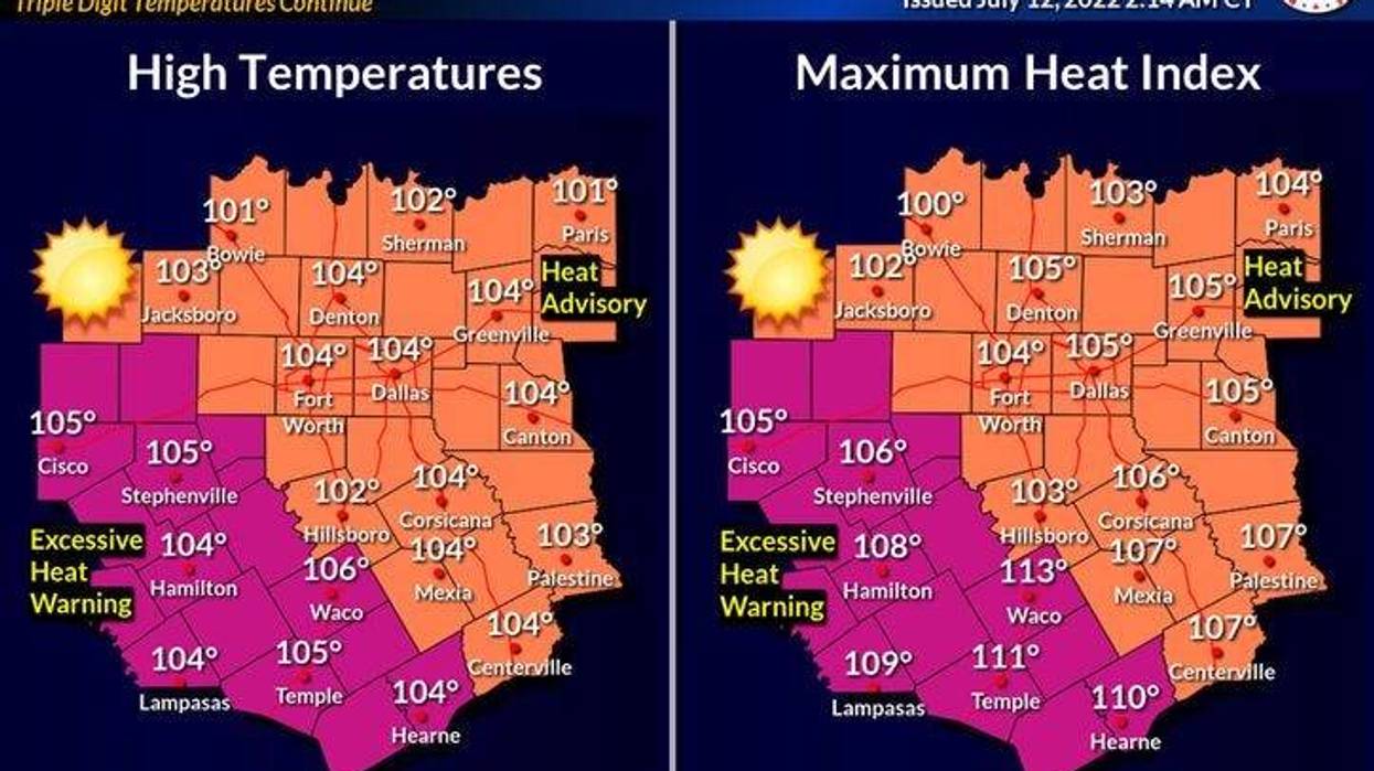
Heat Advisories and Air Quality alerts through tomorrow! Yesterday we hit 102°, that's the 18th triple-digit temperature we felt this year. Abilene now has had 45 triple digit days, San Angelo 44, Austin 31, and Waco 27.
 National Weather Service - Fort Worth
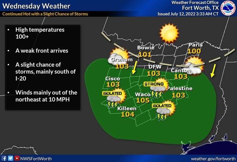
Sunny and hot today with a high around 104. Wind will be very light from the east. Tonight, we drop into the upper 70s to low 80s. Tomorrow, partly cloudy and hot with a high of 105. There is a very slight chance for a late afternoon and evening storm tomorrow, especially south of Interstate 30.
 National Weather Service - Fort Worth
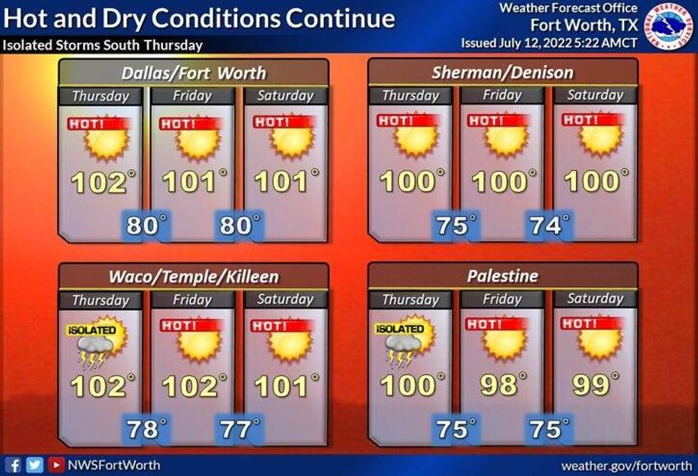
More of the same Thursday through Saturday with afternoon highs between 102 and 104. By Sunday, another weak front will slowly approach the area. Daytime highs will be around 101.
Some of the extended model data has a little bit better chance for showers and storms on Monday with highs only in the 90s? Time will tell.
*Yest Rain: 0.00"; *Yest High: 102; Low: 81
*Today's Averages: High: 95; Low: 76
*Record high: 110 (1980); Record low: 64 (1899)
* July rain: 0.00"; July deficit: 1.00"
*2022 rain: 12.41"; 2022 deficit: 8.88"
*Sunrise: 6:29am; Sunset: 8:38pm
Today: *Heat Advisory and Air Quality Alert* Sunny and hot. High: 104. Heat index 106. Wind: East 5-10 mph.
Tonight: Clear, warm and muggy. Low: Low 78-82. Wind: East 5-10 mph.
Tomorrow: *Heat Advisory* Sunny and hot. Slight chance of showers and storms between 5pm and 9pm. High: 105. Heat index 107. Wind: ENE 5-10 mph.
Thursday - Saturday: Mostly sunny and hot. High: 102-104.
Sunday: Partly cloudy, continued hot. Slight chance of showers and storms. High: 101.
Monday: Mostly cloudy and cooler. Scattered showers and storms? High: Low to mid 90s?
LISTEN on the Audacy App
Sign Up and Follow NewsRadio 1080 KRLD


