
Well, it’s back to work and school we go, ladies and gentlemen. I hope you had a great holiday weekend and survived the heat.
That heat wave will continue here through pretty much all of this week and into next weekend, with a slight break in the heat tomorrow and especially Thursday as a weak cold front slides into the area. That front may also increase our chances for scattered showers and thunderstorms during that 24-hour period.
Good morning and welcome to Tuesday! Temperatures are in the upper 70s to low 80s at this hour under mostly clear skies. We’ll keep those clear skies around today, with a few fair-weather cumulus clouds building during the peak heating of the afternoon.
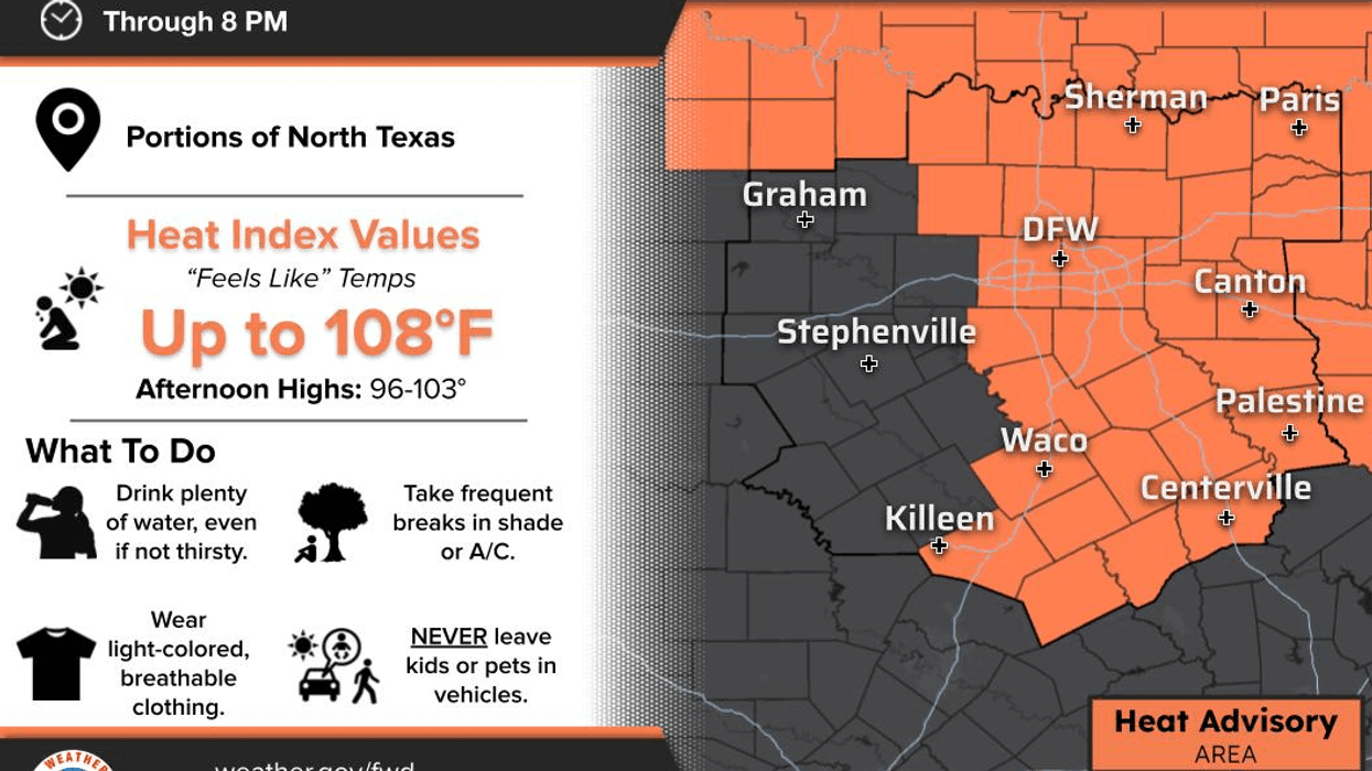
Temperatures are in the upper 70s and low 80s right now, and we’ll reach around 101° this afternoon. We’ve had approximately 42 or 43 triple-digit days so far this year, and we’re now at 54 consecutive days without measurable rainfall. Unfortunately, that streak will continue today.
There will be a few isolated showers and thunderstorms trying to sneak into our southern and eastern counties later today.
Tomorrow, I’ll be watching a weak cold front try to slide south of the Red River during the afternoon and early evening hours. We could see a few scattered showers and thunderstorms across our northern counties, with additional activity coming in from the southeast.
We may even see a couple of showers or storms around the Dallas-Fort Worth area on Thursday as temperatures cool into the upper 90s. However, heat advisories remain in effect at least today and tomorrow.
Otherwise, Friday through the weekend looks dry as high pressure builds back across the area. It will be breezy at times, and grass fire danger will remain high, with daytime highs around 100° and morning lows near 80°.
Fall officially begins in just two weeks, and the State Fair of Texas starts two weeks from Friday.
Eventually, we will cool off. We have to, right? It is September!
The second half of September should be cooler than the first half, with better rain chances returning as we get deeper into the month. I can guarantee you one thing: eventually, this heat will break.
Have a great day today, and enjoy the weather whenever you can. It’s the only weather you’ve got!
7-Day Headlines:
- DFW Airport hit 100 degrees on Thursday
- 43 triples this summer
- 54 days with no measurable rain at DFW
- Slight afternoon storms chances today - Friday
- Cold front flirts with us on Thursday
- Heat Advisories!
- Staying unseasonably hot through the weekend
- Download our AUDACY app! Listen to KRLD LIVE at home or at work
Almanac:
- Yest Rain: 0.00”; Yest High: 102; Low: 79
- Today’s Averages: High: 91; Low: 71
- Record high: 110 (2023); Record low 55 (1898)
- September rain: 0.00”; Deficit: <0.67”>
- 2026 Rain: 22.61”; Snow: 2.4”; Deficit: <2.61”>
- Sunrise: 7:08am; Sunset: 7:42pm
Forecast:
Tuesday: **Heat Advisory** Mostly sunny and hot. Isolated late day showers and storms south and east of DFW. High: Near 100. Wind: SE 5-10 mph.
Tuesday night: Mostly clear, warm and humid. Low: Near 80. Wind: SE 5-10 mph.
Wednesday: ** Possible Heat Advisories** Mostly sunny and hot. Isolated late day showers and storms south and east of DFW. High: Near 100. Wind: South 5-10 mph.
Thursday and Friday: Partly cloudy, hot and humid. Slight chance for afternoon and early evening showers and storms. High: Upper 90s.
Weekend: Partly cloudy and hot. Highs: Near 100.
Monday: More of the same. Partly cloudy and hot. Highs: Near 100.