


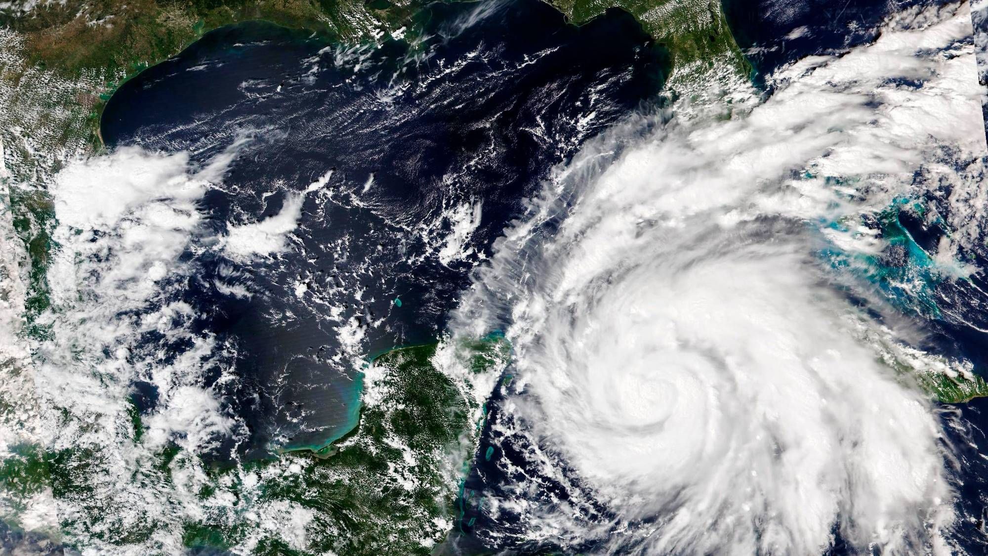
Category 3 Hurricane Ian continues to strengthen as it briefly crosses over western Cuba, and then emerges into the eastern Gulf of Mexico this morning.
Yesterday morning at this time, Ian had just become a hurricane at 75 mph. A 50 mph increase of wind has occurred over the past 24 hours. Incredible!
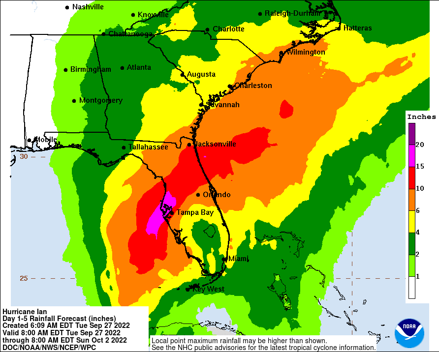
Unfortunately, further strengthening is forecast over the next couple of days, possibly as high as 140mph to 150mph before weakening a little bit before it makes landfall sometime on Thursday between Naples, Florida to just north of Tampa Bay. Hurricane Warnings are in effect in these areas.
A storm surge up to 10 feet, rainfall totals between 1-2 feet and tornadoes are possible.
 National Weather Service - Fort Worth
This is going to be a very dangerous storm. Residents across Florida need to take this hurricane seriously. Ian will continue to move Inland over Florida late into the week and slowly weaken as it moves into Georgia and the Carolinas.
Ian poses no threat for Texas.
LISTEN on the Audacy App
Sign Up and Follow NewsRadio 1080 KRLD


