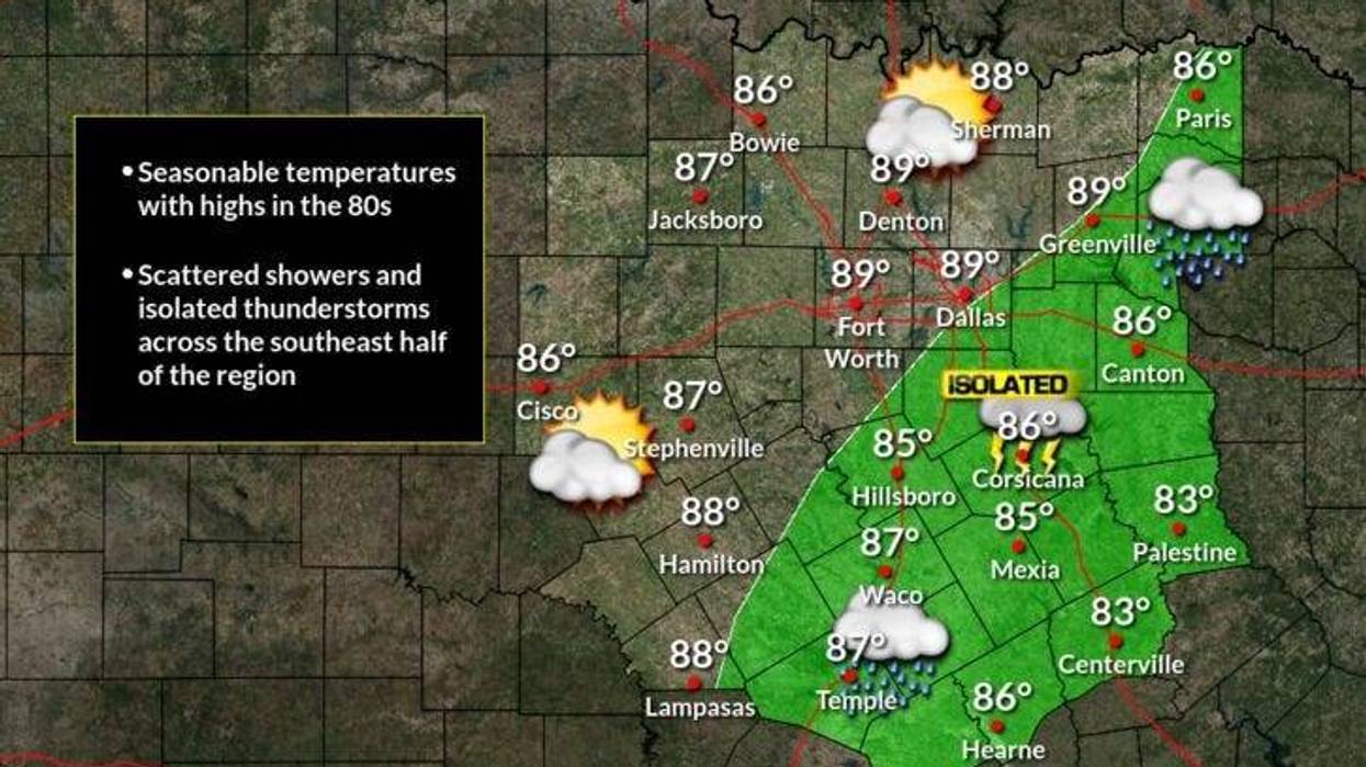
We have a very slight chance of some afternoon and evening showers and storms today and tomorrow, but greatest chances will be south and east of DFW. Daytime highs will be in the mid to upper 80s.
High pressure in the upper levels of the atmosphere controls our weather through the rest of the week and into the weekend. Morning lows will be in the upper 60s to low 70s. Daytime highs will be in the low to mid 90s
Fall officially starts next Wednesday and we may have our 1st decent cold front heading through the area, bringing rain and cooler temperatures with it. This possible weather change is still over a week away and is subject to change on timing and strength.
*Yest Rain: 0.00"; *Yest High: 87; Low: 71
*Today's Averages: High: 89; Low: 69
*Record high: 102 (1953); Record low: 48 (1902)
*September rain: 0.18"; September deficit: 1.12"
*2021 Rain: 27.02"; 2021 surplus +1.17"
*Sunrise: 7:11am; Sunset: 7:35pm
Today: Partly cloudy, warm and breezy. Isolated late day showers and storms. High: Upper 80s. Wind: ESE 10-20 mph.
Tonight: Fair and breezy. Low: Low to mid 70s. Wind: NE 10-20 mph.
Tomorrow and Thursday: Mostly sunny, breezy and seasonable. High: Near 90. Wind: NE 10-20 mph.
Friday: Party cloudy and hot. High: Low 90s.
Weekend: Partly cloudy, breezy and hot. Highs: Low to mid 90s.
Monday: Partly cloudy and continued hot. High: Low 90s.
LISTEN on the Audacy App
Sign Up and Follow NewsRadio 1080 KRLD