Day three of morning Dense Fog Advisories across North Texas. The fog will lift after 10:00 a.m. Current radar continues to show heavy rain to the south and east of the Dallas-Fort Worth area. This is where it will stay through the day.
Temperatures are in the mid to upper 40s this morning. Skies will brighten up a bit today as we warm into the low to mid-50s. By late this evening, an area of showers will move in from the southwest, but will be out of here well before you wake up tomorrow morning.
Temperatures will start in the mid-40s on Thursday. Also, plan on more fog to greet you as you wake up. Believe it or not, I'm looking for the sun to make an appearance by tomorrow afternoon, as high temperatures creep close to 60°!
 National Weather Service - Fort Worth
Clouds will roll back in Friday morning, but another appearance from the sun will arrive by late morning. Would you believe me if I said highs will be in the mid-60s?
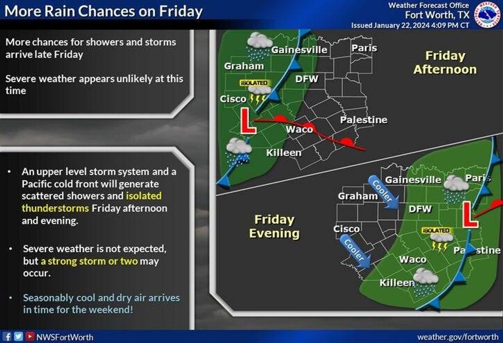
Our next weather change arrives Friday evening as a cold front sweeps through the area. There will be some scattered showers and isolated storms along the front, but not everyone will see rain. It'll turn windy and cooler overnight into Saturday morning, but the clouds will stick around through the first half of the day. North winds will gust to 25 mph with afternoon highs in the low to mid-50s.
 National Weather Service - Fort Worth
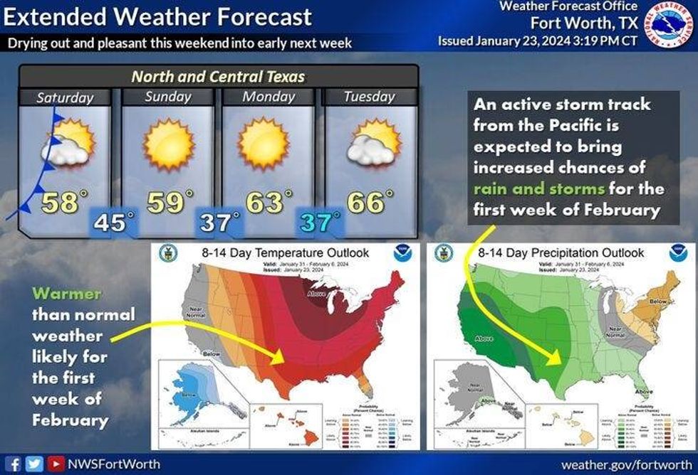
Sunday through Tuesday looks gorgeous. Morning lows will be in the upper 30s to low 40s, with afternoon highs on Sunday pushing 60°. Low to mid-60s on Monday and Tuesday with plenty of sunshine.
*Yest Rain: 0.34"; Yest High: 50 Low: 39
*Today's Averages: High: 57; Low: 36
*Record high: 82 (1943); Record low: 9 (1963)
*January Rain: 2.41"; Surplus: 0.48"
*2024 Rain: 2.41"; Surplus: 0.48"
*Sunrise: 7:28am; Sunset: 5:53pm
LISTEN on the Audacy App
Tell your Smart Speaker to "PLAY 1080 KRLD"
Sign Up to receive our KRLD Insider Newsletter for more news
Follow us on Facebook | Twitter | Instagram | YouTube