


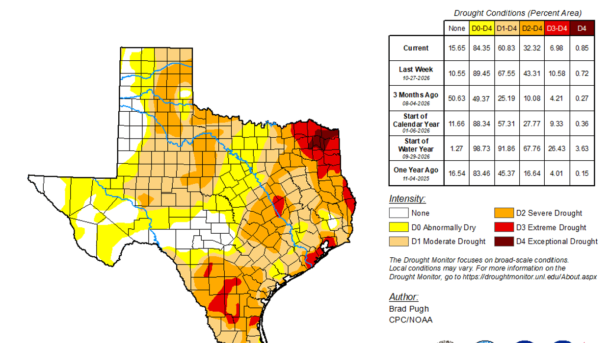

Lack of rainfall and above-average temperatures have been the ongoing weather story across North Texas, and unfortunately, that trend is going to continue for the next several days. We will see a little cooler weather as we head toward the end of the week, but rain chances remain pretty hard to come by.
We do have a few showers moving across the area this morning from southwest to northeast. However, many of you won't see a drop of rain. This little area of precipitation will continue moving out of North Texas through the late morning and early afternoon hours.
Temperatures have fallen into the 50s this morning, but we'll warm things back up today, with afternoon highs near 80 degrees under partly cloudy skies
A weak cold front moves through Wednesday evening, bringing temperatures down into the mid-70s on Thursday. Another front will push back into the area Thursday night into Friday morning. Unfortunately, this one won't bring us any rain either, but it will knock Friday's high temperatures down into the low 70s under mostly sunny skies.
As we head into Saturday, expect breezy conditions with plenty of sunshine and afternoon highs climbing back into the mid-70s.
Our attention then turns to the weekend storm systems. One system currently looks to impact the southern half of Texas late Saturday into Sunday, potentially bringing some pretty strong storms. Another upper-level disturbance is expected to move in from the northwest, and this one could finally bring North Texas a decent chance of rain late Sunday into Monday.
If the current forecast holds, afternoon temperatures will drop back into the 60s by early next week.
Unfortunately, we're going to have to remain patient when it comes to getting some much-needed rainfall across North Texas. Hopefully, the forecast will continue to trend in a wetter direction as we get closer to the weekend.
That's all I have for you in the weather world this morning. Please remember to like and share this forecast to help keep North Texans weather aware. I would sincerely appreciate it!
Have a blessed Tuesday, everyone, and don't forget to enjoy the weather when you can. It's the only weather you've got!
7-Day Headlines:
- DFW Airport hit 72 degrees on Monday.
- A few showers this morning
- Nice weather through Saturday
- Wednesday evening weak cold front, no rain
- Friday morning weak cold front, no rain
- Watching Sunday and Monday for rain
- Colder next week
- Download our AUDACY app! Listen to KRLD LIVE at home or at work
Almanac:
- Yest Rain: 0.02”; Yest High: 72; Low: 55
- Today’s Averages: High: 69; Low: 48
- Record high: 86 (1934, 1949); Record low 26 (1950)
- November rain: 0.02”; Deficit: <0.92”>
- 2026 Rain: 26.79”; Snow: 2.4”; Deficit: <5.79”>
- Sunrise: 6:55am; Sunset: 5:29pm
Forecast:
Tuesday: Mostly cloudy with isolated morning showers, becoming partly cloudy and pleasant this afternoon. High: Mid 70s. Wind: South 5 mph.
Tuesday night: Mostly clear and cool. Low: Mid to upper 50s. Wind: South 5 mph.
Veteran’s Day: Sunny and warm. Late evening DRY cold front #1. High: Near 80. Wind: South 5 mph.
Thursday: Sunny and a tad cooler. High: Mid 70s
Friday: Morning DRY cold front #2. Sunny, breezy and nice! High: Near 70.
Saturday: Mostly sunny, breezy and comfortable. High: Near 70.
Sunday: Increasing clouds, slight rain chance. High: Mid 60s.
Monday: Another cold front. Slight rain chance. Cooler! Mid 50s.
LISTEN on the Audacy App
Tell your Smart Speaker to "PLAY 1080 KRLD"
Sign Up to receive our KRLD Insider Newsletter for more news