


No weather changes today, but it's coming. We're fine this morning with high clouds streaming in from the west, as temperatures slowly fall to near 70 degrees. Filtered sunshine today with high temperatures warming into the low 90s. A south wind picks up as well and gusts to 20 mph.
Tonight, clouds will start to thicken up into the overnight with lows in the low to mid 70s with a south wind still gusting to 20 mph. This will continue to bring moisture off the Gulf of Mexico and into north Texas.
 National Weather Service - Fort Worth
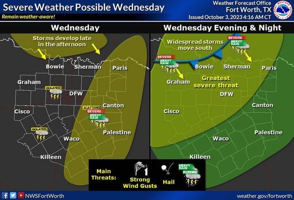
Tomorrow will be mostly cloudy and a little bit cooler with highs in the mid-80s. Also, don't forget to grab your umbrella before leaving the house tomorrow morning, because widespread shower and thunderstorm activity will break out to our SE and head north through the day. As of now, it looks like the best chances for rain will be along and east of I-35W. It's not out of the question that some of you see an isolated severe storm with small hail and wind.
 National Weather Service - Fort Worth
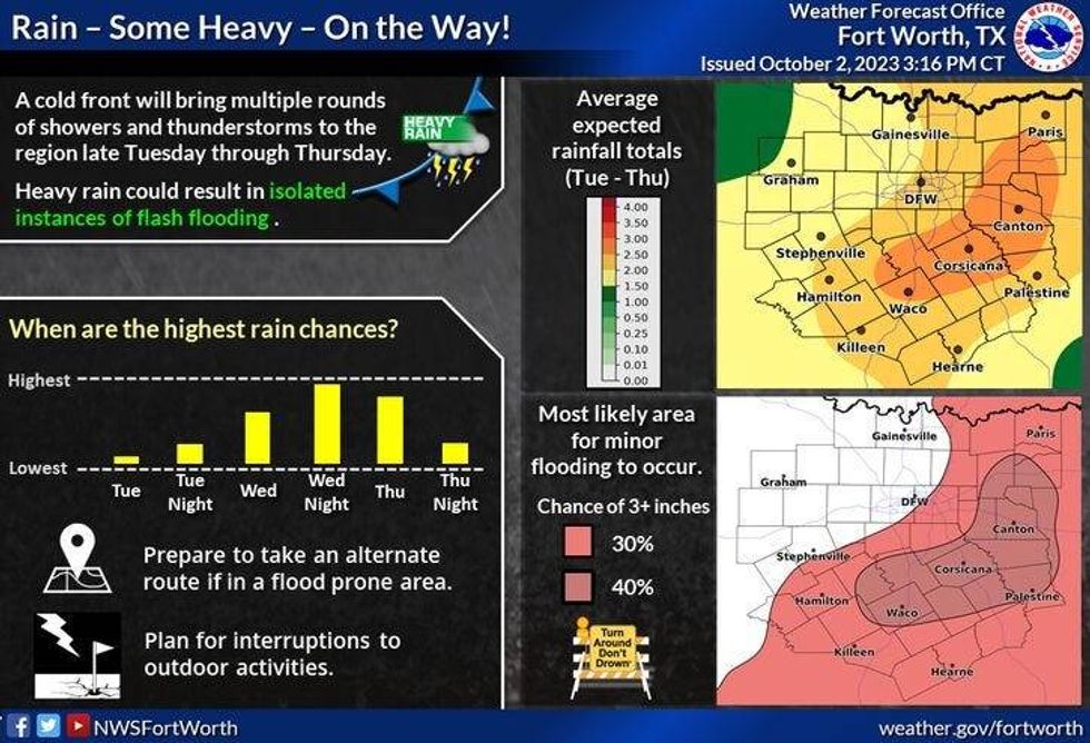
The big weather change arrives from NW to SE Wednesday evening through early Thursday morning, as a slow-moving cold front and upper-level disturbance approach from the northwest. This may be a good old-fashioned Texas squall line plowing through the area. Damaging wind and small hail are the threats. Average rainfall totals will be between one and two inches. The rain shield will slowly drift to our south tomorrow morning.
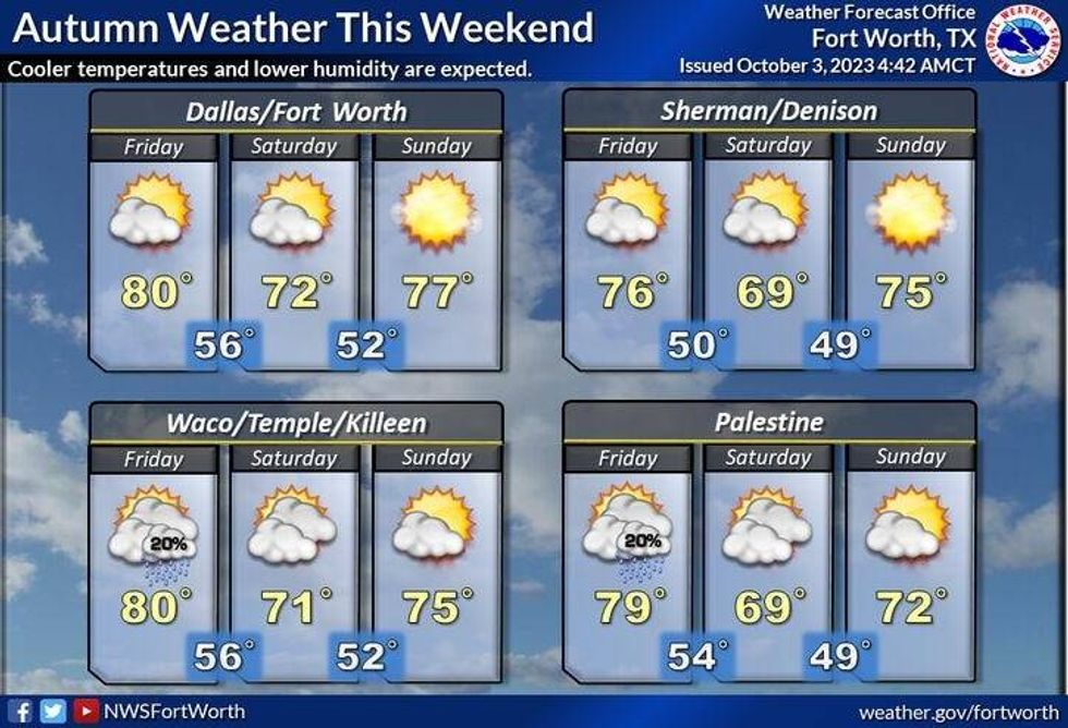
Slow clearing will take place Thursday afternoon with highs near 80°. But, it gets better. By Friday, a reinforcing shot of cooler/drier air will move into north Texas. I still think we will get close to 80° on Friday, with a gusty northerly wind.
 National Weather Service - Fort Worth
Fifty-degree temperatures will greet you Saturday - Monday mornings, with afternoon highs on Saturday only in the low 70s with filtered sunshine. Sunday's high will creep up into the mid to upper 70s, and then into the middle 80s will return by next Monday.
*Yest Rain: 0.00"; Yest High: 92; Low: 71
*Today's Averages: High: 83; Low: 62
*Record high: 106 (1951): Record low: 44 (1961)
*October Rain: 0.00"; Deficit: 0.20"
*2023 Rain: 15.66"; Deficit: 11.81"
*Sunrise: 7:24am; Sunset: 7:10pm
Today: Filtered sunshine, breezy and warm again. High: Low 90s. Wind: South 10-20 mph.
Tonight: Increasing clouds and mild. Low: 68-75. Wind: South 10-20 mph.
Wednesday: Mostly cloudy, warm and breezy. Scattered strong and isolated severe storms, mainly east of I-35E (0.50"). High: Mid to upper 80s. Wind: South 10-20 mph.
Wednesday night: Cloudy, breezy and mild. Widespread showers and isolated severe storms between 8pm and 2am. Threats: Damaging wind and small hail. Rainfall totals: 1.00" to 2.00". Low: Mid to upper 60s.
Thursday: Morning showers, then slow clearing by late afternoon. Breezy and cooler. High: Near 80.
Friday: Sunny, windy and cool. High: Mid to upper 70s.
Saturday: Sunny, windy, and cool. Texas/OU 11:00am kickoff temp: 67 degrees. High: Low 70s.
Sunday: Sunny and perfect. Lows: 50s; Highs: Mid to upper 70s.
Monday: Mostly sunny and nice. High: Mid-80s.
LISTEN on the Audacy App
Tell your Smart Speaker to "PLAY 1080 KRLD"
Sign Up to receive our KRLD Insider Newsletter for more news
Follow us on Facebook | Twitter | Instagram | YouTube


