


Rain chances ramping up this evening through Friday morning, and then much cooler into the weekend.
Some of you lucky ones saw some welcome rain yesterday, but unfortunately not a drop fell at DFW airport. That will change over the next 48 hours.
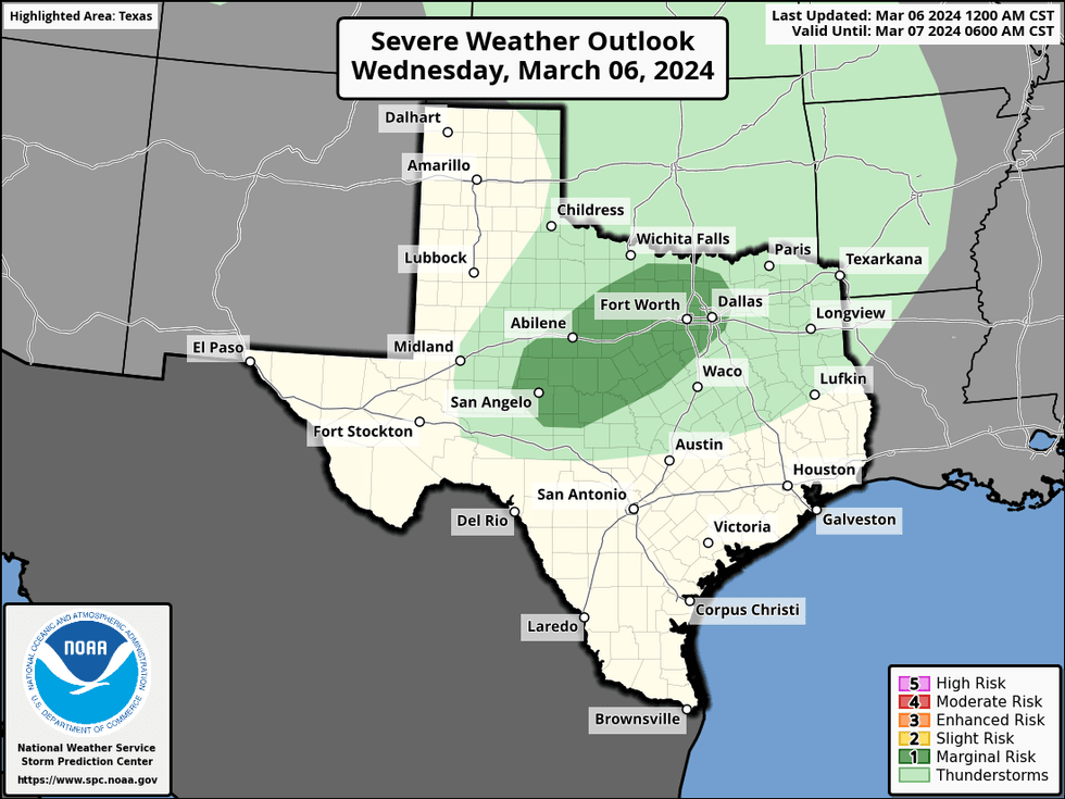
We're waking up to a partly cloudy sky with temperatures in the upper 40s to mid-50s. Today will be partly cloudy and mild. Afternoon highs will top out in the upper 70s. Clouds will rapidly increase this evening, with a decent shot of showers and thunderstorms moving in from the west and continuing off and on through the overnight. A couple of these may become severe, especially west of I-35W. Hail will be the primary threat.
 NOAA / National Weather Service - Fort Worth
The weak cold front that's to the south of DFW will lift back to the north on Thursday. Waves of rain will continue through the morning and into the afternoon hours. The severity looks low as of now. Highs will be near 70 degrees.
 NOAA - National Weather Service - Fort Worth
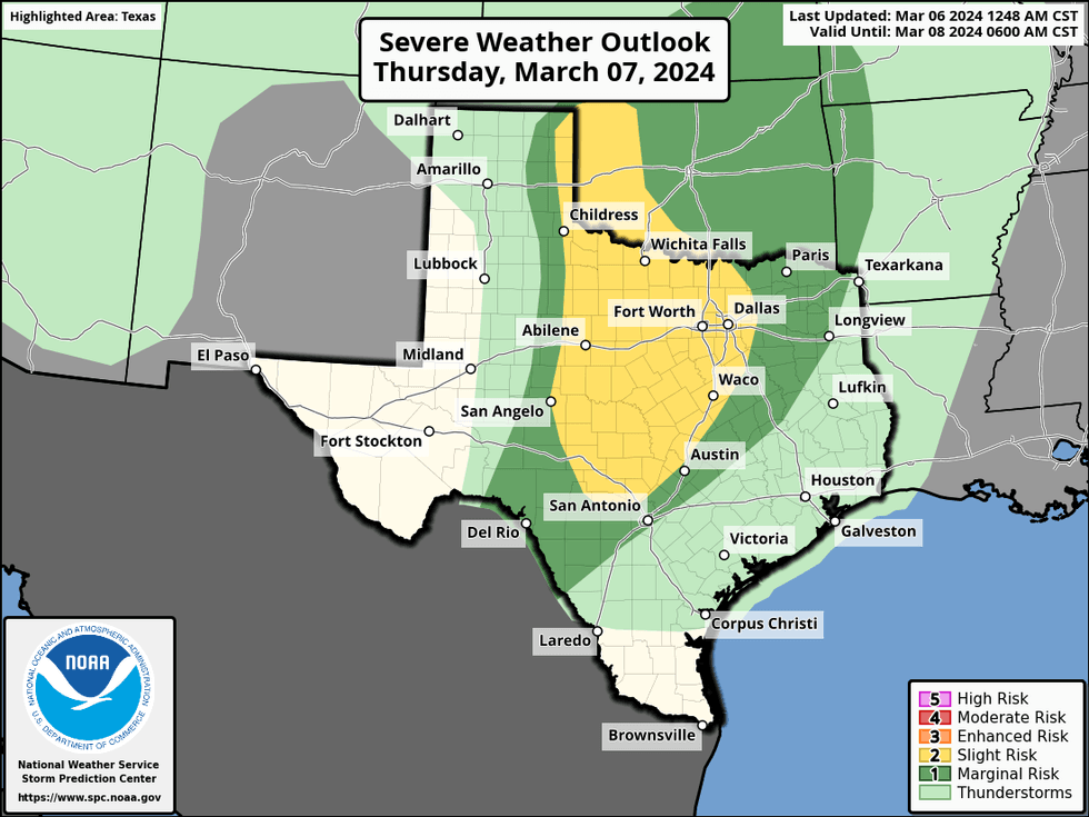
By tomorrow evening, the dryline will be surging out of West Texas and there'll be another round of showers and storms moving into North Texas, lasting through the overnight and into Friday morning. A few of these storms may become severe, especially west of I-35W once again. Hail and isolated damaging wind will be the threats. The tornado threat is very low.
 National Weather Service - Fort Worth
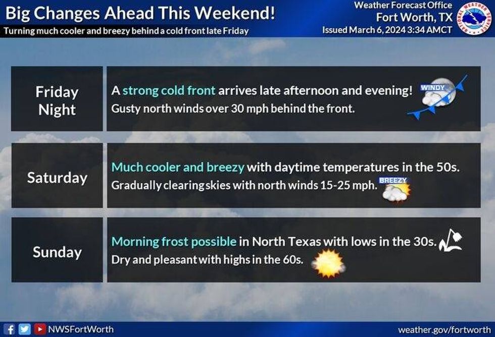
All of the rain will press to the east by noon Friday with some peaks of sunshine. Temperatures will still be warm with readings topping out in the mid to upper 70s. By late tomorrow afternoon, a strong cold front will blow through the area. It'll turn windy and much colder Friday evening into Saturday morning. Morning lows will dip into the low to mid-40s with wind chills in the 30s. Plenty of sunshine Saturday afternoon but it will remain windy and cool. Temperatures will struggle to reach 60°.
I'm going to be keeping an eye on the threat for some patchy frost early Sunday morning as temperatures dip into the 30s across much of the area. Sunny and beautiful by afternoon with highs in the low to mid 60s. We'll be back into the 70s by Monday and Tuesday with ample sunshine.
*Yest Rain: 0.00"; Yest High: 80; Low: 57
*Today's Averages: High: 66; Low: 45
*Record high: 90 (1916, 1929); Record low: 20 (1989)
*March Rain: 0.00"; Deficit: 0.54"
*2024 Rain: 5.14"; Deficit: 0.69"
*Sunrise: 6:49am; Sunset: 6:30pm
LISTEN on the Audacy App
Tell your Smart Speaker to "PLAY 1080 KRLD"
Sign Up to receive our KRLD Insider Newsletter for more news
Follow us on Facebook | Twitter | Instagram | YouTube


