Welcome to the first official day of Spring. We've got a couple of rain chances in our 7-day forecast and temperatures will be close to average through the period.
Wednesday starts off with temperatures near 50° with some passing clouds. There is nothing is showing up on the radar and I don't expect anything until late this evening and into tomorrow morning. Afternoon highs today will top out in the low 70s.
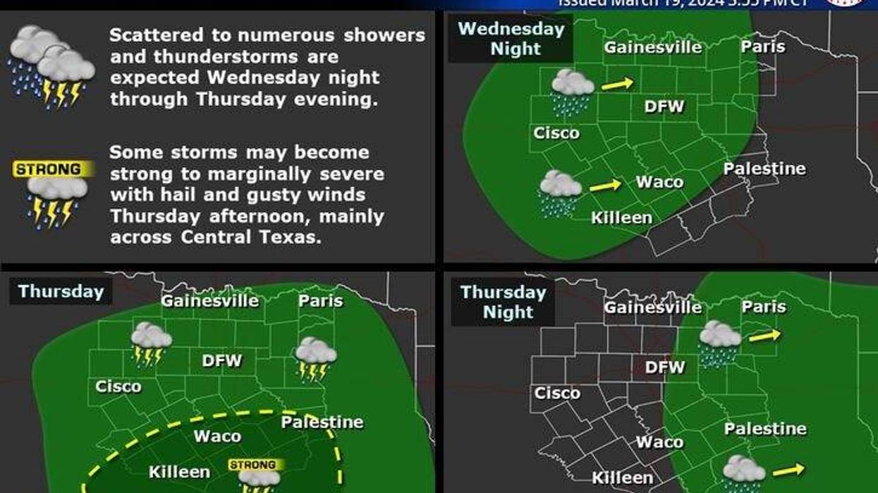
Increasing clouds tonight with a chance for showers and isolated storms after midnight. Coverage will increase by daybreak and continue during the morning hours tomorrow. Nothing severe is expected.
 NOAA
NOAA
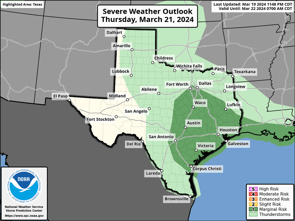
Thursday morning lows will be very mild with readings in the upper 50s. Another wave of showers and storms will move in by the late afternoon and during the evening hours. A couple of these could become severe with pocket change-sized hail and gusty winds. The best chance will be south of Interstate 20. Average rainfall totals will be close to an inch, with heavier totals east and south of DFW. Afternoon highs will top out in the mid to upper 60s.
A few leftover showers will remain early Friday morning, otherwise, skies will slowly clear with highs near 70°.
 National Weather Service - Fort Worth
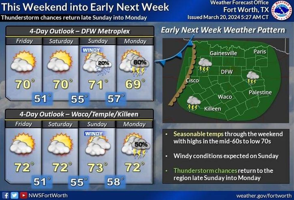
Most of the weekend looks nice. Plenty of sunshine with highs in the low 70s. It will be very windy on Sunday with gusts to 35 mph possible from the south. By Sunday late evening, our next weathermaker arrives. As of now it looks like a line of showers and storms, some severe will arrive by late Sunday evening into early Monday morning. I will continue to monitor this threat over the coming days.
The rain and clouds will slide east early Monday morning giving way to sunshine by afternoon. High temperatures will be near 70. Tuesday looks equally as nice and a little cooler. Plenty of sunshine with highs in the mid 60s.
*Yest Rain: 0.00"; Yest High: 67 Low: 40
*Today's Averages: High: 70; Low: 49
*Record high: 92 (2017); Record low: 19 (1965)
*March Rain: 4.32"; Surplus: 2.29"
*2024 Rain: 9.46"; Surplus: 2.14"
*Sunrise: 7:31am; Sunset: 7:40pm
LISTEN on the Audacy App
Tell your Smart Speaker to "PLAY 1080 KRLD"
Sign Up to receive our KRLD Insider Newsletter for more news
Follow us on Facebook | Twitter | Instagram | YouTube