Fall officially starts at 8:31 a.m. this morning!
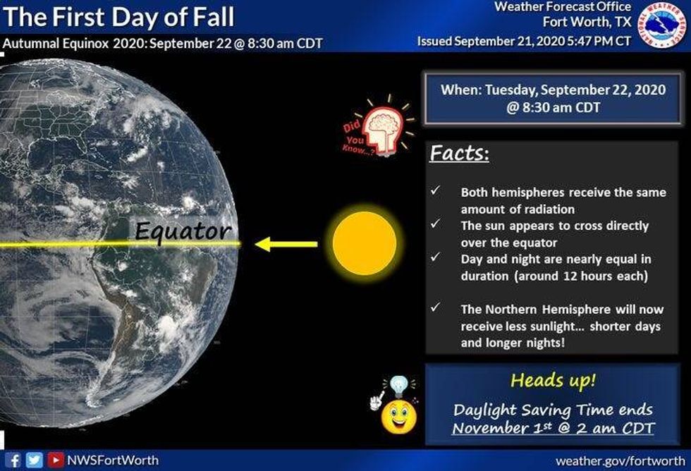 First Day of FallNational Weather Service
It's a blah kind of morning and afternoon ahead as moisture continues to wrap-around what's left over from Beta. Light rain, light drizzle, and fog will be around this morning as scattered showers continue to wrap into the area from the southeast through the afternoon.
With temperatures in the sixties this morning we'll have a hard time getting above 70゚ today as the measurable rain slowly shifts to the east by late this evening.
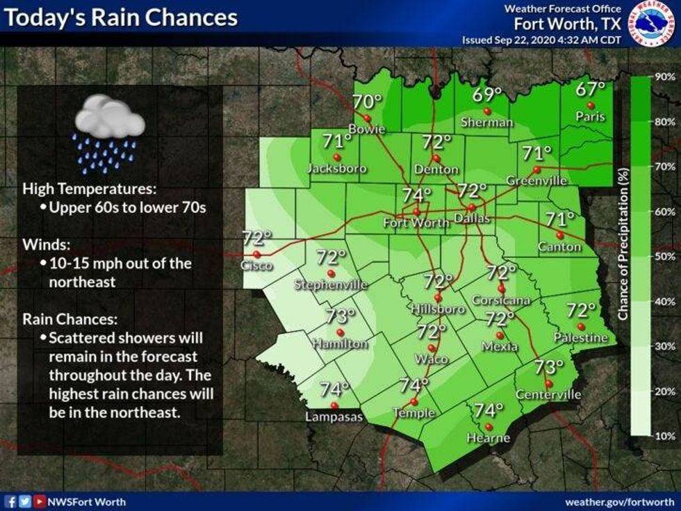 Tuesday RainNational Weather Service
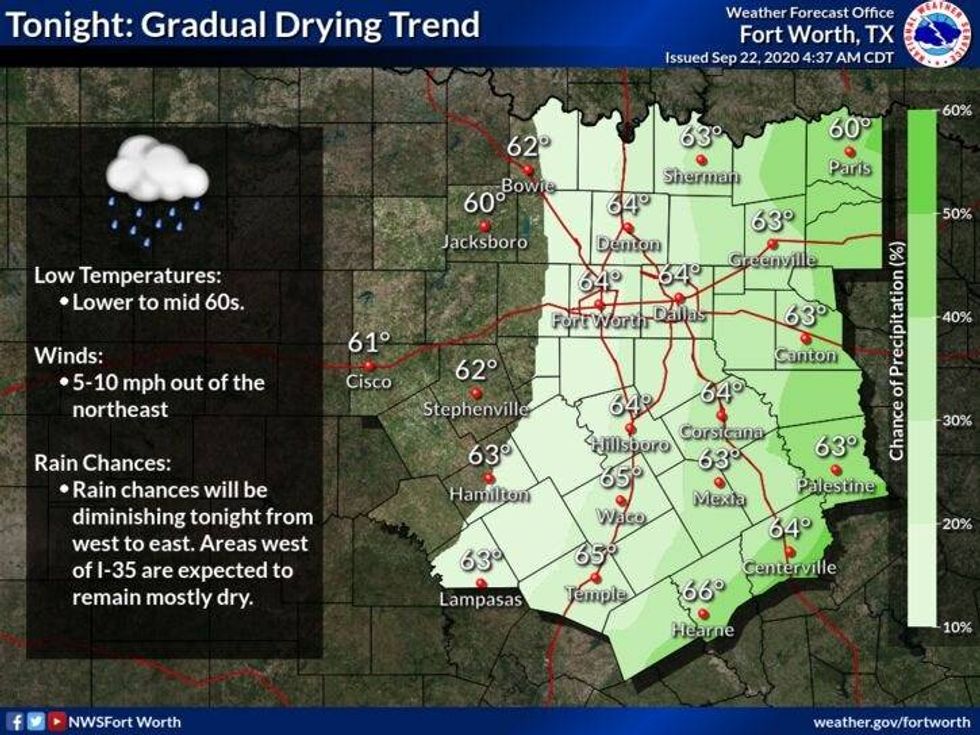 Tuesday NightNational Weather Service
Tomorrow's weather will remain mostly cloudy through the day, but I'm not expecting that much in the way of rain... except maybe for some morning drizzle. Some of you might even see some peeks of sunshine before the day is done as temperatures warm into the mid to upper seventies.
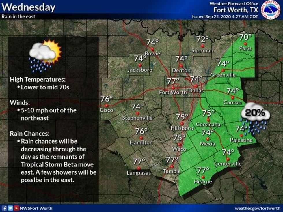 Wednesday ForecastNational Weather Service
By Thursday, sunshine will return and our warm up starts. We'll warm into the low eighties Thursday mid eighties Friday and upper 80s through the weekend. We might even exceed the 90゚ mark on Sunday and especially Monday.
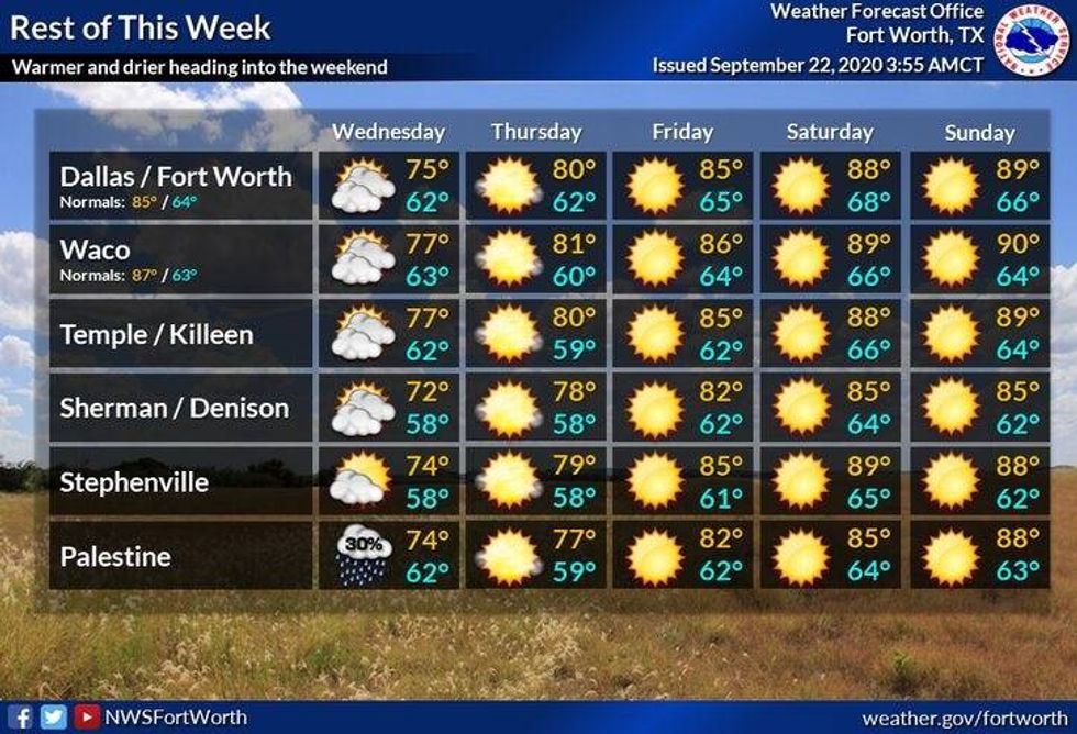 Rest of The WeekNational Weather Service
Our 1st decent fall front looks to arrive early Tuesday of next week. Right now, it doesn't look like much rain will accompany this front, but temperatures will definitely cool off into the seventies for highs on Wednesday and Thursday with morning lows of the fifties.