
GOOD MORNING, NORTH TEXAS! WARM & DRY WEATHER CONTINUES — AND THE GULF HAS A HURRICANE!
Good morning, everyone! Welcome to Thursday! I hope you’ve had a great work week so far.
The weather story across North Texas is pretty straightforward: above-average temperatures and below-average rainfall will continue at least through the middle of next week.
And while things are relatively quiet here at home, the Gulf of Mexico has gotten very busy overnight.
HURRICANE UPDATE
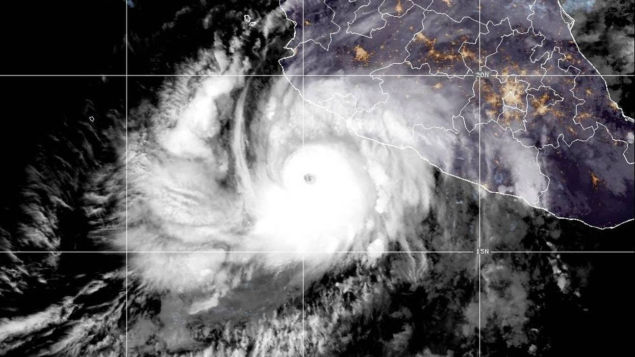
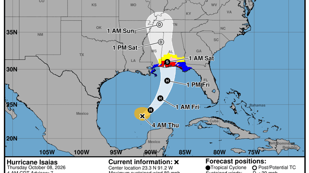
Tropical Storm Isaias strengthened into Hurricane Isaias while you were sleeping. As of 4 a.m., maximum sustained winds are now 80 mph, and the hurricane is moving east-northeast at about 9 mph.
A turn toward the north is expected late tonight and early Friday. The current forecast takes the hurricane toward the central Gulf Coast, with landfall expected somewhere between Mobile Bay and Pensacola, Florida.
Maximum sustained winds could be around 110 mph at landfall, which would make Isaias a strong Category 2 hurricane.
I’ll be watching this storm very closely over the next 36 to 48 hours, and I’ll keep updates pinned to the top of my Facebook page.
NORTH TEXAS WEATHER
As for us, I’m not expecting much to happen here over the next seven days. In fact, Hurricane Isaias should have little to no direct impact on our weather.
Instead, the storm will help keep our dew points low, our mornings relatively cool, and our afternoons well above average for this time of year.
Morning temperatures will generally remain in the 60s through next Wednesday, while afternoon highs climb well into the 80s.
We could even flirt with 90 degrees late this weekend and early next week.
By then, our average high temperature is only around 80 degrees, so it’s definitely going to feel more like summer than fall.
A BIG WEATHER CHANGE IS COMING!
The good news is that a significant change is beginning to show up toward the middle and end of next week.
As Hurricane Isaias weakens and moves northeastward into the eastern United States, it will gradually help change the upper-level wind pattern across the country. That should eventually allow a cold front to slowly slide southward through Texas toward Thursday and Friday.
It’s still too early to know exactly how quickly that front will move or how much rain we’ll see, but the overall pattern is increasingly pointing toward:
- Above-average precipitation
- Cooler-than-average temperatures
- A much more fall-like weather pattern
- And that would be arriving just in time for the last weekend of the State Fair of Texas!
HIGH SCHOOL & COLLEGE FOOTBALL
If you’re heading out to high school football tomorrow night, shorts are definitely in order. The same goes for college football, especially those afternoon games. Some areas of Texas could be approaching 90 degrees.
Remember to stay hydrated, wear light-colored and loose-fitting clothing, use plenty of sunscreen, wear a hat, and take breaks from the heat when needed.
So enjoy this beautiful weather while it lasts. We’ve got a warm and dry stretch ahead, but a pretty significant pattern change may be waiting for us about 8 to 9 days from now.
I’ll continue keeping a very close eye on Hurricane Isaias, and I’ll have updates posted at the top of my Facebook page.
Have a GREAT Thursday, everyone!
— Dan the Weatherman
LISTEN on the Audacy App
Tell your Smart Speaker to "PLAY 1080 KRLD"
Sign Up to receive our KRLD Insider Newsletter for more news
Follow us on Facebook | Twitter | Instagram | YouTube