


We'll be shaking hands with low clouds, patchy drizzle, a lot of wind and humidity during the morning hours through the weekend, with peaks of afternoon sun. Morning lows will be near 70. Afternoon highs will warm into the middle eighties. South winds will gust as high as 30MPH through the period. It's a pretty simple forecast.
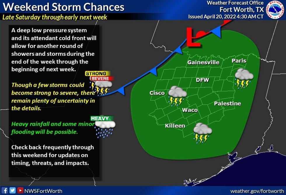
No measurable rain is in the forecast until late Saturday and especially Sunday into early Monday, as a slow-moving, powerful storm system creeps across the area. If you have outdoor plans on Sunday, get them done early, because widespread rain will move into the area through the day. It's still way too early to tell how severe the storms will be, but everybody should see rain on Sunday into early Monday.
 Weekend storm chancesNational Weather Service - Fort Worth
By Monday morning, a strong cold front will move through north Texas, pushing the heaviest rain south of the area. There still could be some lingering showers around during the day, with afternoon highs falling through the sixties. A north wind will gust to 30MPH.
Dry air should win out by Tuesday morning, with clear skies and cool conditions. Morning lows may dip in the forties in some areas with afternoon highs pushing 70゚. That's it. A slow warm up will start Wednesday through the end of the next week.

LISTEN on the Audacy App
Sign Up and Follow NewsRadio 1080 KRLD


