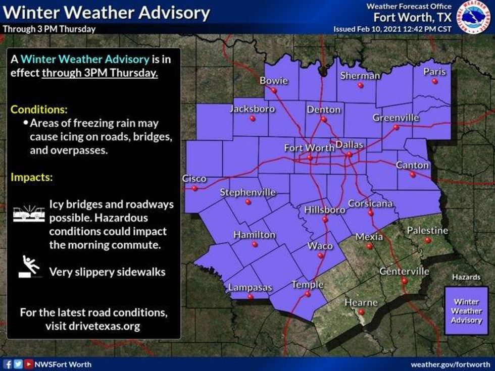
Travel conditions will start to deteriorate Wednesday evening across the eastern half of north Texas. Plus, temperatures will stay below freezing through Thursday. This being said, a Winter Weather Advisory is in effect through 3pm Thursday.

 NWS
NWS
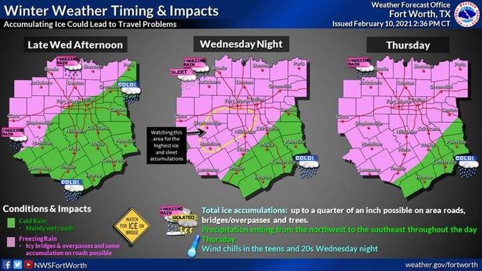
A large area of freezing rain is heading our way from the southwest. Plan for waves of freezing rain and some sleet through the overnight hours.
Thursday morning's commute will be a mess in some areas.
 NWS
NWS
Remember to slow down!
 NWS
NWS
Thursday's 7-Day Forecast:
* Winter Weather Advisory.
* Wintry mix causes dangerous travel.
* Temps hover just below freezing through Friday.
* Bitter cold arrives Saturday along with wintry mix.
* Serious snow late Sunday into Monday.
* Morning lows close to zero…or below! Record Breaking!
_____________________
*Yesterday's High: 31; Low: 28
*Today's Averages: High: 60; Low: 38
*Records: High: 88 (1922. 2017); Low: 10 (1981)
______________________
*Yesterday's rain: Trace; Feb. rain: 0.01"; Feb. deficit: ">
*2021 Rain: 0.86"; 2021 Deficit: ">
*Sunrise: 7:15am; Sunset: 6:10pm
______________________
*Winter Weather Advisory at least 3pm Thursday*
Today: Areas freezing drizzle/freezing rain/sleet. Cold! High: 29-32. Wind: North 10-20 mph.
Tonight: Evening wintry mix. Cloudy with areas freezing drizzle. Low: Mid to upper 20s. Wind: North 10-20 mph.
Tomorrow: Pockets of morning freezing drizzle. Cloudy and cold! High: Low 30s. Wind: North 10-20 mph.
Saturday: Morning and early afternoon wintry mix. Cloudy and cold. Bitter cold air still north of DFW, but still COLD. High: Mid to upper 20s.
Sunday: Mostly cloudy, windy and turning bitter cold! Snow by evening. High: Mid 20s early, falling into the teens. Windchills: Single digits!
Monday: High chance of snow the first half of the day. Windy and bitter cold! High: Low teens.
Tuesday: Cloudy. Bitter cold! Low: Near zero; High: Low teens.
Wed: Cloud and cont. cold. Low chance of a wintry mix. High: Low 20s.