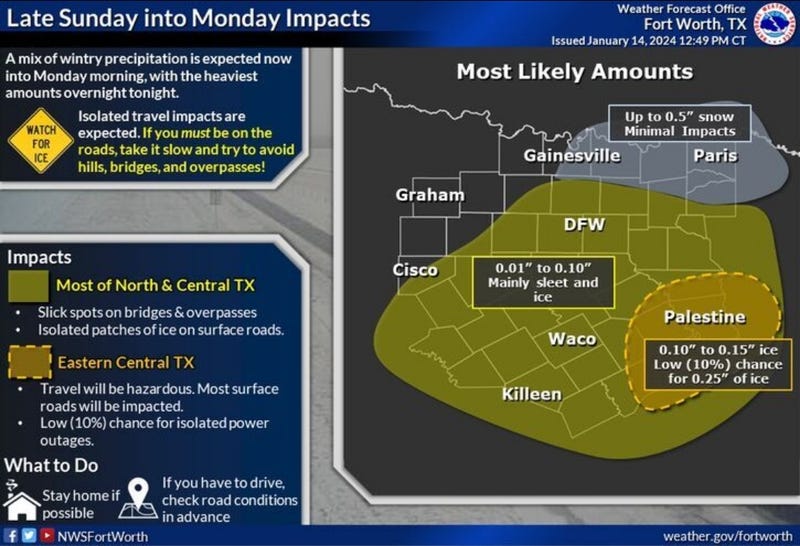

There is a 40% to 60% chance for a wintry mix of freezing rain, sleet, and snow across all of North Texas from Sunday into Monday.
While the precipitation will be generally light, there will be enough to cause slick travel conditions, especially late Sunday and early Monday.
A Winter Weather Advisory is in effect for North Texas, including Dallas and Fort Worth, from noon Sunday until noon Monday.
Tonight: *Winter Weather Advisory* *Wind Chill Advisory* Cloudy, breezy, and cold. Areas of light freezing drizzle before midnight. Areas of light sleet and snow, midnight to 9 am. Light accumulations are possible. Slick spots of roadways. Low: Mid-teens. Wind chills near zero. Wind: North 10 mph.
MLK Day: *Winter Weather and Wind Chill Advisory until noon* Morning light sleet and snow, ending by noon. Light accumulations are possible. Slick spots on roadways. The worst of it stays south and east of DFW. High: Low 20s. Wind chills: Single digits. Wind: North 10-20 mph.
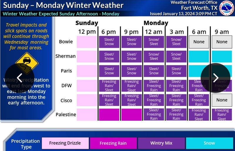
Monday night: Mostly to partly cloudy, windy and VERY cold. Flurries late. Low: 8-12. Wind chills: Below zero. Wind: North 15-25 mph.
Tuesday: Morning clouds, isolated flurries, afternoon sun. Windy and cold. High: Mid to upper 20s. Wind chills: Single digits. Wind: NW 15-25 mph.
LISTEN on the Audacy App
Tell your Smart Speaker to "PLAY 1080 KRLD"
Sign Up to receive our KRLD Insider Newsletter for more news
Follow us on Facebook | Twitter | Instagram | YouTube