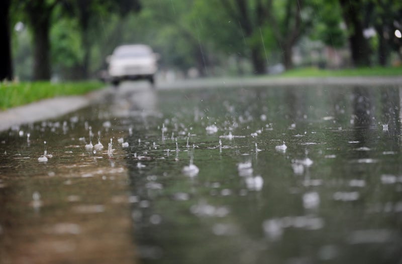

After a wet weekend that saw sometimes-heavy downpours, more rain fell in parts on Southern California on Monday, with showers possibly extending into Tuesday before yet another bout of unsettled weather arrives later in the week.
Want to get caught up on what's happening in SoCal every weekday afternoon? Click to follow The L.A. Local wherever you get podcasts.
The National Weather Service issued several flood advisories Monday afternoon as some storm cells dropped rain at a rapid pace in parts of the area. Many areas, however, saw only light rain, but enough to dampen streets heading into the afternoon commute.
Forecasters said the rain would continue to fall into late Monday night, "with decreasing showers continuing into Tuesday."
"Behind the front (Monday night) and Tuesday, an unstable and showery pattern will prevail as the upper low drops southward," according to the NWS. "By Tuesday evening, rainfall totals with this system are expected to range from 0.50-1.00 inches for coastal/valley areas with 1-2 inches for the foothills and mountains. Rainfall rates through Tuesday are expected to generally be under 0.50 inches per hour and will generate nuisance flooding across the area."
But forecasters warned that isolated pockets could see rain rates of about an inch per hour, which could trigger more serious flooding and debris flows. A dusting of snow was also possible along the Grapevine stretch of the 5 Freeway on Tuesday morning.
"Along with the rain and snow, thunderstorms will be a risk ... through Tuesday. As the upper low drops southward today, a cold and unstable air mass will bring a threat of thunderstorms to all areas. On Tuesday, the threat of thunderstorms looks to be confined to LA county as well as interior sections of Ventura and Santa Barbara counties."
The storm system was expected to be out of the area by late Tuesday, with the area getting a respite from the rain on Wednesday. But another storm system was expected to arrive in the L.A. area by Thursday afternoon.
Forecasters said that system could drop another quarter- to three- quarters of an inch of rain.
All evacuation warnings and orders that were in place in L.A. County during the strong weekend storm were lifted on Sunday, but residents were warned to remain alert for potential debris-related dangers as they travel through storm impacted areas.
In Orange County, evacuation warnings were lifted for areas near the Airport Fire burn area, including Trabuco Creek, Hot Springs Canyon and Bell Canyon.
The rain caused a minor rockfall and debris flows along a stretch of Topanga Canyon Boulevard between Pacific Coast Highway and Grand View Drive, according to Caltrans.
In Huntington Beach, Pacific Coast Highway was closed from Warner Avenue to Seapoint Street due to flooding but reopened Sunday, Caltrans reported. In Buena Park, firefighters rescued a man who was stranded on a ledge above a channel at Beach Boulevard and 11th Street early Sunday.
In Van Nuys, a large tree fell onto a van near Victory Boulevard and Willis Avenue at about 1 a.m. Sunday, crushing the vehicle.
As always after a storm, people were advised to avoid swimming in streams and rivers for at least three days after the rain.
Sheriff's officials urged people to use websites such as Ready.Lacounty.gov to stay up to date on road closures, weather alerts, and emergency notifications.
Follow KNX News 97.1 FM
Twitter | Facebook | Instagram | TikTok