Was it aliens? Humans with superpowers? Or just hard workers? A new study is helping support a long-standing theory about how the ancient Egyptians managed to build the pyramids of Giza.
The study, published on August 24 in the Proceedings of the National Academy of Sciences, had a team of researchers use paleoecological clues to reconstruct how the Nile River may have looked over the past 8,000 years.
The group of researchers was led by geographer Hader Sheisha at Aix-Marseille University in France. They determined that the builders of the oldest of the Seven Wonders of the Ancient World took advantage of a "now-defunct" arm of the river to transport building materials.
Related

The study says that "the former waterscapes and higher river levels around 4,500 years ago facilitated the construction of the Giza Pyramid Complex."
It has been theorized for some time that the Egyptian builders used some part of the Nile to move the tons of limestone and granite required to build the massive structures, but the river's recent flow patterns have since moved too far away to be of use.
But now, it is believed that builders created a canal across from the site of the pyramid to the Nile's Khufu branch on the river's western edge, which resulted in basins filling down to the river's bottom.
Constructors would then wait for annual floods, which worked as a hydraulic lift, allowing massive blocks of stone to move at the construction site, the research said.
Related

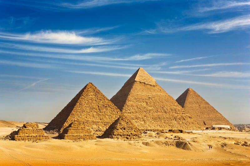
The Great Pyramid was constructed under the rule of Pharaoh Khufu in the 26th century BC and is comprised of 2.3 million stone blocks, standing 455 feet high and weighing 5.75 million tons. The sister pyramids were constructed for Khufu's son Khafre and grandson Menkaure.
The theory has remained as such due to a lack of understanding of how and which landscapes were involved, researchers said. But several techniques have allowed scientists to reconstruct the ancient Nile floodplain, helping explain the theory further.
This was done by analyzing the rock layers of cores drilled in 2019 from the Giza floodplain in order to estimate water levels in the area from thousands of years ago.
What they found was that the area flourished during the first half of Egypt's Old Kingdom period, roughly 2700 to 2200 BC. After that, the water levels remained high for Khufu, his son, and his grandson but are believed to have dipped in the nation's late period, 525 to 332 BC.
By 332 BC, when Alexander the Great conquered Egypt, the Khufu branch had lost its vast flowing water and transitioned into just a small channel.
The data helps confirm that ancient engineers were able to use the Nile and its annual flood patterns "to exploit the plateau area overlooking the floodplain for monumental construction."
Related

LISTEN on the Audacy App
Sign Up and Follow Audacy
Facebook | Twitter | Instagram