
AUSTIN (Talk1370.com) -- As Tropical Storm Beryl continues to head towards landfall on the Texas coast, Austin and the Interstate 35 corridor are now expected to come up mostly dry as the storm moves inland Monday.
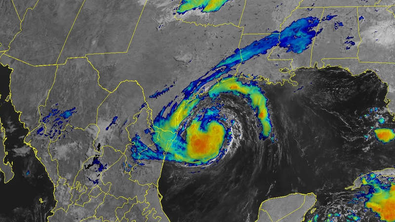
As of the National Hurricane Center's 10 a.m. advisory Sunday morning, Beryl was still a tropical storm with maximum sustained winds of 65mph. The storm was centered about 195 miles southeast of Corpus Christi, moving to the northwest at 10mph.
Hurricane warnings have been posted for much of the Texas coast, from Baffin Bay north to San Luis Pass; tropical storm warnings stretch south into parts of Mexico and north to High Island.
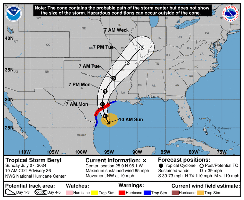
As Beryl nears landfall, the forecast track continues to shift to the east - and the so-called "cone of uncertainty" continues to narrow as well as confidence in the forecast track increases. That cone, which at one point included all of the Austin metro and the Hill Country, is now largely to the east of the area, with the closest significant impacts expected in Fayette, Lee, and Milam Counties.
The latest forecast track has the storm making landfall near Matagorda Bay just before 7 a.m. Monday morning, then quickly racing off to the northeast - exiting the state, likely just 24 hours later.
Widespread rainfall totals across the Austin metro are now expected to be in the neighborhood of an inch or less, with rainfall chances sharply dropping off further to the west.