


AUSTIN (Talk1370.com) -- A first draft of Texas' new congressional map released Monday morning would place the state's two new House districts in the some of the state's fastest-growing metropolitan areas - Austin and Houston.
The new maps are being drawn after Texas gained two seats following the 2020 census, increasing the state's congressional delegation from 36 to 38 seats for the next decade.
Texas is one of six states gaining representation, and the only state to gain two seats; Florida, Colorado, Montana, North Carolina, and Oregon are each gaining one seat. California, Illinois, Michigan, Ohio, West Virginia, Pennsylvania, and New York are each losing one seat.
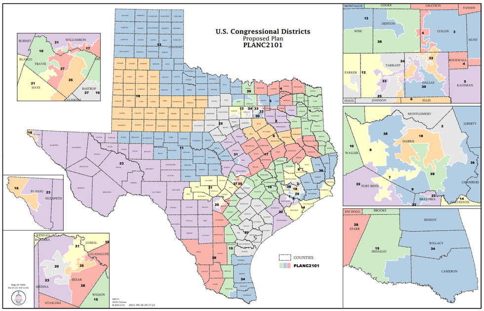 Texas Legislative Council
The draft plan, proposed by State Sen. Joan Huffman (R-Houston), is likely to see some changes as it works its way through the Legislature towards Gov. Greg Abbott's desk.
Under the proposal, the new District 37 would start at the southern Travis County line, bordered by Interstate 35 and FM 1826 north to US 290, in addition to a portion of West Oak Hill and a portion south of Southwest Parkway and north of US 290.
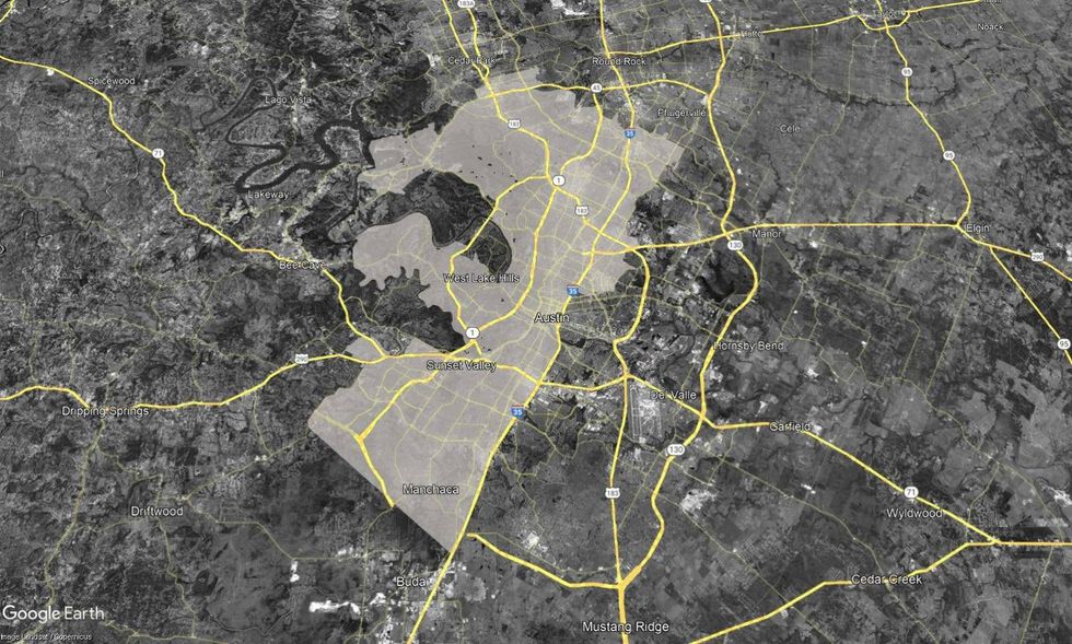 First draft of the newly-proposed Congressional District 37.Texas Legislative Council
The district's western reach would include the Lost Creek area and areas generally north of Barton Creek and south of Lake Austin, west to (but not including) the Lake Pointe area. It would also include all of Western Austin, including Tarrytown and the Northwest Hills areas, a portion of Steiner Ranch and the Four Points area, stretching north to Anderson Mill and the Lakeline area into a portion of Williamson County, including large swaths generally west of Loop 1 and south of Toll 45.
The proposed district's northern border is roughly along Wells Branch Parkway, eastward to Dessau and Cameron Roads, including large portions of the Mueller, Tech Ridge, Walnut Creek, Windsor Park, and Cherrywood neighborhoods east of Interstate 35.
Listen on the Audacy app
Sign Up and become a Talk 1370 Insider
Follow us on Facebook & Twitter


