


(WBBM NEWSRADIO) — Illinois government has posted an online pandemic map that identifies which states are classified as "higher risk" — a designation to which the Land of Lincoln is perilously close.
The Illinois Department of Public Health on Monday unveiled a coronavirus "travel map" designed to inform residents about the risks associated with visiting other states. Chicago does something similar with its "emergency travel order" that is updated weekly, but with an added self-quarantine order for people returning from so-called hot spots.
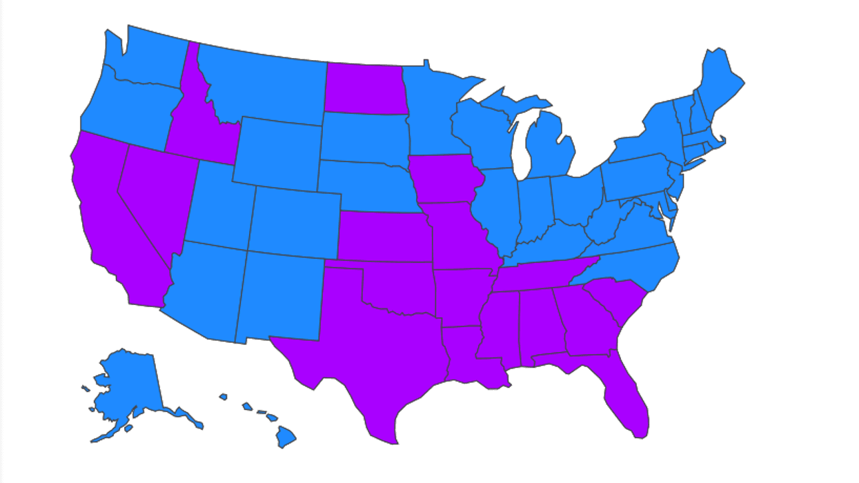
The Illinois map defines "higher risk" states as those having a daily case rate of at least 15 cases per 100,000. As of Monday, 17 states were coded this way, in purple, with "lower risk" states colored blue.
Illinois was at the tipping point, reporting 14 coronavirus cases per 100,000, according to the map.
"Travel may increase the chance of becoming infected and spreading COVID-19," IDPH Director Ngozi Ezike said in a prepared statement. "We encourage people who are traveling, whether for work or otherwise, to check out the map before making plans."
Illinois, which had successfully bent the curve of new coronavirus infections earlier this summer, has trended the wrong way over the past month as it tries to reopen its economy after the spring lockdown.
The state health agency on Monday reported 1,773 new confirmed cases of coronavirus, including 12 additional confirmed deaths. The statewide "positivity rate," which had dropped to 2.5% by early July, has risen to 4.2%.